Plizio Visual Lab
Am Zoer
ℹ️Practical info — Am Zoer
▾
🌤 Weather — 5 days
📍 Nearby
Sights nearby
💡 Tips
- Carry extra fuel and plenty of water, as services in this remote Sahelian region are extremely limited.
- Visit the local market at sunrise, which is when the bustling trade between nomads and merchants is at its peak.
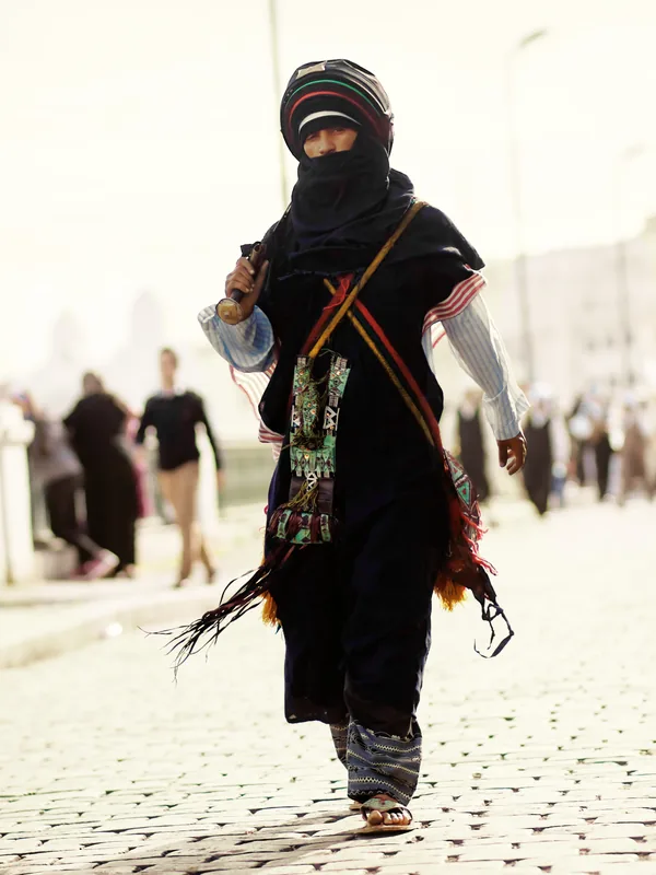
- Dress very conservatively and respect the traditional culture of the local pastoralist communities.
- Seek out the local chief or village elder to introduce yourself upon arrival as a sign of respect.
🍽 Food
A local specialty. Try it freshly grilled at the food stalls surrounding the livestock market.
The standard drink of hospitality. Accept invitations to share a glass in the shade.
Simple, filling flatbreads baked fresh in the tiny kitchens on the edge of the market square.
🛍 Shopping · 🧘 Quiet spots
The region is a hub for tree resin trade. You can find raw pieces sold in the market.
Simple, handcrafted leather bags or straps made by local nomads.
In the afternoon when the market quiets down, find a spot under the large acacia trees on the edge of the settlement.
Walk a short distance out into the open landscape to enjoy the vast starry sky or sunset in peace.
Water temperature…
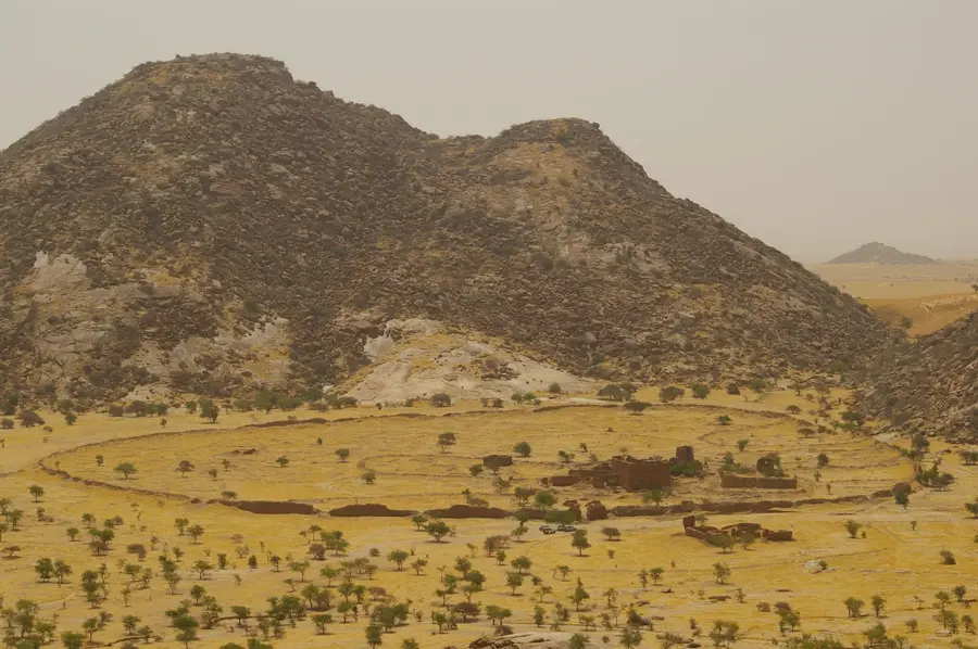
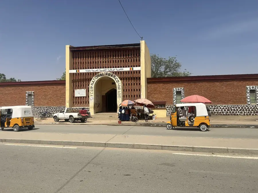
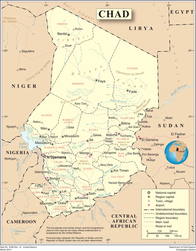
Am Zoer is a strategically significant town in the Ouaddaï region of eastern Chad. Geographically, it is located in an area marking the transition from the Sahel to the desert, characterized by expansive plains and seasonal watercourses. The town gained prominence in Chad's recent history as the site of intense fighting between government forces and rebel groups, particularly in 2008. These events highlight Am Zoer's strategic importance for controlling communication lines between the Sudanese border and the Chadian interior. The local population consists predominantly of sedentary farmers and nomadic pastoralists who have adapted to the arid climate. The economy is mainly based on livestock trade and local agricultural products such as millet. Despite the challenges posed by conflict and climate change, Am Zoer remains a vital regional node in the eastern Chadian territory.
- Location: Chad
- Nearby: Biltine (14 km)
Best time to visit & climate
The most pleasant time to visit is Jan, Nov, Dec.
| Jan | Feb | Mar | Apr | May | Jun | Jul | Aug | Sep | Oct | Nov | Dec | |
|---|---|---|---|---|---|---|---|---|---|---|---|---|
| Avg °C | 22 | 25 | 28 | 31 | 32 | 32 | 29 | 26 | 27 | 27 | 25 | 22 |
| Rain mm | 0 | 0 | 0 | 1 | 7 | 19 | 90 | 168 | 53 | 6 | 0 | 0 |
Geography
Facts
- Am Zoer is located in the Ouara department of the Ouaddaï region.
- In June 2008, a decisive battle took place here between the army and rebels.
- The town is situated approximately 80 kilometers north of Abéché.
- The area is characterized by dry savanna and scattered acacia trees.
- Water supply relies heavily on seasonal wells.
- The region is a transit area for nomadic livestock herds moving north and south.
Explore nearby
Notable places around
Route planner — Car & Motorhome
Where do you start? We build the route here, with stops and country notes along the way.
© OpenStreetMap contributors · OpenRouteService
Frequently asked questions
What is the character of Am Zoer?
Is Am Zoer suitable as a tourist destination?
What is the best time for the area?
How do you get there?
Are there attractions nearby?
Am Zoer: where is it located?
Am Zoer: when is the best time to visit?
Am Zoer: why is it worth visiting?

Nearby cities


History & landmarks


More places