Plizio Visual Lab
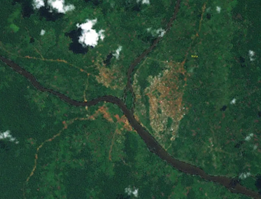
Nola
ℹ️Practical info — Nola
▾
🌤 Weather — 5 days
📍 Nearby
Sights nearby
💡 Tips
- Cash is essential, as ATMs and card payments are virtually non-existent.
- Hire a local boatman to navigate the confluence of the Sangha and Kadeï rivers.
- Take strict malaria precautions, as the area is highly humid and forested.
- Always carry your passport and visa documents, as checkpoints are common.
🍽 Food
Fresh river fish, usually grilled or served in a spicy sauce at local eateries.
Traditional fermented cassava wrapped in leaves, a dense and filling staple.
Try local seasonal fruits sold at the riverbank market.
🛍 Shopping · 🧘 Quiet spots
The main trading spot for fresh produce, fish, and basic supplies.
Look for small hand-carved items made by local artisans.
Animated local fabrics available in the central market area.
Find a quiet spot along the water to watch the traditional pirogues go by.
Walk to the outskirts of town for a peaceful glimpse of the dense tropical foliage.
Water temperature…
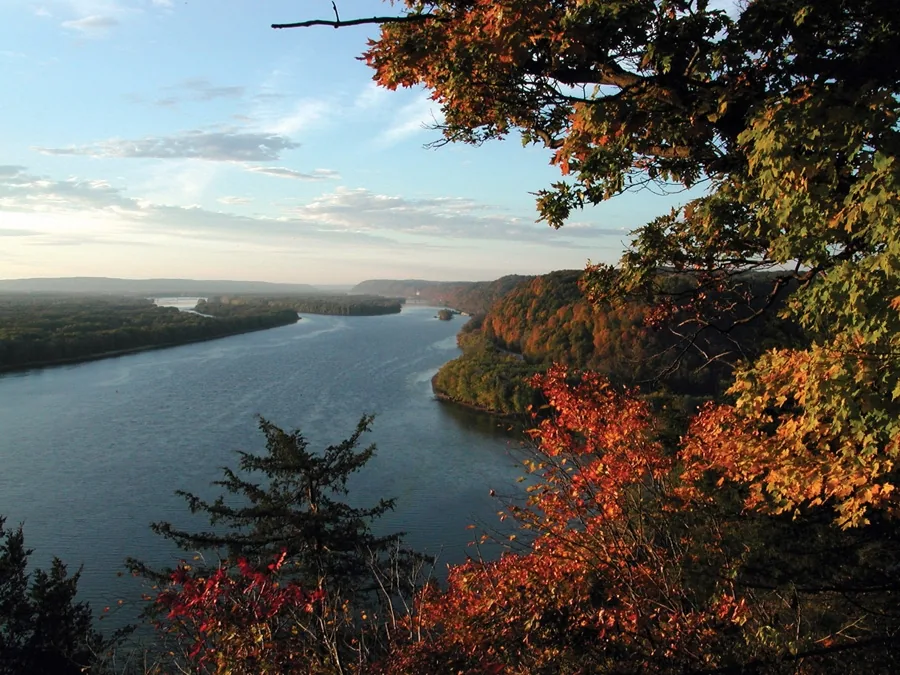
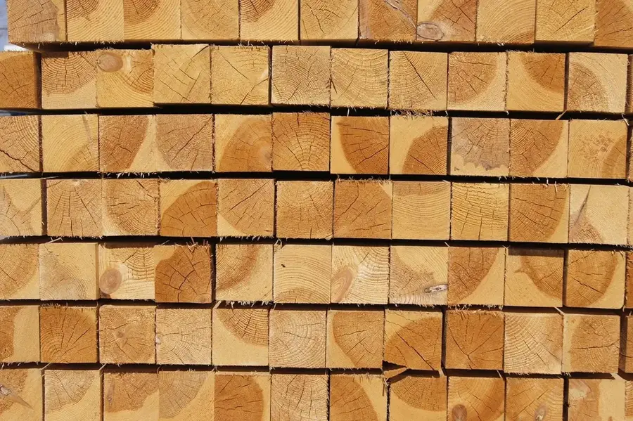
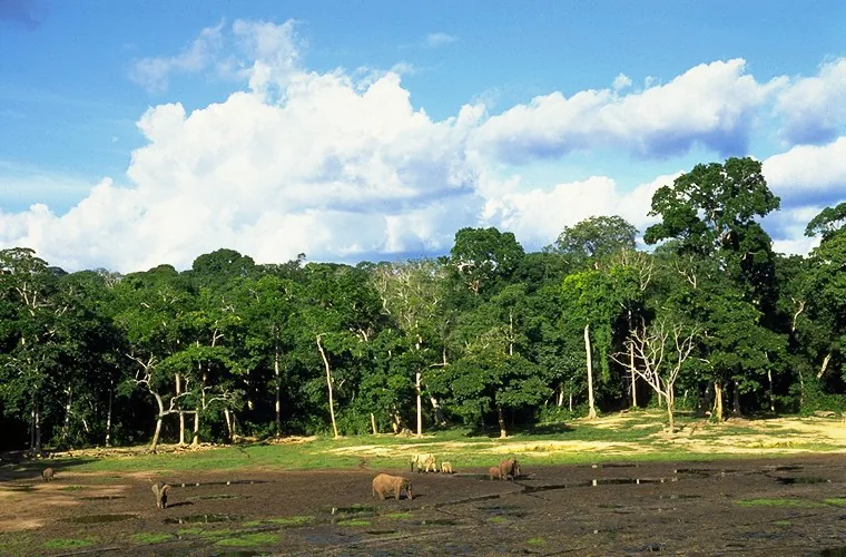
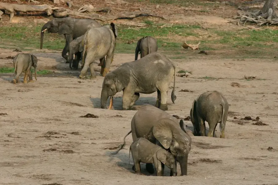
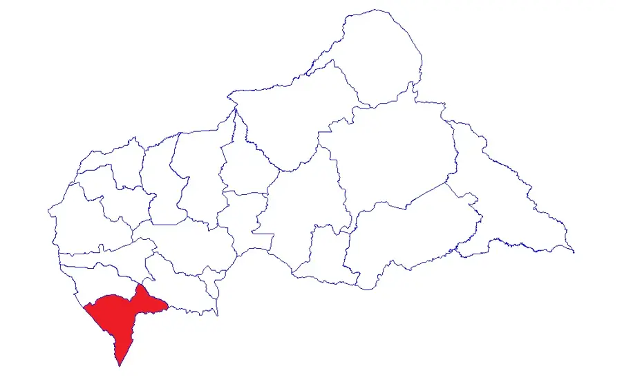
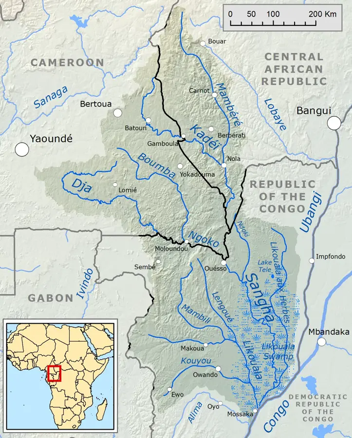
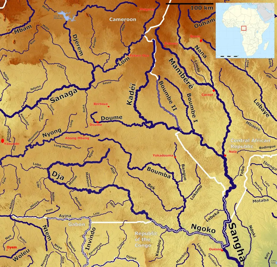
Nola is the capital of the Sangha-Mbaéré prefecture, located in the far southwest of the Central African Republic. The city occupies a strategic geographic position at the confluence of the Mambéré and Kadéï Rivers, which merge at this point to form the mighty Sangha River. This location makes Nola a central hub for riverine transport and the movement of natural resources. The town's economy is built on two primary pillars: diamond and gold mining, and a robust timber industry that draws from the surrounding dense tropical rainforests. Nola is often regarded as the gateway to the Dzanga-Sangha Protected Areas, a critical biodiversity hotspot in Central Africa. Due to its position, it plays a key role in trade routes connecting the CAR with Cameroon and the Republic of the Congo. The cultural fabric of Nola is enriched by various ethnic groups, including indigenous forest communities. The city remains a vital administrative and commercial center in the country's southwestern corner.
- Location: Central African Republic
- Top sights: Kadéï River · Nola, Central African Republic
- Nearby: Bayanga (69 km)
- Population: ~31.923 (2026)
Best time to visit & climate
The most pleasant time to visit is Jan, Feb, Dec.
| Jan | Feb | Mar | Apr | May | Jun | Jul | Aug | Sep | Oct | Nov | Dec | |
|---|---|---|---|---|---|---|---|---|---|---|---|---|
| Avg °C | 25 | 27 | 26 | 26 | 25 | 25 | 24 | 24 | 24 | 24 | 24 | 25 |
| Rain mm | 19 | 61 | 127 | 151 | 154 | 161 | 169 | 194 | 244 | 260 | 116 | 31 |
Geography
Facts
- Nola is located where the Mambéré and Kadéï Rivers form the Sangha River.
- The city is the administrative capital of the Sangha-Mbaéré prefecture.
- It is a major center for the timber and logging industry in CAR.
- Nola serves as a key logistical base for the Dzanga-Sangha Reserve.
- The surrounding area is a significant producer of diamonds and gold.
- The town is a vital link in the river transport network to the Congo River.
Explore nearby
Notable places around
Route planner — Car & Motorhome
Where do you start? We build the route here, with stops and country notes along the way.
© OpenStreetMap contributors · OpenRouteService
Sights in the town Nola (2)
Frequently asked questions
Which rivers meet at Nola?
What is the region around Nola known for?
Is Nola located near the Dzanga-Sangha Park?
How is the transport in Nola?
What is the Sangha Trinational complex?
Nola: where is it located?
Nola: what is there to see?
Nola: when is the best time to visit?
Nola: why is it worth visiting?

Nearby cities

History & landmarks

Nature
More places