Plizio Visual Lab
Historic Confluence of Nola
Weather…
Water temperature…
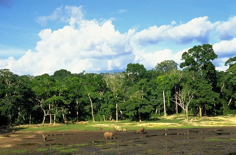
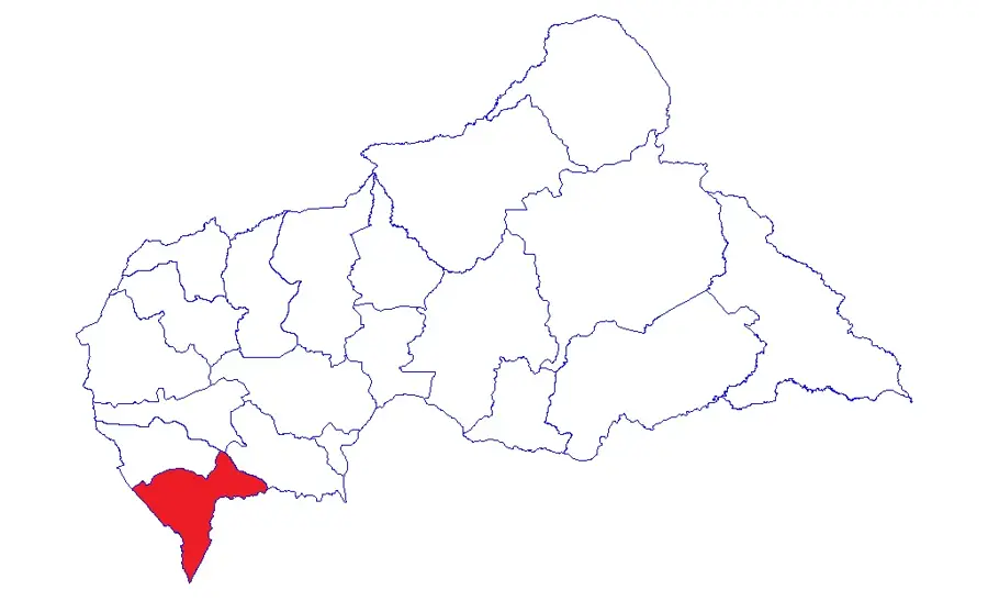
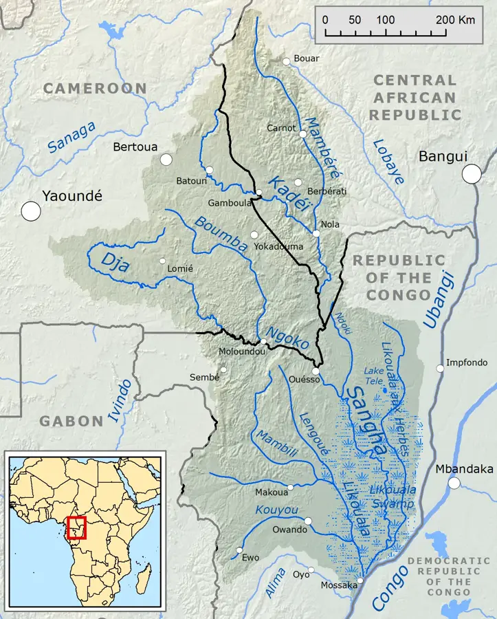
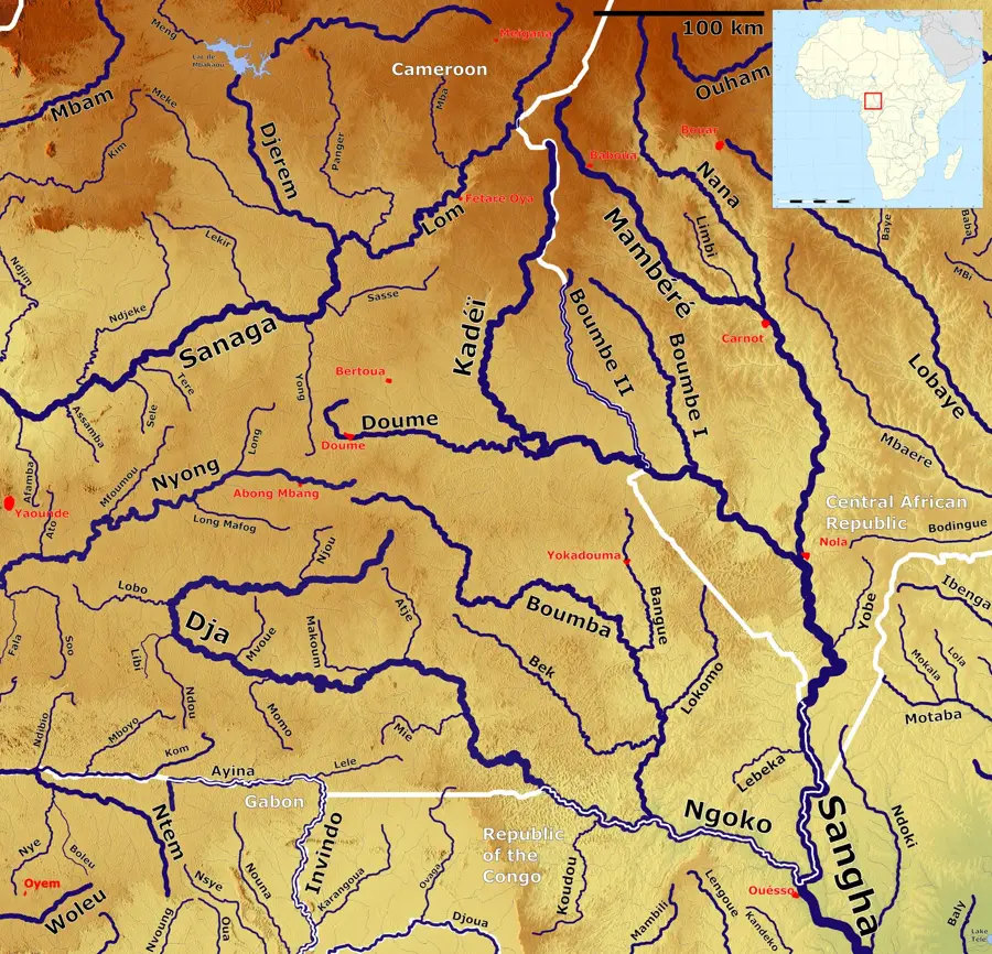
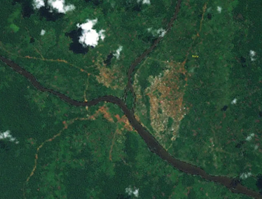
Nola is a fascinating town in the extreme southwest of the Central African Republic, famous for its unique location at the confluence of the Kadeï and Mambéré rivers, which form the Sangha from this point onwards. This strategic position made Nola a historical hub for trade and navigation in Equatorial Africa. Already during the German colonial period (1911-1914) as part of Neukamerun and later under French rule, the town was a center for the export of rubber, ivory, and precious timber. The town's architecture still shows traces of this varied history, with old warehouses and administrative buildings along the riverbank. Geographically, Nola is surrounded by dense tropical rainforests that harbor enormous biodiversity and form the basis of the local economy. Today, the town serves as the gateway to the Dzanga-Sangha Protected Area, one of Africa's most significant national parks. The confluence of the rivers is not only a geographical feature but also a spiritual and cultural meeting point for the various ethnic groups in the region. Nola's importance as a trading post has endured through the centuries, with diamonds and timber being the primary exports today.
- Location: Central African Republic
- Top sights: Kadéï River · Nola, Central African Republic
- Nearby: Bayanga (69 km)
Best time to visit & climate
The most pleasant time to visit is Jan, Feb, Dec.
| Jan | Feb | Mar | Apr | May | Jun | Jul | Aug | Sep | Oct | Nov | Dec | |
|---|---|---|---|---|---|---|---|---|---|---|---|---|
| Avg °C | 25 | 27 | 26 | 26 | 25 | 25 | 24 | 24 | 24 | 24 | 24 | 25 |
| Rain mm | 19 | 61 | 127 | 151 | 154 | 161 | 169 | 194 | 244 | 260 | 116 | 31 |
📋 Practical info
Geography
Facts
- Nola is the administrative seat of the Sangha-Mbaéré prefecture.
- In 1911, the town became German under the Morocco-Congo Treaty.
- The Sangha River is navigable from Nola down to the Congo River.
- The region around Nola is known for its significant sapphire deposits.
- Nola is situated at the edge of the Sangha Trinational landscape complex.
- The climate is humid tropical year-round with high levels of precipitation.
Explore nearby
Notable places around
Route planner — Car & Motorhome
Where do you start? We build the route here, with stops and country notes along the way.
© OpenStreetMap contributors · OpenRouteService
Sights in the town Historic Confluence of Nola (2)
Sights nearby
Frequently asked questions
Which rivers meet in Nola?
Can you take boat trips?
Is Nola a good starting point for national parks?
Are there accommodations in Nola?
How is the climate?
Historic Confluence of Nola: where is it located?
Historic Confluence of Nola: what is there to see?
Historic Confluence of Nola: when is the best time to visit?
Historic Confluence of Nola: why is it worth visiting?

Nearby cities

History & landmarks

Nature
More places