Plizio Visual Lab
Colonial Heritage of Mobaye
Weather…
Water temperature…
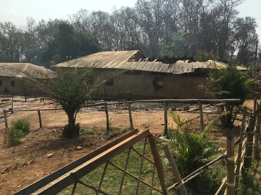
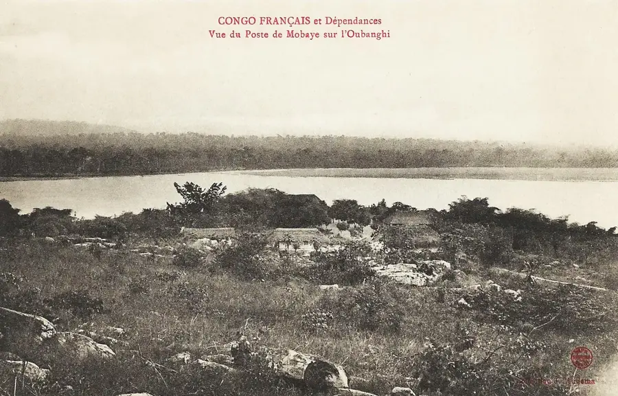
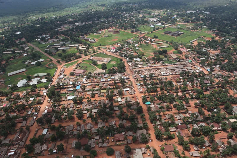
Mobaye is a town steeped in history located on the northern bank of the Ubangi River, which played a decisive strategic role during French colonial rule. Founded at the end of the 19th century, Mobaye served as a frontier post facing what was then the Belgian Congo and was a key station for controlling inland navigation on the Ubangi. The town witnessed numerous administrative developments and functioned as a gateway to the eastern territories of the Oubangui-Chari colony. Its geographical position near the river's rapids necessitated the construction of specific infrastructure, remains of which still characterize the townscape today. Throughout the 20th century, the site developed into a center for the exchange of goods between French and Belgian spheres of influence. The colonial architecture, which once testified to prosperity and administrative power, stands today as a silent monument to the era of European expansion in Central Africa. Despite political instability, Mobaye retains its significance as a historical crossing point and a witness to the early exploration of the regional river system.
- Location: Central African Republic
- Top sights: Mobaye · Mobayi-Mbongo · Mobayi-Mbongo (territory)
- Nearby: Alindao (74 km)
Best time to visit & climate
The most pleasant time to visit is Jan, Feb, Dec.
| Jan | Feb | Mar | Apr | May | Jun | Jul | Aug | Sep | Oct | Nov | Dec | |
|---|---|---|---|---|---|---|---|---|---|---|---|---|
| Avg °C | 27 | 29 | 28 | 27 | 26 | 26 | 25 | 25 | 25 | 25 | 26 | 26 |
| Rain mm | 14 | 34 | 108 | 138 | 172 | 151 | 170 | 183 | 164 | 187 | 94 | 17 |
📋 Practical info
Geography
Facts
- Mobaye is located directly opposite the town of Mobayi-Mbongo in the DR Congo.
- The town was founded in 1891 as a French military post.
- In 1910, Mobaye became part of the newly established French Equatorial Africa.
- The nearby rapids on the Ubangi River prevented continuous year-round navigation.
- Mobaye serves as the capital of the Basse-Kotto prefecture.
- The town features a small hydroelectric power plant built in the 1980s.
Explore nearby
Notable places around
Route planner — Car & Motorhome
Where do you start? We build the route here, with stops and country notes along the way.
© OpenStreetMap contributors · OpenRouteService
Sights in the town Colonial Heritage of Mobaye (3)
Sights nearby
Frequently asked questions
What does the colonial heritage in Mobaye include?
Is the place safe for tourists?
When is the best time to visit?
Are there museums in Mobaye?
Is a guide needed?
Colonial Heritage of Mobaye: where is it located?
Colonial Heritage of Mobaye: what is there to see?
Colonial Heritage of Mobaye: when is the best time to visit?
Colonial Heritage of Mobaye: why is it worth visiting?

Nearby cities