Plizio Visual Lab
Gbadolite
ℹ️Practical info — Gbadolite
▾
🌤 Weather — 5 days
📍 Nearby
Sights nearby
💡 Tips
- To visit the decaying ruins of Mobutu's luxurious palaces in Kawele, you must hire a local guide.
- Always ask for clear permission from guards or local authorities before taking photos of the palace ruins.
- Walk along the unusually wide boulevards to experience the contrast between the town's current state and its grand past.
- Despite the nearby hydroelectric dam, power outages are common, so bring a power bank.
🍽 Food
Caught nearby, it is best enjoyed grilled at the town's local eateries.
Steamed meat infused with local herbs and spices, available in central restaurants.
Buy incredibly fresh and sweet papayas directly from street vendors.
🛍 Shopping · 🧘 Quiet spots
The bustling heart of the town, offering everyday goods, fresh food, and colorful fabrics.
Keep an eye out for small wooden sculptures sold occasionally near the market area.
The vast, reclaimed nature around the palace ruins is eerily quiet and striking.
Take a short trip out of town to relax on the peaceful banks of the massive Ubangi River.
Water temperature…
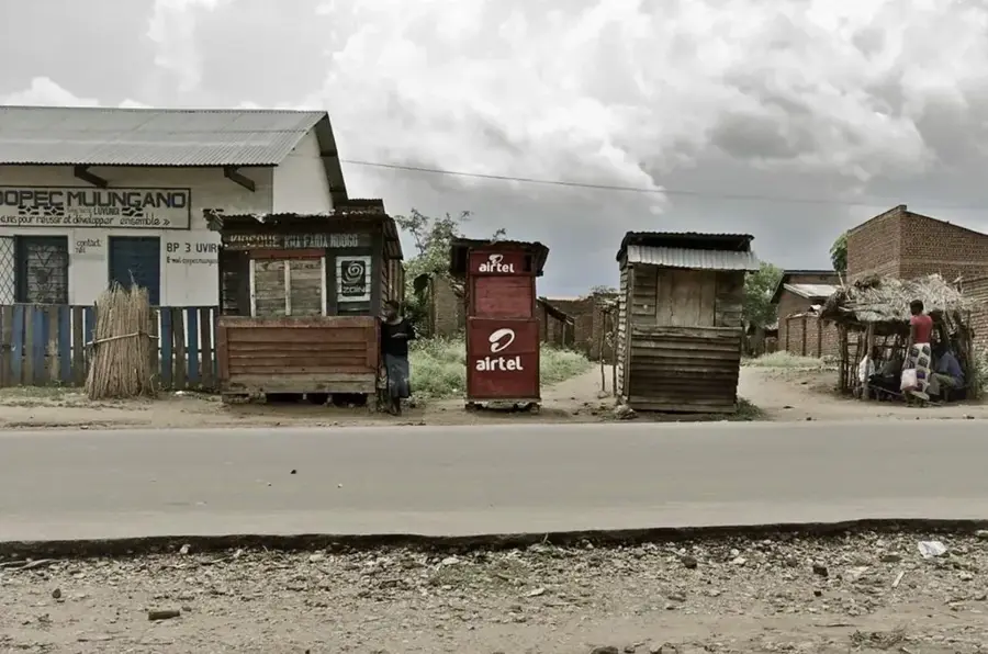
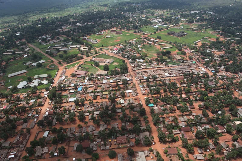
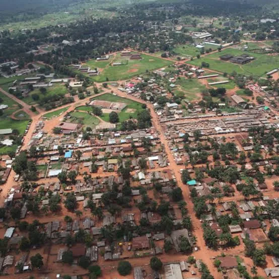
Gbadolite, the capital of North Ubangi Province in the Democratic Republic of the Congo, is a city defined by its extraordinary 20th-century history. Originally a small village, it was transformed into a lavish urban center by President Mobutu Sese Seko, who envisioned it as the 'Versailles of the Jungle.' During its heyday in the 1970s and 80s, Gbadolite boasted high-end infrastructure, including luxury palaces, a five-star hotel, a coca-cola bottling plant, and an international airport with a runway long enough for the Concorde. Located in the remote northwest near the Ubangi River border with the Central African Republic, the city served as a secondary seat of power for the Mobutu regime. Following his ousting in 1997, the city was looted and many of its grand structures fell into decay. Today, the ruins of the Kawele palace provide a haunting glimpse into a period of immense personal wealth amidst national poverty. Despite these setbacks, Gbadolite remains a vital regional administrative hub. Its survival is partly due to the Mobayi-Mbongo hydroelectric dam, which provides electricity to the city and the neighboring Central African Republic. The local economy revolves around trade and agriculture, with coffee, cocoa, and rubber being the primary commercial products. The city also acts as a strategic cross-border trade post, although it frequently hosts refugees fleeing conflict in the Central African Republic. Geographically, Gbadolite is surrounded by dense tropical forests, making it largely dependent on air transport for connection to Kinshasa. The population, predominantly from the Ngbandi ethnic group, maintains a bustling local culture. The University of Gbadolite serves as an important educational center for the province. While the era of grandiosity has passed, the city's planned layout and surviving infrastructure still distinguish it from other regional towns. Gbadolite stands as a complex monument to Congolese political history, reflecting both the heights of autocratic ambition and the resilience of its residents in the face of subsequent decline.
- Location: Congo - Kinshasa
- Top sights: Nord-Ubangi · Gbadolite (commune)
- Population: ~73.835 (2026)
Best time to visit & climate
The most pleasant time to visit is Jan, Feb, Dec.
| Jan | Feb | Mar | Apr | May | Jun | Jul | Aug | Sep | Oct | Nov | Dec | |
|---|---|---|---|---|---|---|---|---|---|---|---|---|
| Avg °C | 27 | 29 | 28 | 27 | 26 | 26 | 25 | 25 | 25 | 25 | 26 | 26 |
| Rain mm | 14 | 34 | 108 | 138 | 172 | 151 | 170 | 183 | 164 | 187 | 94 | 17 |
Geography
Facts
- Gbadolite served as the ancestral home of Mobutu Sese Seko.
- The city's international airport once hosted Air France Concordes.
- Mobayi-Mbongo Dam is located about 20 km from the city center.
- The population is primarily of the Ngbandi ethnic group.
- Gbadolite is the administrative capital of North Ubangi Province.
- The city was a major target during the First and Second Congo Wars.
- It is located at 4.28° North latitude and 21.01° East longitude.
- The local University of Gbadolite was founded in 2004.
Explore nearby
Notable places around
Route planner — Car & Motorhome
Where do you start? We build the route here, with stops and country notes along the way.
© OpenStreetMap contributors · OpenRouteService
Sights in the town Gbadolite (2)
Frequently asked questions
Why is Gbadolite called 'Versailles in the Jungle'?
Is there an international airport?
What can you visit there today?
Where is Gbadolite located?
What is the infrastructure like today?
Gbadolite: where is it located?
Gbadolite: what is there to see?
Gbadolite: when is the best time to visit?
Gbadolite: why is it worth visiting?

Nearby cities
More places