Plizio Visual Lab
Businga
ℹ️Practical info — Businga
▾
🌤 Weather — 5 days
📍 Nearby
Sights nearby
💡 Tips
- Businga is quite remote; ensure you have enough cash for your entire stay as banking facilities are almost non-existent.
- Roads can become impassable during the rainy season, so plan overland travel carefully.
- French and Lingala are the essential languages here; knowing a few basic phrases will help immensely.
- River transport on the Mongala River is scenic but requires a lot of patience regarding departure times.
🍽 Food
Fresh catches from the Mongala River, steamed or roasted wrapped in banana leaves.
A dense, fermented cassava bread that is a staple side dish for most meals here.
Try the sweet, locally grown plantains, often served fried by street vendors.
🛍 Shopping · 🧘 Quiet spots
The best place to buy fresh produce and see the daily trade happening right off the boats.
Small kiosks around the town center where you can find basic necessities and snacks.
Find a quiet spot by the water at dawn to watch the traditional dugout canoes glide by.
Walk slightly out of the center to enjoy the peaceful agricultural surroundings.
Water temperature…
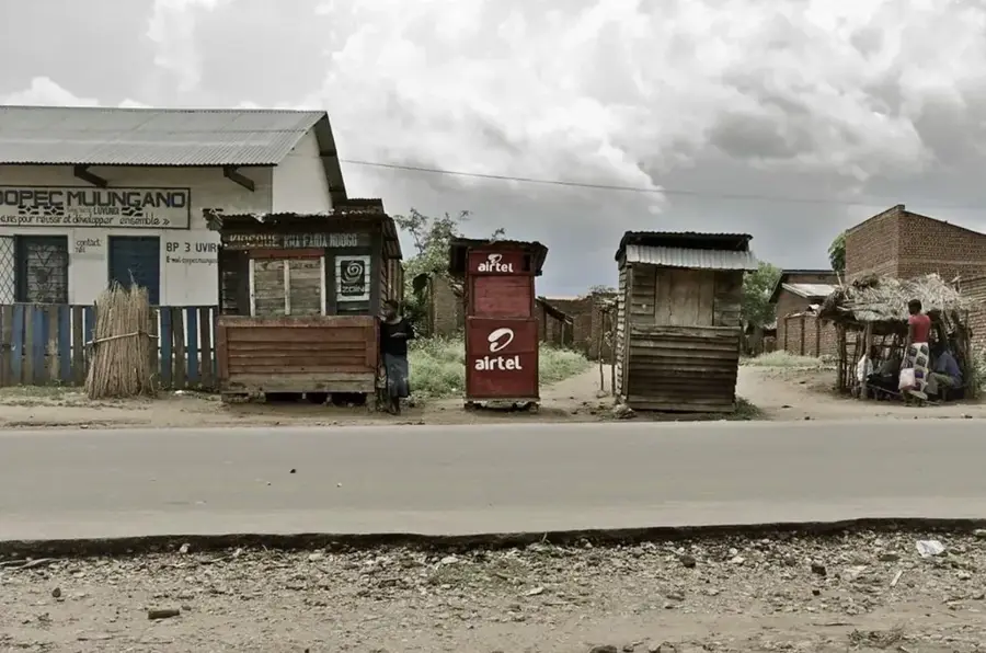
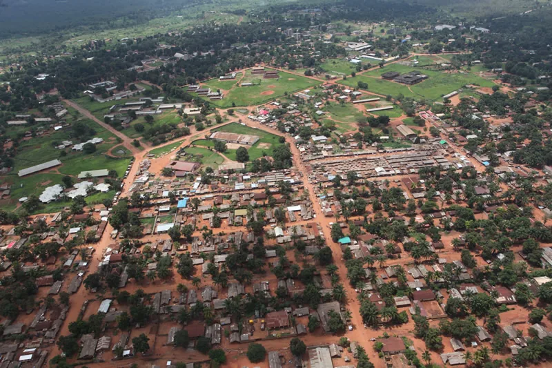
Businga is a significant town in the northwestern Democratic Republic of the Congo, situated within the Nord-Ubangi Province. It is located on the Mongala River, a major tributary of the Congo River, which establishes the town as a strategic port for regional commerce. Geographically, Businga is positioned in a fertile lowland area surrounded by dense rainforests and productive agricultural lands. The town grew during the colonial era as a pivotal center for palm oil and rubber production, with the river serving as the primary conduit for transporting goods to broader markets. Today, the local economy is underpinned by the production of coffee, cocoa, and staple crops such as cassava and maize. Businga maintains an airfield that is vital for connecting the remote region to the national capital, Kinshasa, and other regional hubs. The social landscape is largely defined by the Ngbandi ethnic group, to which the former president Mobutu Sese Seko belonged, resulting in certain regional benefits during his administration. Despite its natural wealth, the town currently grapples with deteriorating transport infrastructure and limited modern investment.
- Location: Congo - Kinshasa
- Population: ~48.339 (2023)
Best time to visit & climate
The most pleasant time to visit is Jan, Feb, Dec.
| Jan | Feb | Mar | Apr | May | Jun | Jul | Aug | Sep | Oct | Nov | Dec | |
|---|---|---|---|---|---|---|---|---|---|---|---|---|
| Avg °C | 27 | 28 | 26 | 26 | 26 | 25 | 25 | 24 | 24 | 25 | 25 | 26 |
| Rain mm | 26 | 61 | 150 | 142 | 156 | 151 | 163 | 197 | 170 | 208 | 117 | 23 |
Geography
Facts
- Businga is located on the navigable Mongala River.
- The town is a cultural center for the Ngbandi people.
- Businga possesses a domestic airport (IATA code: BSU).
- Coffee and palm oil are the primary exports of the region.
- The town is situated about 150 kilometers south of Gbadolite.
- The climate is tropical and humid with high annual rainfall.
Explore nearby
Notable places around
Route planner — Car & Motorhome
Where do you start? We build the route here, with stops and country notes along the way.
© OpenStreetMap contributors · OpenRouteService
Frequently asked questions
What is Businga known for?
What is grown in Businga?
How is the city's connectivity?
Are there accommodations?
When is the best time for a trip?
Businga: where is it located?
Businga: when is the best time to visit?
Businga: why is it worth visiting?

Nearby cities
More places