Plizio Visual Lab
Llanos de Moxos
Weather…
Water temperature…
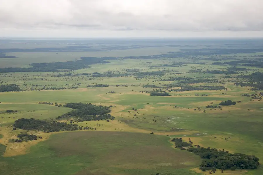
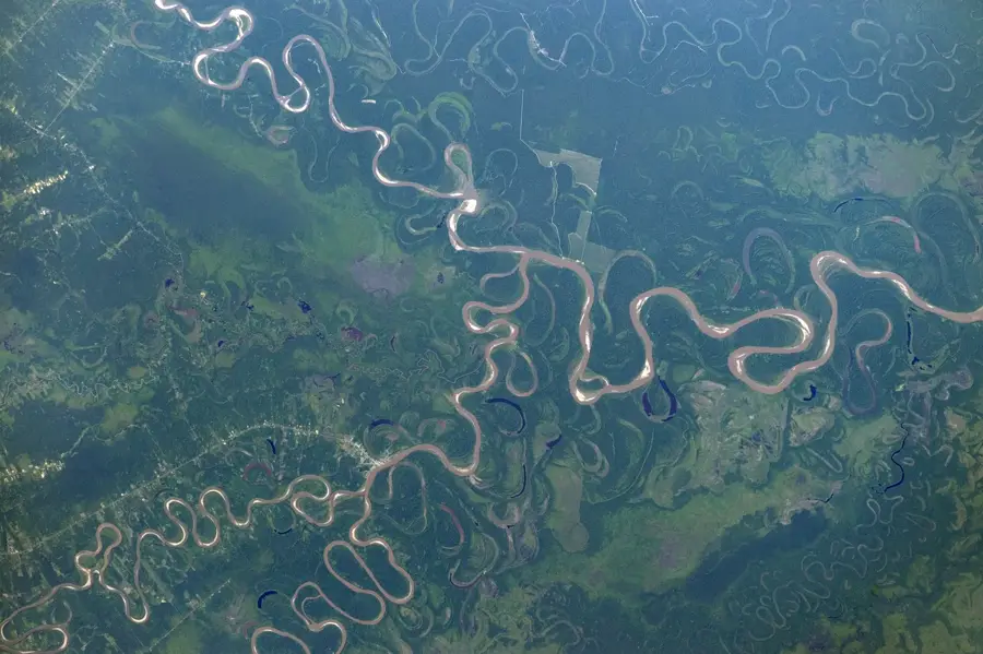
The Llanos de Moxos, also known as the Beni Savanna, covers an area of approximately 120,000 square kilometers in northern Bolivia's Amazon basin. This tropical savanna and wetland region is defined by severe seasonal flooding occurring between December and May, driven by the Mamoré and Iténez river systems. Historically, the area is of immense importance due to the archaeological remains of a pre-Columbian hydraulic civilization that flourished from 500 BC to 1400 AD. These ancient inhabitants engineered a complex landscape of raised fields, canals, and causeways to manage water levels for intensive agriculture. These structures, often called 'camellones', allowed for high population densities in what is now the Beni Department. Today, the region serves as the heart of Bolivia's cattle ranching industry while maintaining high biodiversity, including the critically endangered blue-throated macaw. The landscape alternates between vast open grasslands and isolated forest islands that developed on man-made earthen mounds.
Best time to visit & climate
The most pleasant time to visit is May–Jul.
| Jan | Feb | Mar | Apr | May | Jun | Jul | Aug | Sep | Oct | Nov | Dec | |
|---|---|---|---|---|---|---|---|---|---|---|---|---|
| Avg °C | 26 | 26 | 26 | 26 | 25 | 25 | 26 | 28 | 29 | 29 | 28 | 27 |
| Rain mm | 285 | 269 | 209 | 139 | 81 | 40 | 35 | 32 | 72 | 141 | 179 | 254 |
📋 Practical info
Geography
Facts
- Covers an area of roughly 120,000 square kilometers
- Elevation ranges between 130 and 235 meters above sea level
- Over 20,000 artificial earthen mounds documented by researchers
- Annual precipitation varies between 1,300 and 2,000 mm
- Primary habitat for the endemic blue-throated macaw
- Flooding period typically lasts between 4 and 7 months each year
Explore nearby
Notable places around
Route planner — Car & Motorhome
Where do you start? We build the route here, with stops and country notes along the way.
© OpenStreetMap contributors · OpenRouteService
Sights nearby
Frequently asked questions
What is special about this region?
What's the best way to travel there?
Are there mosquitoes?
What animals can be seen?
Where are the nearest cities?
Llanos de Moxos: where is it located?
Llanos de Moxos: when is the best time to visit?
Llanos de Moxos: why is it worth visiting?

Nature
More places