Plizio Visual Lab
Helagsfjället
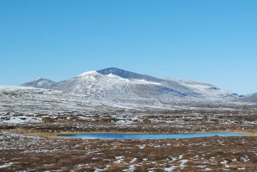
Helagsfjället, commonly known as Helags, is the highest peak in Sweden south of the Arctic Circle, standing at 1,797 meters above sea level. Located in the province of Härjedalen near the Norwegian border, it is most famous for housing the Helags Glacier, the southernmost glacier in Sweden. The mountain features a distinctive horseshoe shape with a massive cirque carved out by millennia of glacial activity. This area is a major hub for alpine hiking and mountaineering, anchored by the Helags Mountain Station, one of the oldest and most well-known lodges of the Swedish Tourist Association. Ecologically, the region is critically important as a sanctuary for the endangered Arctic fox and as a vital summer grazing ground for the reindeer herds of local Sami communities. Reaching the summit provides hikers with panoramic views of the Jämtland and Härjedalen highlands, stretching far into Norway on clear days. Despite its relatively southern location, it maintains a true alpine climate with snowfields often remaining year-round.
- Location: Sweden
- Top sights: Predikstolen · Helagsfjället
- Nearby: Funäsdalen (40 km)
Best time to visit & climate
The most pleasant time to visit is Jun–Aug.
| Jan | Feb | Mar | Apr | May | Jun | Jul | Aug | Sep | Oct | Nov | Dec | |
|---|---|---|---|---|---|---|---|---|---|---|---|---|
| Avg °C | -8 | -8 | -6 | -2 | 4 | 9 | 12 | 11 | 6 | 0 | -5 | -7 |
| Rain mm | 89 | 73 | 82 | 71 | 100 | 137 | 157 | 147 | 115 | 98 | 87 | 95 |
📋 Practical info
Geography
Facts
- Summit elevation is 1,797 meters.
- Home to Sweden's southernmost glacier.
- Highest mountain south of the Arctic Circle.
- Crucial breeding ground for Arctic foxes.
- Helags Mountain Station opened in 1897.
- Located in the province of Härjedalen.
Explore nearby
Notable places around
Route planner — Car & Motorhome
Where do you start? We build the route here, with stops and country notes along the way.
© OpenStreetMap contributors · OpenRouteService
Sights in the town Helagsfjället (2)
Sights nearby
Frequently asked questions
What is special about Helags?
Which animal is the symbol of the mountain?
How high is Helags?
Is there accommodation?
How do you reach the mountain?
Helagsfjället: where is it located?
Helagsfjället: what is there to see?
Helagsfjället: when is the best time to visit?
Helagsfjället: why is it worth visiting?

Nearby cities