Plizio Visual Lab
Sierra de la Cabrera
Weather…
Water temperature…
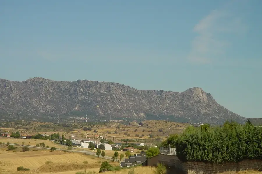
The Sierra de la Cabrera is a distinctive granite massif in northern Madrid, part of the Carpetano-Vetónica range within the Central System. This mountain group is characterized by its jagged peaks and bizarre rock formations created by the long-term erosion of the granite. The most famous summit is Pico de la Miel, which is a premier destination for rock climbers across the region due to its steep vertical faces. Geologically, the Sierra is an excellent example of a horst structure uplifted during the Alpine orogeny. Set among the rocks lies the medieval monastery of San Julián y San Antonio, a testament to the historical settlement of this rugged terrain. The vegetation is typically Mediterranean, consisting of rockroses, junipers, and scattered holm oaks adapted to the thin soil. Due to its proximity to the capital, the Sierra serves as a major recreational area for the citizens of Madrid.
- Location: Galicia, Spain
- Top sights: Castro Celta - Arévaco · Tumba del Moro · Zona Arqueológica La Cabrera
- Nearby: San Agustín del Guadalix (19 km)
Best time to visit & climate
The most pleasant time to visit is Jun–Aug.
| Jan | Feb | Mar | Apr | May | Jun | Jul | Aug | Sep | Oct | Nov | Dec | |
|---|---|---|---|---|---|---|---|---|---|---|---|---|
| Avg °C | 2 | 3 | 6 | 9 | 13 | 19 | 22 | 22 | 17 | 12 | 6 | 3 |
| Rain mm | 48 | 44 | 53 | 59 | 51 | 30 | 13 | 17 | 27 | 72 | 63 | 49 |
📋 Practical info
Geography
Facts
- Pico de la Miel stands at approximately 1,392 meters high.
- The Sierra de la Cabrera range stretches for a length of only 4 kilometers.
- The monastery of San Julián y San Antonio dates back to the 11th century.
- Granite is the dominant rock type throughout the entire formation.
- The region is known for quarries that supplied building materials to Madrid.
- The highest peak in the range is Cancho Gordo at 1,564 meters.
Explore nearby
Notable places around
Route planner — Car & Motorhome
Where do you start? We build the route here, with stops and country notes along the way.
© OpenStreetMap contributors · OpenRouteService
Sights in the town Sierra de la Cabrera (5)
Sights nearby
Frequently asked questions
What is Pico de la Miel?
How far is it from Madrid?
Are there historical sights there?
Is the terrain suitable for beginning climbers?
Is there shade on the hiking trails?
Sierra de la Cabrera: where is it located?
Sierra de la Cabrera: what is there to see?
Sierra de la Cabrera: when is the best time to visit?
Sierra de la Cabrera: why is it worth visiting?

Nearby cities