Plizio Visual Lab
Rubkona
ℹ️Practical info — Rubkona
▾
🌤 Weather — 5 days
📍 Nearby
Sights nearby
💡 Tips
- Rubkona is the twin city of Bentiu; the bridge connecting them is a hive of activity.
- The airport is the main gateway; expect security checks and prioritize morning flights.
- Flood levels can change rapidly in the wet season; always check local accessibility.
- The market is excellent for finding goods from both Sudan and Juba due to its hub status.
- Nile fish is the local delicacy; look for the drying and smoking areas near the river.
🍽 Food
Look for vendors near the Ghazal river banks selling tilapia or perch caught that morning.
A staple in the market eateries, especially in the late afternoon.
The local thin fermented bread, great for scooping up fish stews.
🛍 Shopping · 🧘 Quiet spots
Locally made nets and traps sold by the river-dwelling communities.
A variety of fabrics and clothes brought in from neighboring Sudan.
Strong baskets woven from local swamp reeds, used for transporting fish.
Walk away from the main bridge to find quieter spots for birdwatching.
These elevated pathways offer great views and a breeze above the town level.
The areas beyond the market hub are surprisingly calm and spacious.
Water temperature…
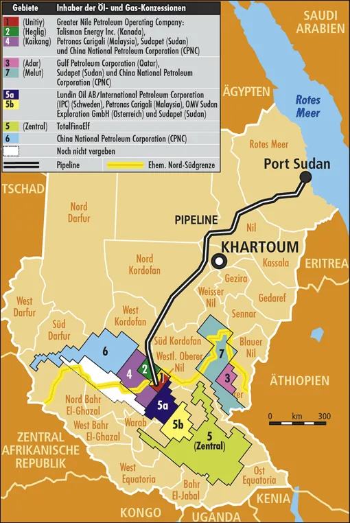
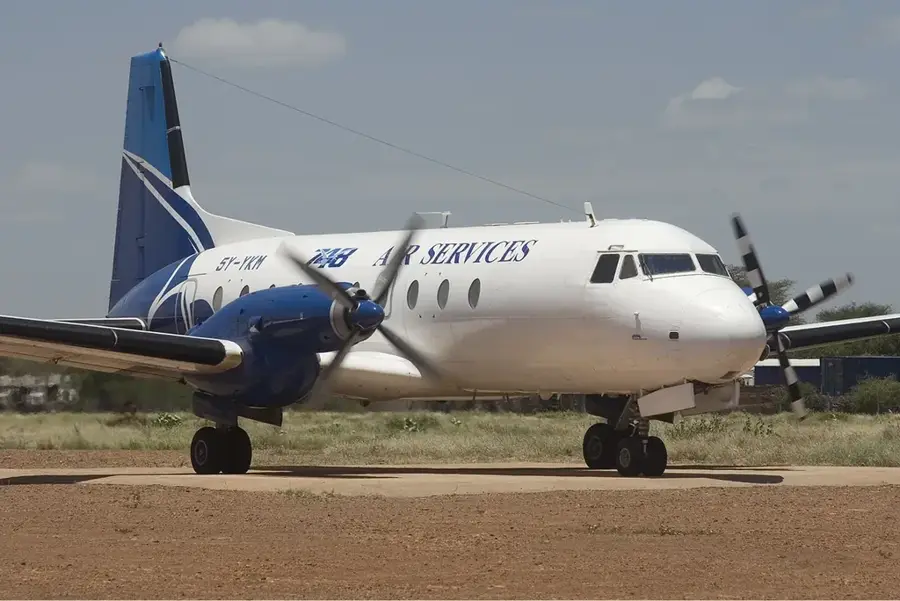
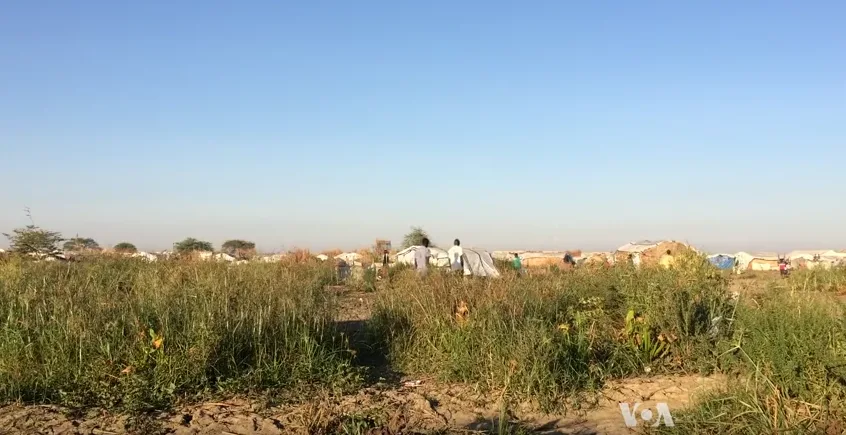
Rubkona is a strategically vital town in Unity State, South Sudan, serving as a primary transport and logistics hub for the northern part of the country. Situated on the southern bank of the Bahr el Ghazal River, it is linked to the state capital, Bentiu, by a major bridge that facilitates trade and movement across the region. The town gained significant importance due to its proximity to major oil fields, which have historically driven the local and national economy. Rubkona is also home to a major airfield and serves as a critical base for international humanitarian operations, including a large United Nations Mission in South Sudan (UNMISS) site. The local population is primarily composed of the Nuer ethnic group, whose culture is deeply rooted in pastoralism and cattle rearing. Despite the environmental challenges of the Sudd wetlands and the social impacts of civil conflict, Rubkona remains a bustling center of commerce with a large market that attracts traders from across the border with Sudan. The town's infrastructure includes schools, hospitals, and administrative offices that support both the urban residents and the large number of internally displaced persons in the area. Its geographical position makes it a gateway for both commercial goods and humanitarian aid.
- Location: South Sudan
- Nearby: Mayom (86 km)
- Population: ~7.653 (2026)
Best time to visit & climate
The most pleasant time to visit is Jan, Nov, Dec.
| Jan | Feb | Mar | Apr | May | Jun | Jul | Aug | Sep | Oct | Nov | Dec | |
|---|---|---|---|---|---|---|---|---|---|---|---|---|
| Avg °C | 29 | 31 | 33 | 33 | 31 | 28 | 27 | 26 | 27 | 28 | 28 | 29 |
| Rain mm | 0 | 0 | 2 | 24 | 104 | 124 | 162 | 187 | 159 | 89 | 4 | 1 |
Geography
Facts
- Located in Unity State along the Bahr el Ghazal River.
- Connected to the city of Bentiu by a strategic bridge.
- Hosts an important airfield for the northern region.
- Center for oil industry logistics and supply.
- Site of a large UNMISS protection base.
- Major marketplace for cross-border trade with Sudan.
Explore nearby
Notable places around
Route planner — Car & Motorhome
Where do you start? We build the route here, with stops and country notes along the way.
© OpenStreetMap contributors · OpenRouteService
Frequently asked questions
What is Rubkona?
What is the role?
Is tourism possible?
What is the climate like?
How to travel there?
Rubkona: where is it located?
Rubkona: when is the best time to visit?
Rubkona: why is it worth visiting?

Nearby cities
History & landmarks

Nature

More places