Plizio Visual Lab
Bentiu
ℹ️Practical info — Bentiu
▾
🌤 Weather — 5 days
📍 Nearby
Sights nearby
💡 Tips
- Bentiu is a major commercial hub, but travel here requires careful planning and up-to-date security information due to regional instability.
- Cash is king; ATMs are rare or unreliable, so carry enough local currency (South Sudanese Pound) in small notes.
- Expect daytime temperatures to be very high; it's advisable to do any necessary travel or shopping in the early morning.
- The rainy season can make local dirt roads impassable; always check road conditions if planning to travel outside the city.
🍽 Food
A thin, fermented sorghum bread, a staple often eaten with stews at local eateries.
A porridge made from sorghum flour, widely available in simple local restaurants.
Fresh fish from the nearby rivers, typically roasted or fried, found in local markets or riverside food stalls.
🛍 Shopping · 🧘 Quiet spots
A bustling market across the river offering fresh produce, local grains, and everyday items.
The central area for purchasing basic supplies, textiles, and household goods.
A calmer spot away from the market chaos to observe the river's daily life.
Find a shaded tea stall to sit quietly and enjoy a traditional spiced tea.
Water temperature…
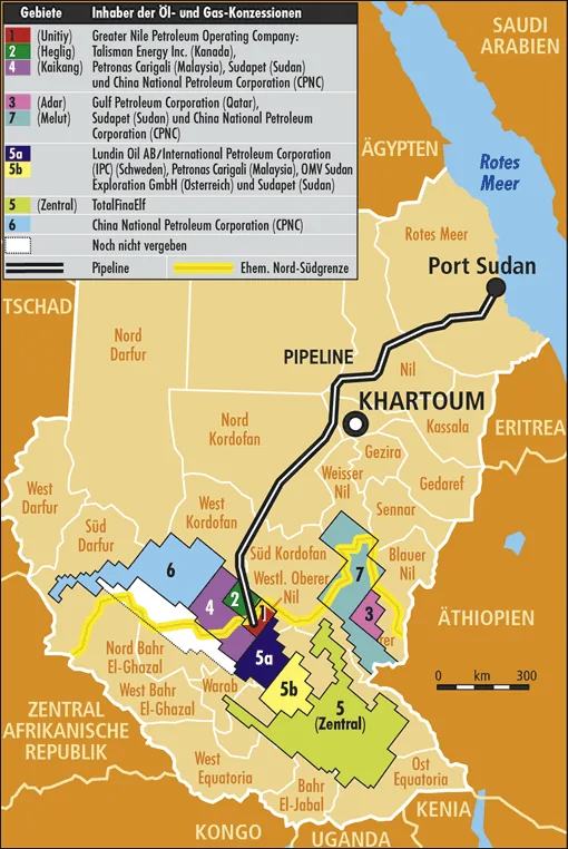
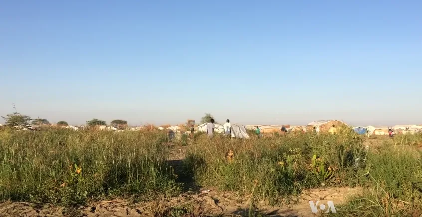
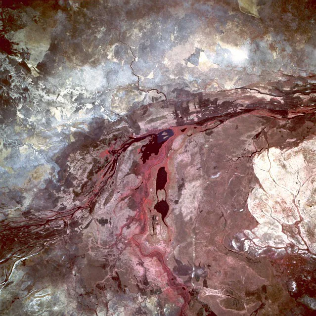
Bentiu is the capital of Unity State in northern South Sudan, positioned on the southern bank of the Bahr el Ghazal River. The city is primarily known as the hub of the South Sudanese petroleum industry, as it is surrounded by some of the country's most productive oil fields. These resources have granted Bentiu economic significance and strategic importance during past conflicts. Geographically, the terrain is flat and marshy, leading to major logistical hurdles during the rainy season. The city is linked by the Rubkona Bridge to its twin town, Rubkona, on the opposite side of the river. Due to the civil war, Bentiu hosts one of the largest internally displaced persons camps (PoC sites) in the nation. Culturally, the region is the heartland of the Nuer ethnic group. Despite suffering destruction from fighting, Bentiu remains a critical junction for the national economy and international humanitarian operations.
- Location: South Sudan
- Nearby: Rubkona (6 km)
- Population: ~7.653 (2026)
Best time to visit & climate
The most pleasant time to visit is Jan, Nov, Dec.
| Jan | Feb | Mar | Apr | May | Jun | Jul | Aug | Sep | Oct | Nov | Dec | |
|---|---|---|---|---|---|---|---|---|---|---|---|---|
| Avg °C | 29 | 31 | 33 | 33 | 31 | 28 | 27 | 26 | 27 | 28 | 29 | 29 |
| Rain mm | 0 | 0 | 3 | 25 | 101 | 127 | 146 | 185 | 154 | 96 | 5 | 2 |
Geography
Facts
- Bentiu is situated at an altitude of approximately 395 meters above sea level.
- The city was modernized in the late 1970s following the discovery of oil.
- Bentiu Airport (IATA: BNT) is actually located near Rubkona.
- The Rubkona Bridge is one of the few permanent river crossings in the region.
- Major oil fields like Thar Jath are located in the immediate vicinity of the city.
- The region is characterized by extensive wetlands that are part of the Sudd system.
Explore nearby
Notable places around
Route planner — Car & Motorhome
Where do you start? We build the route here, with stops and country notes along the way.
© OpenStreetMap contributors · OpenRouteService
Sights in the town Bentiu (1)
Frequently asked questions
Why is the place known?
What is the security situation?
Is there infrastructure?
Is the place visited?
What should you look out for?
Bentiu: where is it located?
Bentiu: when is the best time to visit?
Bentiu: why is it worth visiting?

Nearby cities
History & landmarks

Nature

More places