Plizio Visual Lab
Pariang
ℹ️Practical info — Pariang
▾
🌤 Weather — 5 days
📍 Nearby
Sights nearby
💡 Tips
- Travel requires extensive planning and often a 4x4 vehicle; coordinate with local guides or NGOs.
- Tourist infrastructure is practically non-existent; bring all essential supplies and medications.
- Carry enough cash in South Sudanese Pounds, as ATMs are generally unavailable.
- Always ask for permission before photographing people, especially in local Dinka communities.
🍽 Food
A thin, fermented sorghum flatbread that serves as the staple food, available in local markets.
A hearty and simple meat stew, typically served with Kisra or maize porridge in basic eateries.
Locally caught river fish, often simply grilled or dried, available when in season.
🛍 Shopping · 🧘 Quiet spots
The bustling center of daily life where you can find basic goods and agricultural produce.
Traditional, colorful bead jewelry sometimes available directly from local artisans.
Walk to the edge of the town for peaceful, sweeping views of the surrounding wetlands and plains.
Local churches or NGO compounds often serve as quiet, shaded spots for rest.
Water temperature…
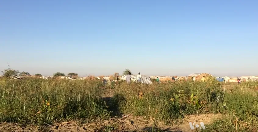
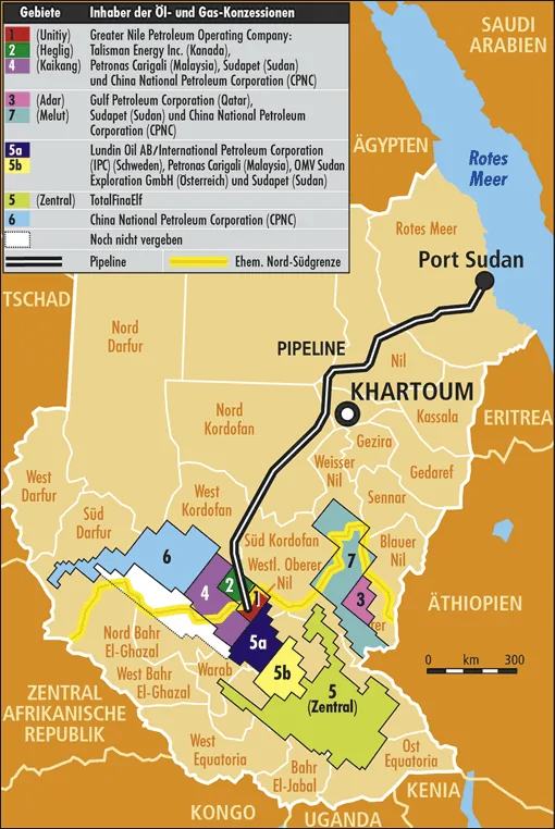
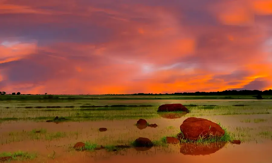
Pariang serves as the headquarters of the Ruweng Administrative Area in northern South Sudan, a region synonymous with the nation's vast petroleum wealth. Geographically, the city is located within the flat savannahs and marshlands of the Greater Upper Nile region, positioned strategically near the Thar Jath and Unity oil fields. Pariang's identity is defined by its role as the administrative heart for the Dinka Pariang community, whose traditional pastoralist lifestyle now coexists with the complex machinery of the international oil industry. Since its designation as a special administrative center, Pariang has seen a surge in population and the development of essential services, including government offices, health clinics, and schools. The local economy is uniquely structured around the energy sector, which provides employment and royalty-based funding for local projects, alongside traditional cattle rearing and subsistence farming of sorghum and peanuts. However, the environmental impact of oil extraction remains a critical concern for the local leadership, driving efforts toward better regulation and sustainable land use. The city acts as a vital security and logistics hub for the northern frontier, ensuring the steady flow of crude oil that sustains the national budget. Culturally, Pariang is a center for Ruweng traditions, characterized by intricate beadwork, traditional wrestling, and oral histories that link the community to the land. The climate is tropical wet and dry, with a harsh dry season followed by monsoons that transform the landscape into a lush green expanse. Despite its remote location, Pariang's global economic significance makes it a focal point for national policy and international interest. The town is gradually modernizing, with expanding telecommunications and improved road links to nearby markets, marking its transition into a key urban anchor for South Sudan's industrial future.
- Location: South Sudan
- Nearby: Rubkona (40 km)
Best time to visit & climate
The most pleasant time to visit is Jan, Nov, Dec.
| Jan | Feb | Mar | Apr | May | Jun | Jul | Aug | Sep | Oct | Nov | Dec | |
|---|---|---|---|---|---|---|---|---|---|---|---|---|
| Avg °C | 29 | 31 | 33 | 33 | 31 | 28 | 27 | 26 | 27 | 28 | 28 | 29 |
| Rain mm | 0 | 0 | 2 | 24 | 104 | 124 | 162 | 187 | 159 | 89 | 4 | 1 |
Geography
Facts
- Capital of the Ruweng Administrative Area in the north of South Sudan.
- Heart of the country's oil production, specifically the Unity fields.
- Primary ethnic group is the Dinka Pariang, part of the Ruweng Dinka.
- Strategic location near the border with Sudan and the Nuba Mountains.
- Economy is driven by the petroleum sector and pastoralism.
- Site of significant humanitarian and developmental aid projects.
- Elevation is approximately 390 meters in a low-lying marshy basin.
- Critical hub for the maintenance of oil infrastructure and security.
Explore nearby
Notable places around
Route planner — Car & Motorhome
Where do you start? We build the route here, with stops and country notes along the way.
© OpenStreetMap contributors · OpenRouteService
Frequently asked questions
What is Pariang?
Are there hotels?
What is the terrain like?
Is it touristic?
What do you need?
Pariang: where is it located?
Pariang: when is the best time to visit?
Pariang: why is it worth visiting?

Nearby cities
History & landmarks
Nature
More places