Plizio Visual Lab
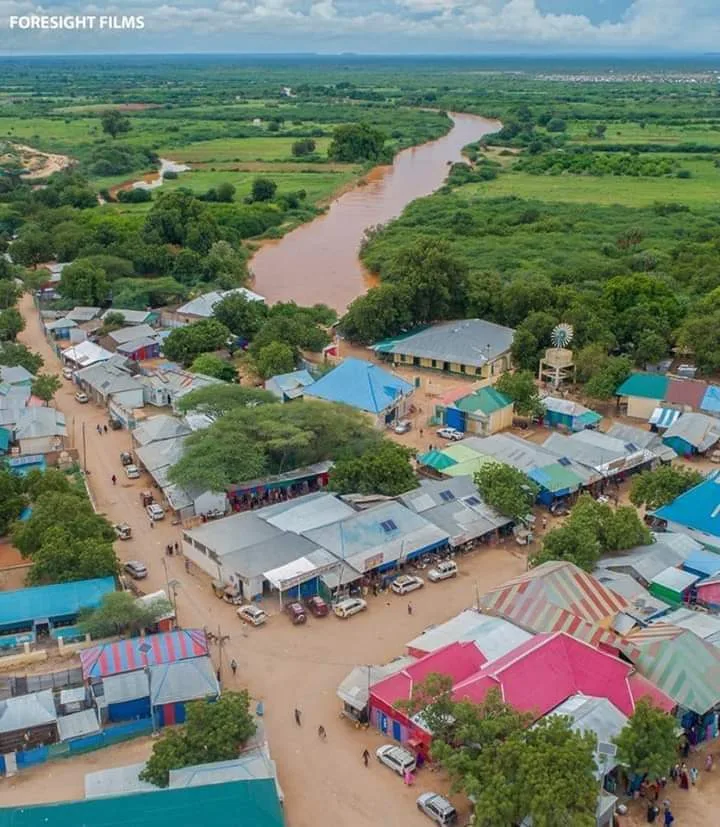
Dolow
ℹ️Practical info — Dolow
▾
🌤 Weather — 5 days
📍 Nearby
Sights nearby
💡 Tips
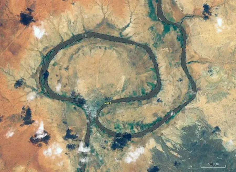
- The confluence of the Dawa and Ganale Dorya rivers is a must-see geographic landmark.
- The climate is extremely hot year-round; always carry water and seek shade during midday.
- As a border town, expect security checkpoints; always have your identification handy.
- Dress very conservatively to respect the local Islamic culture.
🍽 Food
Tea spiced with cardamom and cloves, very popular at the local tea shops.
A traditional dish often served with Sabaayad (flatbread) at local eateries.
Buy fresh mangoes and papayas from the river valleys at street stands.
🛍 Shopping · 🧘 Quiet spots
You can find brightly colored fabrics and traditional clothing in the main market.
Buy aromatic frankincense and spices from the small market stalls.
Viewpoints overlooking the meeting of the rivers offer a peaceful atmosphere.
Rest under the large trees just outside the bustling town center.
Water temperature…
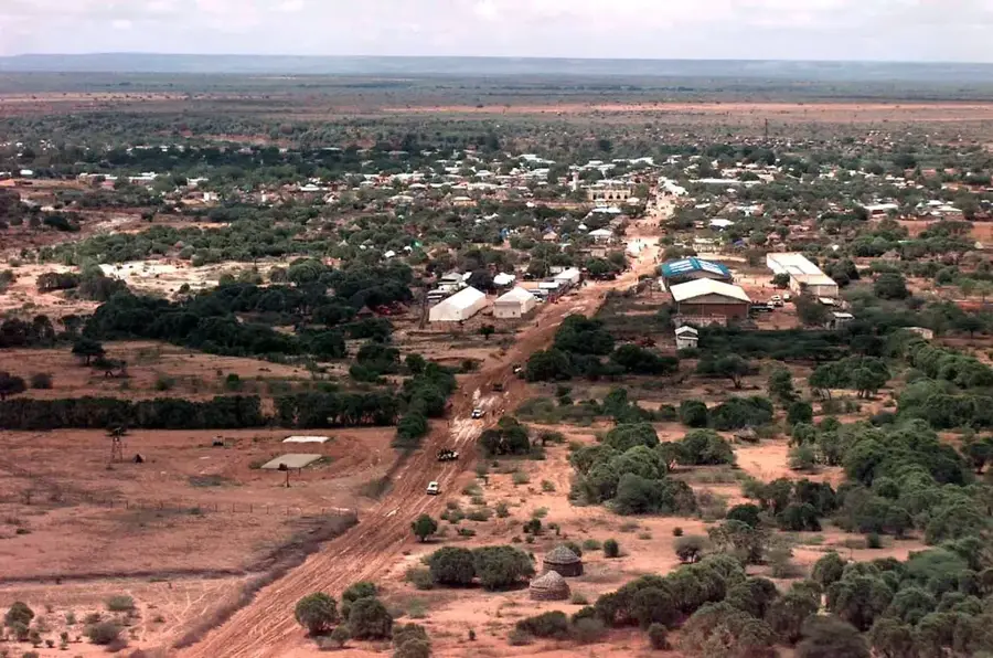
Dolow is a town in the Gedo region of southwestern Somalia, situated on the Juba River right at the Ethiopian border. It serves as a major border crossing and trade hub, handling livestock, agricultural produce, and consumer goods. The population is estimated at 15,000, mostly from the Marehan clan. The economy relies on irrigated farming along the Juba (maize, sesame, beans), livestock herding, and cross-border commerce. Dolow has been a focal point for humanitarian aid due to recurring droughts and conflicts; refugee camps are located nearby. Infrastructure is basic: there are a few schools, a health clinic, and a market. The town lacks electricity grid and piped water; generators and river water are used. No significant historical or architectural landmarks exist. Dolow's strategic location makes it a key transit point, but development is hindered by insecurity and limited resources.
- Location: Somalia
- Top sights: Dolo, Ethiopia · Ganale Doria River
- Nearby: Garbahaarey (71 km)
Best time to visit & climate
The most pleasant time to visit is Jan, Jun, Jul.
| Jan | Feb | Mar | Apr | May | Jun | Jul | Aug | Sep | Oct | Nov | Dec | |
|---|---|---|---|---|---|---|---|---|---|---|---|---|
| Avg °C | 28 | 30 | 32 | 30 | 29 | 28 | 28 | 29 | 30 | 30 | 28 | 28 |
| Rain mm | 3 | 3 | 24 | 126 | 37 | 5 | 3 | 4 | 7 | 87 | 86 | 24 |
Geography
Facts
- Dolow is located on the Juba River at an elevation of 180 meters.
- The town has an estimated population of 15,000.
- It lies less than 1 km from the Ethiopian border.
- The Gedo region covers an area of approximately 60,000 km².
- Average annual temperature is 28 °C.
- The Juba River is 1,650 km long.
Explore nearby
Notable places around
Route planner — Car & Motorhome
Where do you start? We build the route here, with stops and country notes along the way.
© OpenStreetMap contributors · OpenRouteService
Sights in the town Dolow (2)
Frequently asked questions
Why is Dolow significant?
Are there sights in Dolow?
What is the trip to Dolow like?
Are there hotels for tourists?
What is the best time for a visit?
Dolow: where is it located?
Dolow: what is there to see?
Dolow: when is the best time to visit?
Dolow: why is it worth visiting?

Nearby cities