Plizio Visual Lab
Jalingo

ℹ️Practical info — Jalingo
▾
🌤 Weather — 5 days
📍 Nearby
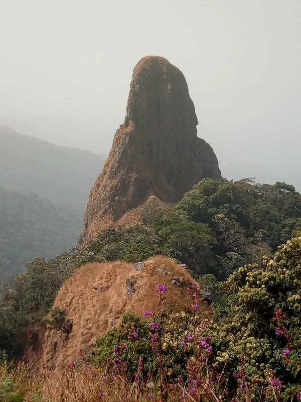
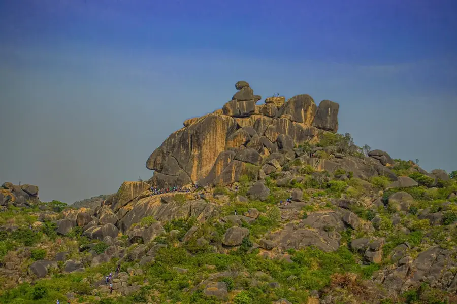
Sights nearby
💡 Tips
- Jalingo is the gateway to the Mambilla Plateau; stock up on supplies and cash here before heading into the mountains.
- The weather is generally warm during the day, but evenings can be cooler due to the surrounding hills.
- ATMs can be unreliable outside the main commercial banks, so make sure to carry enough cash.
- Try the local tea (shayi) and fresh bread at evening street stalls, a daily staple of local life.
🍽 Food
Best bought fresh in the mornings at local stalls, often enjoyed with savory soups.
Spicy grilled meat that is ubiquitous at evening street food hubs around the town.
Locally grown tea sourced from the nearby plateau, served at evening tea stands.
🛍 Shopping · 🧘 Quiet spots
The central hub for local agricultural produce, grains, and traditional attire.
Look for beautifully woven baskets and leather goods in the market outskirts.
A surprisingly quiet and green spot for a refreshing drink and afternoon relaxation.
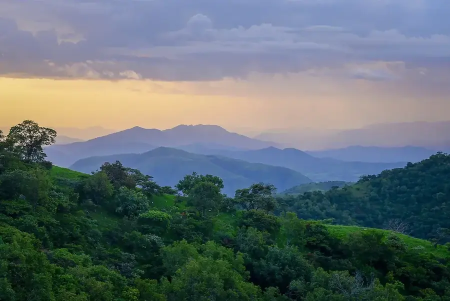
Take a scenic drive towards the rolling hills for peaceful views of the savannah.
Water temperature…
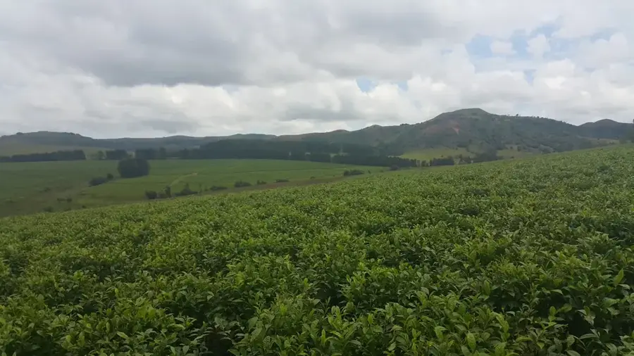
Jalingo, the capital city of Taraba State in North Eastern Nigeria, stands as a testament to the country's rapid administrative and urban evolution. Established as the capital in 1991 upon the creation of the state from the former Gongola State, it has grown from a quiet provincial town into a bustling center of governance and commerce. The city is geographically positioned at the foothills of the Shebshi Mountains, providing a scenic backdrop that contrasts with the surrounding savannah plains. Jalingo serves as the primary economic hub for a state often referred to as 'Nature's Gift to the Nation,' largely due to its immense agricultural potential. The local economy thrives on the trade of staple crops like yams, maize, cassava, and rice, which are transported to major markets across Nigeria. Culturally, Jalingo is a melting pot of ethnic diversity, home to the Mumuye, Fulani, Jukun, and many other groups, each contributing to the city's rich social fabric and linguistic variety. The educational sector is anchored by the Taraba State University, which has become a focal point for academic research and youth development in the region. Infrastructure projects, including the expansion of the Jalingo Airport and improved road networks, have enhanced the city's connectivity to other regional capitals like Yola and Bauchi. The climate is typically tropical, characterized by distinct wet and dry seasons, with the Benue River playing a crucial role in the regional hydrology. Visitors to Jalingo can explore the local markets, visit the Emir's palace, or use the city as a starting point for expeditions to the remote Mambilla Plateau. The city's growth is balanced by a commitment to preserving local heritage, visible in the traditional architecture and communal celebrations that take place throughout the year. As Jalingo continues to modernize, it remains an essential link in the socioeconomic stability of Nigeria's Middle Belt and North East regions.
- Location: Nigeria
- Population: ~117.757 (2026)
Best time to visit & climate
The most pleasant time to visit is Jan, Nov, Dec.
| Jan | Feb | Mar | Apr | May | Jun | Jul | Aug | Sep | Oct | Nov | Dec | |
|---|---|---|---|---|---|---|---|---|---|---|---|---|
| Avg °C | 25 | 28 | 31 | 30 | 28 | 27 | 26 | 25 | 25 | 26 | 26 | 25 |
| Rain mm | 0 | 1 | 6 | 66 | 110 | 133 | 155 | 199 | 173 | 90 | 9 | 0 |
Geography
Facts
- Jalingo became the capital of Taraba State on August 27, 1991.
- The city is a major transit point for the famous Mambilla Plateau cattle trade.
- Taraba State University provides tertiary education to thousands of students annually.
- The Shebshi Mountains nearby contain some of the highest peaks in the region.
- The city's central market is one of the largest in North Eastern Nigeria.
- Jalingo is located approximately 700 kilometers from the national capital, Abuja.
- The predominant languages spoken are Hausa, Fulfulde, and Mumuye.
- The city's infrastructure includes a modern state-of-the-art specialist hospital.
Explore nearby
Notable places around
Route planner — Car & Motorhome
Where do you start? We build the route here, with stops and country notes along the way.
© OpenStreetMap contributors · OpenRouteService
Frequently asked questions
What makes Jalingo special?
What is the weather like in Jalingo?
How do I get to Jalingo?
What activities are there?
What is the local specialty?
Jalingo: where is it located?
Jalingo: when is the best time to visit?
Jalingo: why is it worth visiting?

More places