Plizio Visual Lab
Lake Faguibine

Weather…
Water temperature…
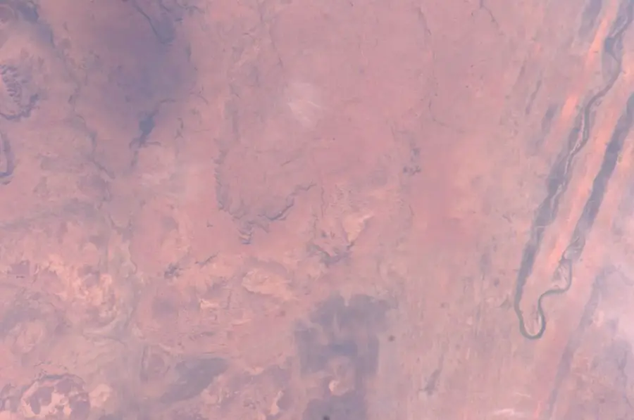
Lake Faguibine is located in the Timbuktu region of northern Mali and is part of a complex system of five interconnected depressions. It is fed by the Niger River through two primary channels that transport water over a distance of approximately 170 kilometers. During periods of high water, the lake's surface area exceeded 500 square kilometers, making it one of the largest in West Africa and a hub for fishing and agriculture. However, following the severe droughts of the 1970s and 1980s, water levels plummeted, and vast sections of the lakebed are now dry or choked with silt. The exposed lakebed is utilized by local communities for grain cultivation and grazing whenever seasonal inflows permit. The ecosystem is critically important for regional biodiversity, particularly as a habitat for migratory birds. Ongoing efforts to rehabilitate the inflow channels are vital to combat desertification and secure the livelihoods of thousands of people. Lake Faguibine serves as a powerful indicator of the Sahel's vulnerability to climate change.
- Location: Mali
- Nearby: Goundam (35 km)
Best time to visit & climate
The most pleasant time to visit is Jan, Feb, Dec.
| Jan | Feb | Mar | Apr | May | Jun | Jul | Aug | Sep | Oct | Nov | Dec | |
|---|---|---|---|---|---|---|---|---|---|---|---|---|
| Avg °C | 20 | 23 | 27 | 31 | 34 | 35 | 33 | 31 | 31 | 31 | 26 | 22 |
| Rain mm | 1 | 0 | 0 | 1 | 5 | 23 | 62 | 110 | 44 | 7 | 1 | 0 |
📋 Practical info
Geography
Facts
- Part of a system of 5 interconnected basins
- Maximum surface area reached approx. 590 sq km
- Fed by 170 km long channels from the Niger
- Severe drying trend began in the 1970s
- Important habitat for Palearctic migratory birds
- Central hub for rice and sorghum production
Explore nearby
Notable places around
Route planner — Car & Motorhome
Where do you start? We build the route here, with stops and country notes along the way.
© OpenStreetMap contributors · OpenRouteService
Sights nearby
Frequently asked questions
What characterizes Lac Faguibine?
Does it have water all year round?
Can one watch birds there?
Is an off-road vehicle needed?
Are there accommodations nearby?
Lake Faguibine: where is it located?
Lake Faguibine: when is the best time to visit?
Lake Faguibine: why is it worth visiting?

Nearby cities

Nature
More places