Plizio Visual Lab
Jebel Uwaynat

Weather…
Water temperature…
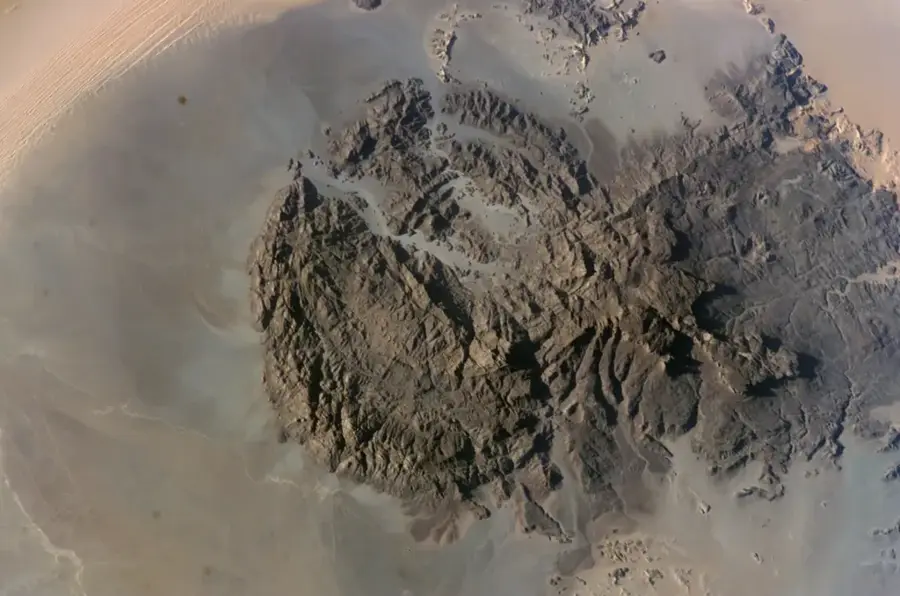
Jebel Uwaynat is a prominent mountain range situated at the triple border of Libya, Egypt, and Sudan, rising to an elevation of 1,934 meters. This isolated massif in the Eastern Sahara is world-renowned for its extraordinary collections of prehistoric rock paintings and engravings, spanning several millennia. The mountain's geology is bipartite: the western section consists of granite intrusions, while the east is characterized by stratified sandstone. Due to its altitude, Jebel Uwaynat occasionally intercepts rare rainfall, enabling the existence of small, temporary water holes (gueltas) and specialized flora. Its modern discovery and exploration by Ahmed Hassanein in 1923 marked the beginning of scientific expeditions into this remote region. Historically, the mountain served as a vital landmark for caravans and a sanctuary for various cultures throughout different eras. Today, it is considered one of the most significant open-air museums of post-glacial art in North Africa, providing critical data on the ecological transformation of the Sahara.
Best time to visit & climate
The most pleasant time to visit is Mar, Oct, Nov.
| Jan | Feb | Mar | Apr | May | Jun | Jul | Aug | Sep | Oct | Nov | Dec | |
|---|---|---|---|---|---|---|---|---|---|---|---|---|
| Avg °C | 12 | 15 | 19 | 25 | 28 | 31 | 31 | 31 | 29 | 24 | 18 | 13 |
| Rain mm | 0 | 0 | 0 | 0 | 0 | 0 | 0 | 1 | 0 | 0 | 0 | 0 |
📋 Practical info
Geography
Facts
- The highest point of the massif stands at 1,934 meters above sea level.
- It houses thousands of rock art images dating from 6,000 to 2,000 BCE.
- The first comprehensive mapping occurred during the Hassanein expedition in 1923.
- The mountain consists of a Precambrian granite core and Paleozoic sandstone.
- It is one of the few places in the Libyan Desert with permanent ground water.
- The region was proposed as a protected area in 2007 due to its cultural value.
Route planner — Car & Motorhome
Where do you start? We build the route here, with stops and country notes along the way.
© OpenStreetMap contributors · OpenRouteService
Sights nearby
Frequently asked questions
Why is Jebel Uwainat famous?
Where exactly is the mountain located?
Can you climb to the summit?
Are there any plants or animals there?
Is a special permit required?
Jebel Uwaynat: where is it located?
Jebel Uwaynat: when is the best time to visit?
Jebel Uwaynat: why is it worth visiting?