Plizio Visual Lab
Jebel Uwaynat

Weather…
Water temperature…
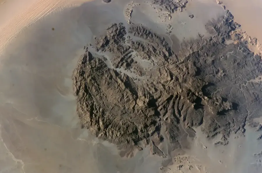
Jebel Uwaynat is a massive mountain range located at the tripoint of Egypt, Libya, and Sudan, rising to an elevation of 1,934 meters. Geologically, it consists of a western granite section and an eastern sandstone plateau, making it a scientifically intriguing formation in the extreme Sahara. The mountain is world-renowned for its extraordinary prehistoric rock paintings and petroglyphs, depicting scenes from a time when the Sahara was still a green savanna. These artworks feature giraffes, cattle, and hunters, providing valuable insights into the Neolithic culture of North Africa. Due to its extreme remoteness, the area remained undiscovered for a long time and was only mapped in the 1920s. Despite minimal rainfall, there are permanent water sources at the base of the mountain called karkurs, which support specialized flora and fauna. Jebel Uwaynat is a critical site for studying climate change and human adaptation strategies over millennia. Reaching its summit is considered one of the most challenging expeditions in the entire Sahara today.
Best time to visit & climate
The most pleasant time to visit is Mar, Oct, Nov.
| Jan | Feb | Mar | Apr | May | Jun | Jul | Aug | Sep | Oct | Nov | Dec | |
|---|---|---|---|---|---|---|---|---|---|---|---|---|
| Avg °C | 12 | 15 | 19 | 25 | 28 | 31 | 31 | 31 | 29 | 24 | 18 | 13 |
| Rain mm | 0 | 0 | 0 | 0 | 0 | 0 | 0 | 1 | 0 | 0 | 0 | 0 |
📋 Practical info
Geography
Facts
- The highest peak stands at 1,934 meters above sea level.
- It is located exactly at the border point of Sudan, Egypt, and Libya.
- The mountain houses thousands of Neolithic rock paintings.
- The formation consists of both intrusive granite and sandstone.
- Permanent springs known as karkurs allow wildlife to survive the desert.
- Ahmed Hassanein Bey discovered the mountain for modern geography in 1923.
Route planner — Car & Motorhome
Where do you start? We build the route here, with stops and country notes along the way.
© OpenStreetMap contributors · OpenRouteService
Sights nearby
Frequently asked questions
Are there rock paintings at Jebel Uwaynat?
In which country is the mountain located?
Can water be found in the mountains?
What equipment is needed for an expedition?
Are there guides available?
Jebel Uwaynat: where is it located?
Jebel Uwaynat: when is the best time to visit?
Jebel Uwaynat: why is it worth visiting?