Plizio Visual Lab
Tengiz Oil Field

Weather…
Water temperature…
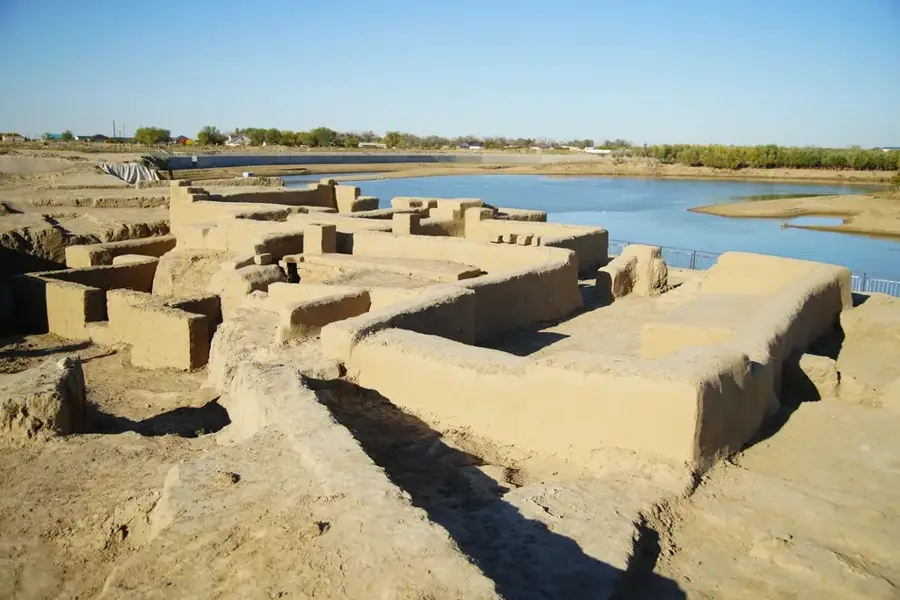
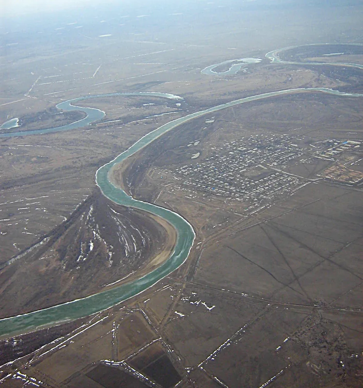
The Tengiz Oil Field is one of the world's largest and deepest onshore oil fields, located in the low-lying wetlands on the northeastern shores of the Caspian Sea in western Kazakhstan. Discovered in 1979, the field spans an area of approximately 565 square kilometers within the Atyrau Region. It is renowned for its challenging geological conditions, with oil situated at depths exceeding 3,800 meters under extremely high pressure. Recoverable reserves are estimated to be between 6 and 9 billion barrels, making Tengiz a cornerstone of the Kazakh economy and global energy markets. The field is operated by Tengizchevroil (TCO), a joint venture including Chevron, ExxonMobil, KazMunayGas, and Lukoil. A defining characteristic of Tengiz crude is its high hydrogen sulfide content, necessitating advanced processing facilities to remove impurities before export. Most of the produced oil is transported via the Caspian Pipeline Consortium (CPC) pipeline to the Russian port of Novorossiysk on the Black Sea. Current expansion projects, such as the Future Growth Project, aim to increase the field's production capacity to over one million barrels per day.
Best time to visit & climate
The most pleasant time to visit is May, Jun, Sep.
| Jan | Feb | Mar | Apr | May | Jun | Jul | Aug | Sep | Oct | Nov | Dec | |
|---|---|---|---|---|---|---|---|---|---|---|---|---|
| Avg °C | -7 | -6 | 3 | 12 | 21 | 27 | 29 | 28 | 20 | 10 | 2 | -4 |
| Rain mm | 16 | 12 | 17 | 20 | 23 | 14 | 11 | 6 | 6 | 15 | 17 | 18 |
📋 Practical info
Geography
Facts
- Tengiz was discovered in 1979 and started production in 1991.
- The oil reservoir covers an area of roughly 19 by 21 kilometers.
- Current daily production averages about 650,000 barrels of crude oil.
- The CPC pipeline, the main export route, was completed in 2001.
- Recoverable oil reserves represent about 1/3 of Kazakhstan's total.
- The Future Growth Project involves an investment of over $45 billion.
Route planner — Car & Motorhome
Where do you start? We build the route here, with stops and country notes along the way.
© OpenStreetMap contributors · OpenRouteService
Sights nearby
Frequently asked questions
What is the Tengiz oil field?
Can you visit the oil field?
Who operates the field?
What are the challenges of extraction?
What is the significance of Tengiz for Kazakhstan?
Tengiz Oil Field: where is it located?
Tengiz Oil Field: when is the best time to visit?
Tengiz Oil Field: why is it worth visiting?

Nature
More places