Plizio Visual Lab
Slieve Croob
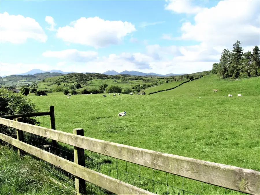
Slieve Croob is a prominent mountain in the heart of County Down, Northern Ireland, rising to an elevation of 534 metres. It is best known as the source of the River Lagan, which flows through the city of Belfast before entering the sea. Geologically, the mountain is composed of granite and forms part of the wider Mourne Mountains area, though it stands slightly apart from the main range. At its summit lies an ancient cairn, a Bronze Age burial mound that is steeped in Irish mythology and local folklore. Legends often link the site to the mythical warrior Fionn mac Cumhaill, adding a layer of mystery to the landscape. The slopes are covered in extensive heathland and blanket bog, providing a vital habitat for various bird species and mountain flora. Hikers frequently visit the peak via the Slieve Croob Trail to enjoy panoramic views that stretch as far as the Isle of Man and the Scottish coast on clear days. The mountain is designated as an Area of Special Scientific Interest (ASSI) due to its unique ecological features.
- Location: Ireland
- Top sights: rath · Slievehanny cashel & souterrain · Standing Stone
- Nearby: Castlewellan (5 km)
Best time to visit & climate
The most pleasant time to visit is Jun–Aug.
| Jan | Feb | Mar | Apr | May | Jun | Jul | Aug | Sep | Oct | Nov | Dec | |
|---|---|---|---|---|---|---|---|---|---|---|---|---|
| Avg °C | 5 | 5 | 6 | 8 | 11 | 13 | 15 | 14 | 13 | 10 | 7 | 5 |
| Rain mm | 93 | 74 | 76 | 62 | 77 | 90 | 99 | 106 | 82 | 109 | 105 | 95 |
📋 Practical info
Geography
Facts
- Elevation: 534 metres above sea level
- Source of the River Lagan
- Ancient summit cairn dating to the Bronze Age
- Geological composition: Caledonian granite
- Part of the wider Mourne Mountains region
- Designated Area of Special Scientific Interest (ASSI)
Explore nearby
Notable places around
Route planner — Car & Motorhome
Where do you start? We build the route here, with stops and country notes along the way.
© OpenStreetMap contributors · OpenRouteService
Sights in the town Slieve Croob (4)
Standing Stone
Upright monolith from the Bronze Age, a menhir on Slieve Croob.
Sights nearby
Frequently asked questions
Which river rises at Slieve Croob?
How do you reach the summit?
Are there historical sights there?
Is parking allowed there?
What is the legend of Blaeberry Sunday?
Slieve Croob: where is it located?
Slieve Croob: what is there to see?
Slieve Croob: when is the best time to visit?
Slieve Croob: why is it worth visiting?

Nearby cities