Plizio Visual Lab
Col du Galibier
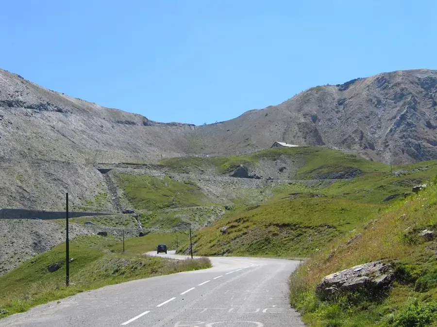
The Col du Galibier is one of the most famous and highest mountain passes in the French Alps, connecting the regions of Saint-Michel-de-Maurienne and Briançon. Reaching an elevation of 2,642 meters, it forms the natural boundary between the Savoie and Hautes-Alpes departments. Geographically part of the Dauphiné massif, the pass features sweeping views of the nearby Meije glacier and Mont Blanc. The Galibier is inextricably linked to the history of the Tour de France, having been a regular feature since 1911 and often representing the highest point of the race (the Souvenir Henri Desgrange). Due to extreme weather conditions, the road is typically navigable only from June to October. A tunnel constructed beneath the summit in 1891 once facilitated easier passage, whereas the modern pass road is celebrated for its steep gradients and tight hairpin bends. For cyclists worldwide, the Galibier is regarded as the ultimate challenge and a historic monument to alpine cycling.
- Location: Provence-Alpes-Côte d'Azur, France
- Top sights: Sommet du Santin - Serre Orel · Pointe des Lauzettes · La Pare
- Nearby: Valloire (12 km)
Best time to visit & climate
The most pleasant time to visit is Jun–Aug.
| Jan | Feb | Mar | Apr | May | Jun | Jul | Aug | Sep | Oct | Nov | Dec | |
|---|---|---|---|---|---|---|---|---|---|---|---|---|
| Avg °C | -7 | -7 | -3 | 2 | 6 | 11 | 13 | 12 | 9 | 5 | -1 | -6 |
| Rain mm | 69 | 54 | 67 | 61 | 90 | 71 | 58 | 59 | 59 | 75 | 89 | 79 |
📋 Practical info
Geography
Facts
- The pass summit is at an elevation of 2,642 meters.
- It was first included in the Tour de France in 1911.
- It marks the divide between the Northern and Southern French Alps.
- A tunnel under the ridge was completed as early as 1891.
- Site of a monument to Henri Desgrange, the founder of the Tour.
- The gradient exceeds 10% during the final kilometers of the climb.
Explore nearby
Notable places around
Route planner — Car & Motorhome
Where do you start? We build the route here, with stops and country notes along the way.
© OpenStreetMap contributors · OpenRouteService
Sights in the town Col du Galibier (7)
Sights nearby
Frequently asked questions
When is the Col du Galibier open for traffic?
How high is the pass?
Is there a tunnel at the summit?
Which regions does the pass connect?
Why is it famous for cyclists?
Col du Galibier: where is it located?
Col du Galibier: what is there to see?
Col du Galibier: when is the best time to visit?
Col du Galibier: why is it worth visiting?

Nearby cities