Concert - Elmer Food Beat
Catch the legendary French rock band Elmer Food Beat live on stage for an energetic performance in Quimperlé.
Plizio Visual Lab
Savor savory buckwheat pancakes (galettes) and sweet crêpes in a traditional crêperie in the Lower Town.
Try the famous flat oysters from the nearby Belon river at a local seafood brasserie.
Buy this intensely buttery and flaky Breton cake at a traditional bakery near the abbey.
The indoor market is the best place to find local cheeses, fresh seafood, and artisanal Breton cider.
Look for regional products like salted butter caramels and traditional striped shirts in the small shops of Haute Ville.
Stroll along the tranquil banks of the Laïta river, where the Isole and Ellé rivers converge.
Take a short drive to this vast, mythical forest just outside the town for peaceful walking trails.
Water temperature…
Catch the legendary French rock band Elmer Food Beat live on stage for an energetic performance in Quimperlé.
An evening of classical music and sacred harmony in the unique atmosphere of Quimperlé, performed by talented artists.
A popular local running event through the scenic landscapes of Baye and the Quimperlé countryside.
A retrospective cycle dedicated to the work of the great director Sidney Lumet as part of Quimperlé's film heritage program.
A sporting challenge for endurance walkers through the diverse natural landscapes of the Quimperlé region.
Celebrate the beginning of summer with free concerts and a vibrant atmosphere in the streets of Quimperlé.
An original open-air performance full of humor and energy that brings the city center of Quimperlé to life.
A diverse musical program across various locations in Quimperlé, inviting the public to discover local talent.
A traditional neighborhood celebration with music, games, and social gatherings in the Feunteun-Zann district of Quimperlé.
Dive into the glittering world of the disco era with rhythm, dancing, and great vibes in Quimperlé.
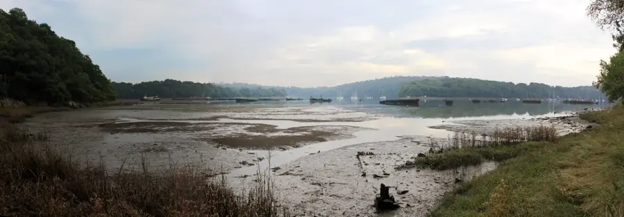
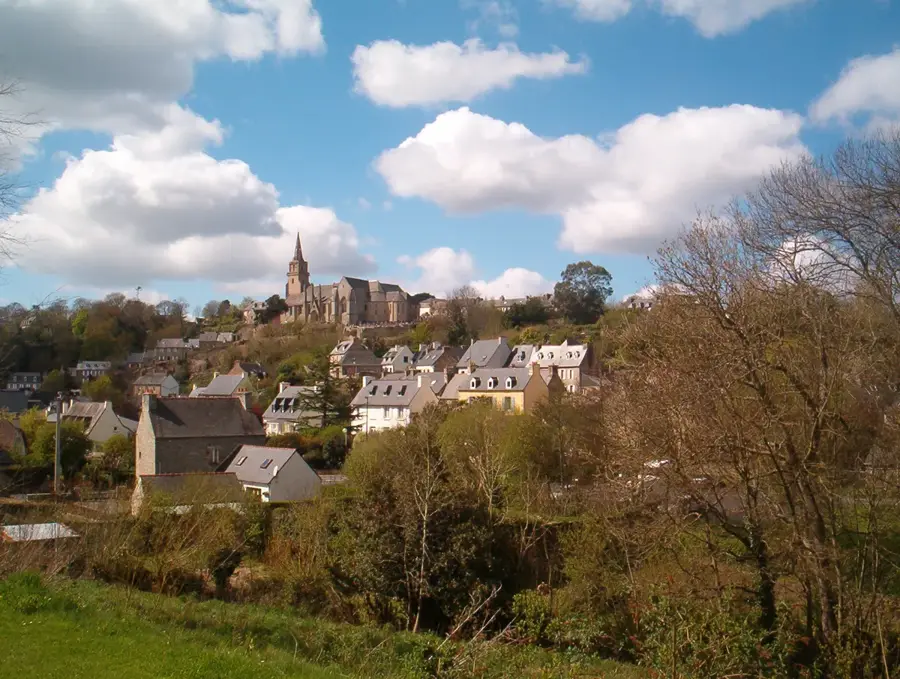
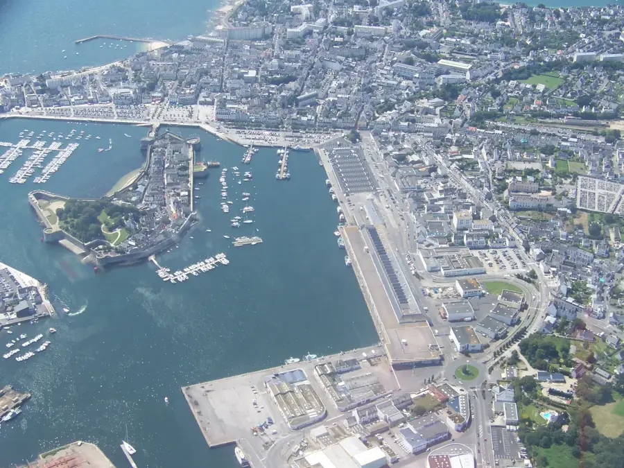
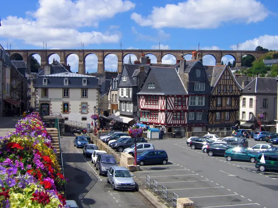
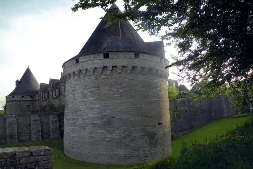
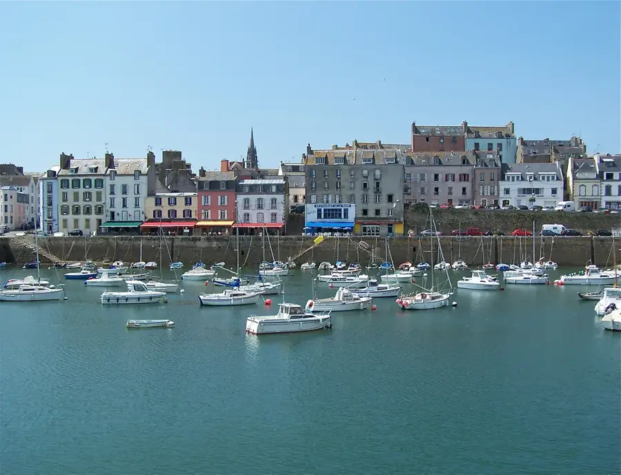
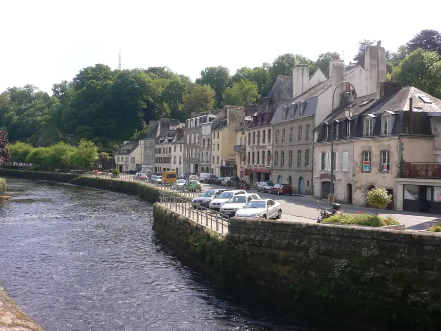
Quimperlé, picturesquely situated in the Finistère department, is a historic town defined by the confluence of the Isole and Ellé rivers, which join here to form the Laïta. This unique geographical setting divides the town into an atmospheric lower town (Basse Ville) and a characterful upper town (Haute Ville). In the heart of the lower town, the Sainte-Croix abbey church fascinates visitors with its unusual circular layout, modeled after the Church of the Holy Sepulchre in Jerusalem, and its impressive Romanesque crypt. A stroll through the cobbled streets leads past historic timber-framed houses, such as the famous Maison des Archers, and flower-decked stone bridges. The upper town, accessible via steep, photogenic stairways, is dominated by the Church of Notre-Dame de l'Assomption and provides wonderful views of the river valleys. Quimperlé is also a paradise for nature lovers; the nearby Toulfoën forest invites long hikes, while the Laïta river provides excellent opportunities for kayaking all the way down to the Atlantic Ocean. Its authentic atmosphere and rich heritage make the town a true lesser-known spot in Brittany.
The most pleasant time to visit is Jul–Sep.
| Jan | Feb | Mar | Apr | May | Jun | Jul | Aug | Sep | Oct | Nov | Dec | |
|---|---|---|---|---|---|---|---|---|---|---|---|---|
| Avg °C | 6 | 6 | 8 | 10 | 13 | 16 | 18 | 18 | 16 | 13 | 9 | 7 |
| Rain mm | 103 | 85 | 68 | 56 | 55 | 52 | 54 | 55 | 44 | 96 | 107 | 109 |
Notable places around
Where do you start? We build the route here, with stops and country notes along the way.
© OpenStreetMap contributors · OpenRouteService
Begin your walking tour at Sainte-Croix Abbey, where the rare circular design transports you to the Middle Ages. Stroll next to the Maison des Archers to dive deeper into the rich local history. Midday draws you to the Quimperlé Market Halls, bustling with Breton specialties and lively energy. It is the perfect place to feel the true pulse of the city. In the afternoon, wander down to the charming Pont Fleuri. This idyllic, flower-draped bridge over the water provides wonderful photo opportunities. Conclude your journey in the upper town at the Notre-Dame de l'Assomption Church. Soak in the peaceful atmosphere and majestic Gothic architecture.
The morning starts in the historic center, where umbrellas are essential in the narrow streets against the Breton drizzle. At noon, the market halls provide a dry and lively sanctuary. In the afternoon, we focus on the impressive interiors of the abbey and the church to stay dry. The evening ends with a short walk as the city lights reflect beautifully on the wet granite stones.
A frosty morning awaits you in the lower town, so dress in warm layers. At noon, we warm up near the market halls. Since the sun sets around 5:00 PM, we use the golden afternoon light to admire the historical facades. The evening is spent in a cozy spot in the center with a hot drink to escape the winter chill.
Start your bike ride high up at the splendid Notre-Dame de l'Assomption Church before coasting down into the center. There, the lively Market Halls await with fresh, local delicacies. Midday takes you further to the Maison des Archers to marvel at the half-timbered architecture. Just around the corner, Sainte-Croix Abbey impresses with its distinct shape. Your afternoon route crosses the flower-decked Pont Fleuri bridge. It is a wonderful moment to pause and enjoy the view of the gently flowing rivers. End the day with a relaxed ride towards the green park areas. The playground vicinity offers the perfect, family-friendly conclusion to an active exploration.
Cycling in the rain requires caution on Quimperlé's slippery cobblestones. We start at the church in the morning and seek shelter at the market halls at noon. The afternoon leads us to the abbey, a solid destination for rain breaks. The ride to the playground is short, but ensure you have waterproof gear for the open sections.
Cold winds blow along the Ellé, so wear windproof clothing for cycling. The morning starts at the church with a clear view. At noon, we seek the warmth of the town. Since daylight is limited in winter, we finish our playground tour well before darkness sets in at 5:00 PM.
Start your driving tour in the upper town at the Gothic Notre-Dame de l'Assomption Church. Then, park near the center to easily visit the unique circular Sainte-Croix Abbey. Around midday, explore the neighboring Maison des Archers and take in its medieval charm. A brief walk from your parking spot brings you to the beautiful Pont Fleuri. In the afternoon, leave the city center behind and drive out to the tranquil water reservoir. This nature spot invites you to a comfortable, relaxing break away from the crowds. Finally, navigate to the historic Kerluhec washhouse. Hidden in the lush greenery, it provides a peaceful and reflective finale to your varied day trip.
By car, we explore Quimperlé today in total comfort, staying dry between stops. In the morning, we visit the central church and abbey. At noon, parking near the market halls is ideal. In the afternoon, we drive to the more remote sites like the washhouse, which retains its rustic charm even in the rain.
Enjoy the winter drive in a heated car through picturesque Quimperlé. We start at the church in the morning, admiring the clear views. At noon, a stop in town to warm up is planned. Since it gets dark around 5:00 PM, we head to the outlying sites in time to catch the last bits of daylight.