Plizio Visual Lab
Guadeloupe National Park
Weather…
Water temperature…
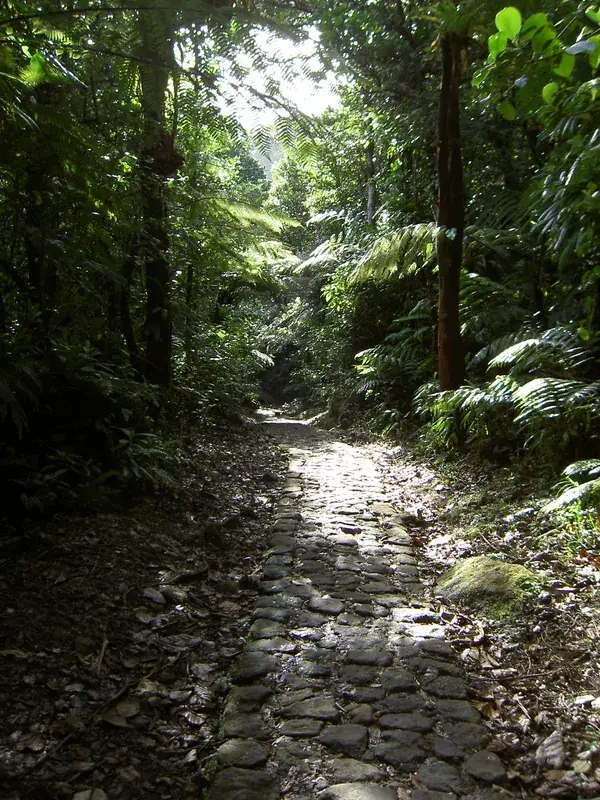
Guadeloupe National Park was established in 1989 and covers the mountainous part of Basse-Terre island in the Lesser Antilles. It protects an exceptional tropical ecosystem characterized by dense rainforests, mangroves, and coastal areas. At the heart of the park stands the active La Soufrière volcano, which at 1,467 meters is the highest point in the Lesser Antilles. The flora is extremely diverse, featuring over 300 tree species and numerous orchids and ferns, while the fauna is home to rare species such as the Guadeloupe woodpecker and various bats. The protected area also includes the Grand Cul-de-Sac Marin marine reserve, encompassing significant coral reefs and seagrass beds. As a UNESCO Biosphere Reserve, the park plays a key role in preserving Caribbean biodiversity and promoting sustainable tourism. Hikers can discover spectacular waterfalls like the Chutes du Carbet along more than 300 kilometers of trails, experiencing the unique volcanic landscape first-hand.
Best time to visit & climate
The most pleasant time to visit is Jan–Mar.
| Jan | Feb | Mar | Apr | May | Jun | Jul | Aug | Sep | Oct | Nov | Dec | |
|---|---|---|---|---|---|---|---|---|---|---|---|---|
| Avg °C | 26 | 26 | 26 | 27 | 27 | 28 | 28 | 28 | 28 | 28 | 27 | 27 |
| Rain mm | 65 | 46 | 47 | 78 | 108 | 125 | 154 | 170 | 167 | 198 | 163 | 95 |
📋 Practical info
Geography
Facts
- The national park was officially established in the year 1989.
- La Soufrière is the highest volcano in the region at 1,467 meters.
- There are over 300 kilometers of marked hiking trails in the park.
- The Carbet Falls consist of three spectacular waterfalls in a row.
- The park is home to the Guadeloupe woodpecker, the island's only endemic bird.
- The core protected area spans approximately 17,300 hectares.
Explore nearby
Notable places around
Route planner — Car & Motorhome
Where do you start? We build the route here, with stops and country notes along the way.
© OpenStreetMap contributors · OpenRouteService
Sights nearby
Frequently asked questions
What are the Chutes du Carbet waterfalls?
Can you climb the volcano?
Are there venomous animals in the park?
Where can I find the rainforest?
How is the weather in the park?
Guadeloupe National Park: where is it located?
Guadeloupe National Park: when is the best time to visit?
Guadeloupe National Park: why is it worth visiting?

Nearby cities