Plizio Visual Lab
Inzia Valley
Weather…
Water temperature…
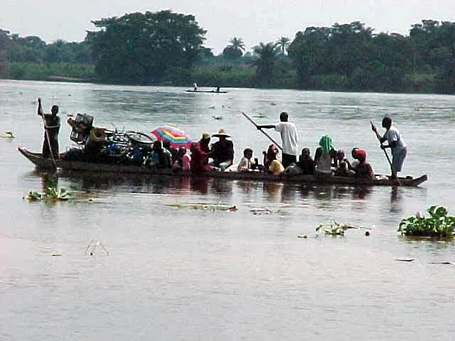
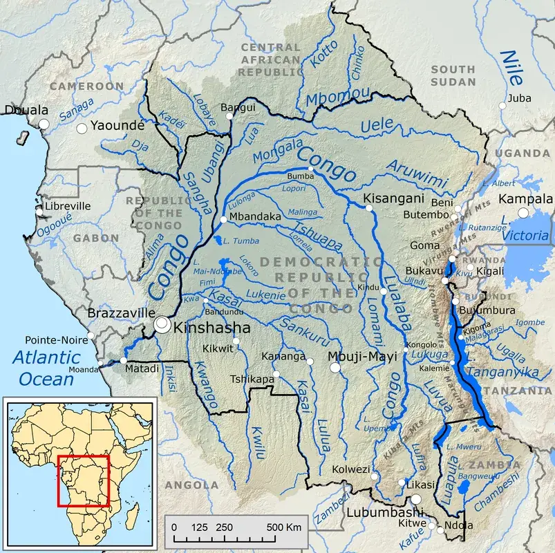
The Inzia Valley is formed by the Inzia River, an important tributary of the Kwilu River in the western Democratic Republic of the Congo. The river originates on the Kwango Plateau and flows northwards through a landscape characterized by savannas and gallery forests. The valley itself is relatively wide and flat, which is typical for the rivers of the southern Congo Basin. Its soils are sandy and often covered by lateritic crusts. The hydrological regime of the Inzia is heavily influenced by seasonal rains, with high water levels during the rainy season from September to May and significantly lower levels in the dry season. For the local population, which consists mainly of rural communities, the Inzia Valley is of great importance. The river serves as a water source, fishing ground, and transport route, especially for transporting agricultural products such as cassava, maize, and palm oil to local markets. The largest nearby city is Kikwit on the Kwilu River, an important commercial center. Ecologically, the gallery forests along the river form important corridors for wildlife in an otherwise savanna-dominated landscape. However, the region faces challenges such as soil erosion and deforestation due to slash-and-burn agriculture.
- Location: Congo - Kinshasa
- Nearby: Kikwit (67 km)
Best time to visit & climate
The most pleasant time to visit is Jun–Aug.
| Jan | Feb | Mar | Apr | May | Jun | Jul | Aug | Sep | Oct | Nov | Dec | |
|---|---|---|---|---|---|---|---|---|---|---|---|---|
| Avg °C | 26 | 26 | 26 | 26 | 26 | 26 | 27 | 28 | 27 | 26 | 25 | 25 |
| Rain mm | 124 | 139 | 171 | 143 | 91 | 21 | 10 | 43 | 116 | 167 | 191 | 161 |
📋 Practical info
Geography
Facts
- The Inzia River is a right tributary of the Kwilu River.
- The valley is located in the Kwilu province.
- The soils in the valley are predominantly sandy Ferralsols.
- The region has a tropical savanna climate (Aw according to Köppen-Geiger classification).
- The main bridge over the Inzia River was built in the 1950s.
- The vegetation is a mosaic landscape of savanna and forest.
Explore nearby
Notable places around
Route planner — Car & Motorhome
Where do you start? We build the route here, with stops and country notes along the way.
© OpenStreetMap contributors · OpenRouteService
Sights nearby
Frequently asked questions
Where is the Inzia Valley located?
What characterizes the landscape?
Are there settlements there?
Is the river navigable?
Is there tourism there?
Inzia Valley: where is it located?
Inzia Valley: when is the best time to visit?
Inzia Valley: why is it worth visiting?