Plizio Visual Lab
Buta
ℹ️Practical info — Buta
▾
🌤 Weather — 5 days
📍 Nearby
Sights nearby
💡 Tips
- Buta is an old railway town with a slow pace; embrace the relaxed atmosphere.
- Electricity can be quite sporadic, so rely on power banks to keep your devices charged.
- Greeting locals politely in Lingala ('Mbote') before asking questions is a highly valued custom.
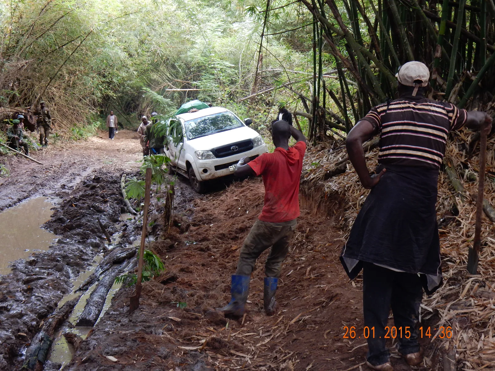
- Travel during the dry season if possible, as the dirt roads leading here degrade severely in the rain.
🍽 Food
A very popular and filling dish of mashed and boiled plantains, usually served with meat or fish.
Locally caught fish from the nearby river, cooked with tomatoes and onions.
Fresh local peanuts available at street corners, great for a quick and safe energy boost.
🛍 Shopping · 🧘 Quiet spots
Explore the animated core of the town where farmers bring their daily harvests.
Browse the old shops in the town center for everyday basics in a historic setting.
Relax by the riverbanks to observe the slow flow of the Itimbiri.
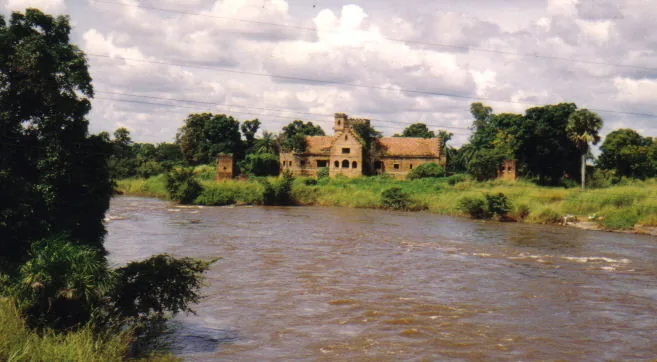
Wander around the remnants of the old railway station for a quiet, historical atmosphere.
Water temperature…
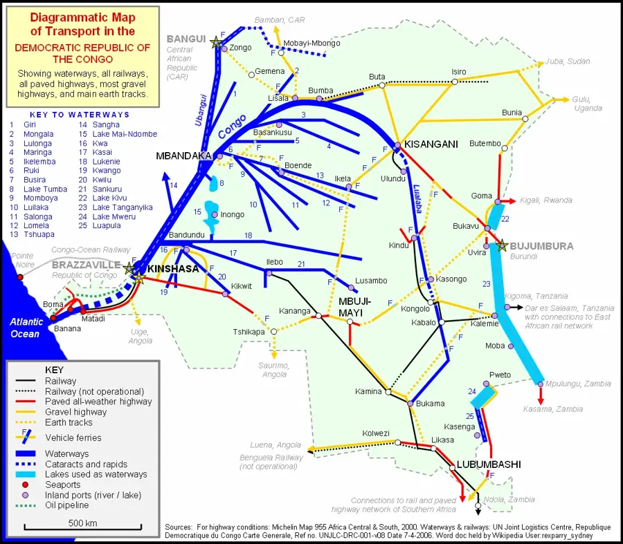
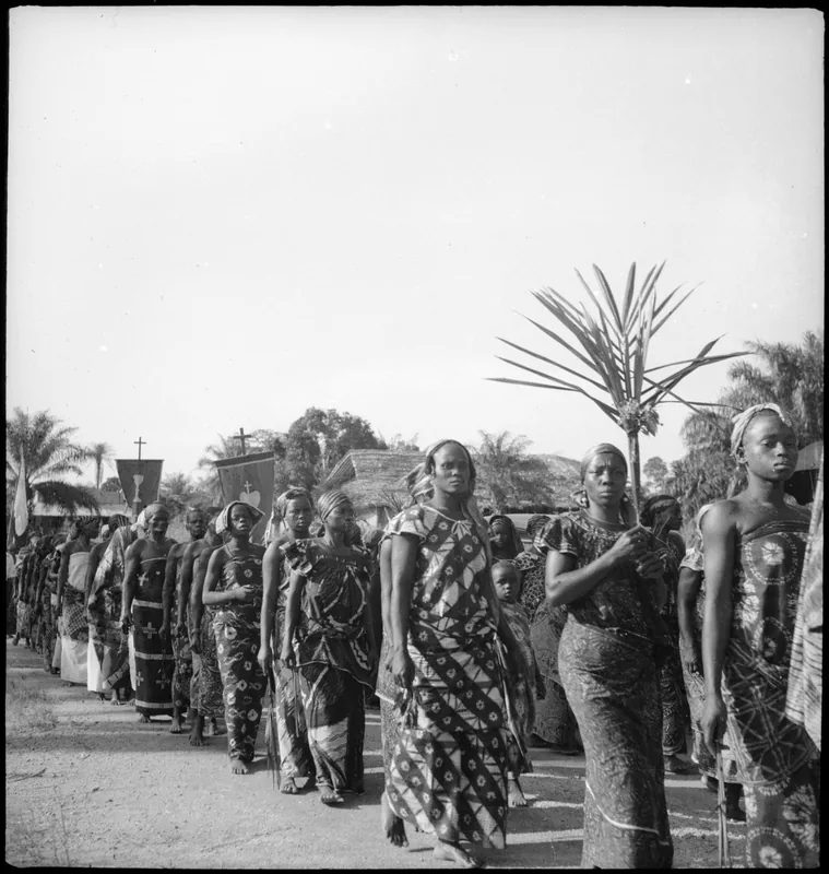
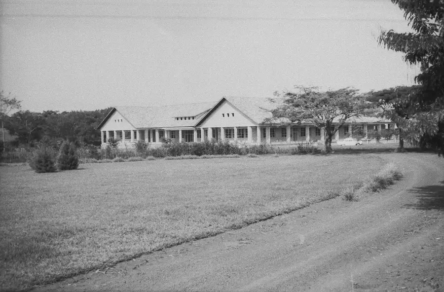
Buta is the capital city of the Bas-Uele Province in the northern part of the Democratic Republic of the Congo. Situated along the Rubi River, it serves as a critical administrative and commercial hub for the surrounding equatorial region. The city's history is deeply intertwined with the Belgian colonial era, specifically as a key terminal on the Vicicongo narrow-gauge railway system. This railway was once the backbone of the region's economy, transporting cotton, coffee, and ivory from the hinterlands to the Congo River's navigable reaches. Today, although the railway has fallen into disuse, Buta remains a focal point for regional trade and missionary activities. The Premonstratensian missionaries established a significant presence here in the early 20th century, leading to the construction of the impressive St. Joseph's Cathedral and several educational institutions that continue to serve the population. Geographically, Buta is located in a transition zone between dense rainforests and wooded savannas, experiencing a tropical climate with high rainfall and consistent humidity. The local economy is primarily driven by agriculture, with small-scale farmers producing crops for local consumption and trade in nearby markets. The city faces significant logistical challenges due to the deterioration of transport infrastructure, which limits its connectivity with major urban centers like Kisangani. However, its position as a provincial capital has brought renewed focus on administrative reforms and public service delivery. The population is diverse, reflecting the ethnic tapestry of northern Congo, with Lingala and Swahili being widely spoken alongside local dialects. Efforts are underway to improve the local airport and road networks to facilitate the movement of goods and people. Buta also serves as a gateway for those exploring the remote wilderness of Bas-Uele, offering a unique blend of historical colonial architecture and animated Congolese culture. The city's resilience is evident in its bustling markets and the active role played by local communities in maintaining social and economic life despite national challenges.
- Location: Congo - Kinshasa
- Top sights: Buta, Democratic Republic of the Congo · Bas-Uélé · Bas-Uele District
- Nearby: Aketi (86 km)
- Population: ~80.751 (2026)
Best time to visit & climate
The most pleasant time to visit is Jan, Feb, Dec.
| Jan | Feb | Mar | Apr | May | Jun | Jul | Aug | Sep | Oct | Nov | Dec | |
|---|---|---|---|---|---|---|---|---|---|---|---|---|
| Avg °C | 27 | 28 | 27 | 26 | 26 | 25 | 25 | 25 | 25 | 25 | 25 | 26 |
| Rain mm | 28 | 52 | 137 | 172 | 172 | 139 | 154 | 176 | 153 | 231 | 104 | 29 |
Geography
Facts
- Buta serves as the provincial capital of Bas-Uele since 2015.
- The city is located on the banks of the Rubi River in northern DRC.
- It was a major hub for the Vicicongo narrow-gauge railway.
- The local airport, Buta Zega, has a 2,100-meter unpaved runway.
- Buta is situated at an elevation of approximately 450 meters (1,476 ft).
- The Roman Catholic Diocese of Buta was established in 1959.
- Primary crops in the region include cotton, coffee, and rubber.
- The population is estimated to be over 50,000 residents.
Explore nearby
Notable places around
Route planner — Car & Motorhome
Where do you start? We build the route here, with stops and country notes along the way.
© OpenStreetMap contributors · OpenRouteService
Sights in the town Buta (3)
Frequently asked questions
What is Buta?
What is the significance of the city?
Is there an airport there?
Which religion is predominant?
What is the terrain like?
Buta: where is it located?
Buta: what is there to see?
Buta: when is the best time to visit?
Buta: why is it worth visiting?

Nearby cities
More places