Plizio Visual Lab
Mont Kaga-Djir

Weather…
Water temperature…
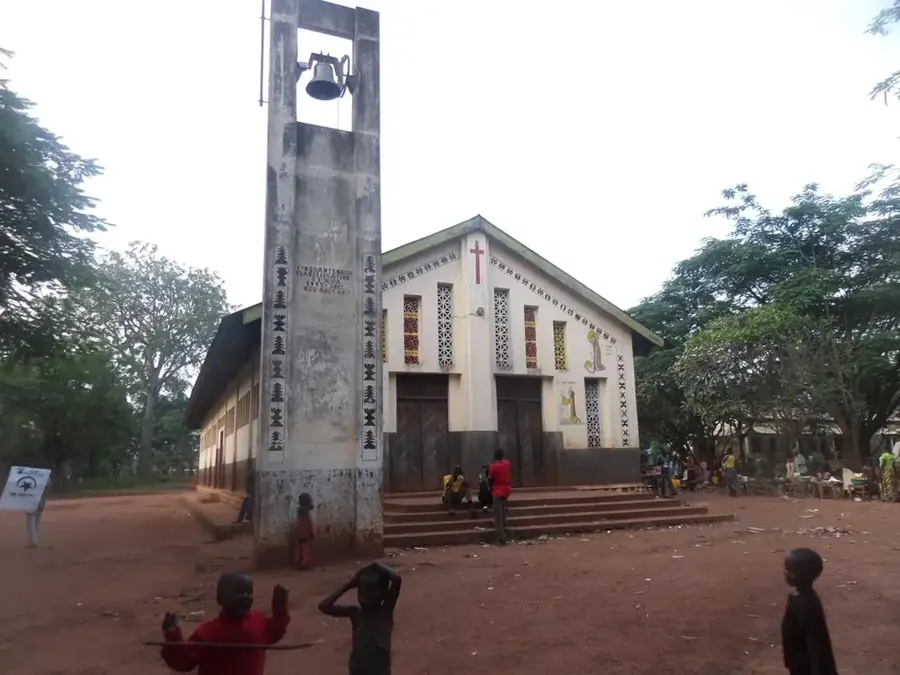
Mont Kaga-Djir is a prominent elevation in the Central African landscape and part of the Yadé Massif in the northwestern region of the country. With its characteristic silhouette, it rises above the surrounding savanna landscape and serves as a significant geographical landmark. Geologically, the mountain primarily consists of crystalline basement rock that has been shaped by millions of years of erosion. The slopes of Kaga-Djir are characterized by a mix of granite formations and dense shrub vegetation, providing shelter for numerous bird species and smaller mammals. Historically, such elevations often held spiritual significance for local communities and served as natural fortresses during times of conflict. The mountain's surroundings are characterized by a tropical wet-and-dry climate, where Kaga-Djir is frequently shrouded in clouds due to its altitude, creating a slightly more humid micro-environment. From its summit, a wide view extends over the foothills of the Ouham prefecture, making it important for cartographic purposes. Despite its relative remoteness, the mountain stands as a testament to the complex geological history of the African shield.
- Location: Central African Republic
- Nearby: Kaga-Bandoro (10 km)
Best time to visit & climate
The most pleasant time to visit is Jan, Nov, Dec.
| Jan | Feb | Mar | Apr | May | Jun | Jul | Aug | Sep | Oct | Nov | Dec | |
|---|---|---|---|---|---|---|---|---|---|---|---|---|
| Avg °C | 27 | 30 | 31 | 30 | 28 | 27 | 25 | 25 | 25 | 26 | 26 | 26 |
| Rain mm | 2 | 9 | 55 | 77 | 133 | 155 | 213 | 225 | 216 | 168 | 29 | 1 |
📋 Practical info
Geography
Facts
- Part of the Yadé Massif in the northwestern Central African Republic.
- Geologically composed of ancient crystalline basement rock.
- Significant landmark for the local population in the Ouham region.
- Altitude provides a cooler and more humid microclimate at the summit.
- Serves as a habitat for endemic bird species of the region.
- Historically utilized as a place of refuge during times of conflict.
Explore nearby
Notable places around
Route planner — Car & Motorhome
Where do you start? We build the route here, with stops and country notes along the way.
© OpenStreetMap contributors · OpenRouteService
Sights nearby
Frequently asked questions
How high is the mountain?
Is the climb dangerous?
Is photography allowed?
Are there drinking water sources?
How long does a tour take?
Mont Kaga-Djir: where is it located?
Mont Kaga-Djir: when is the best time to visit?
Mont Kaga-Djir: why is it worth visiting?