Plizio Visual Lab
Batangafo

ℹ️Practical info — Batangafo
▾
🌤 Weather — 5 days
📍 Nearby
Sights nearby
💡 Tips
- This is a very remote region; independent travel is extremely challenging without a local guide or NGO support.
- The confluence of the Ouham and Fafa rivers provides beautiful scenery, but check local security updates before exploring.
- Infrastructure is very basic, so bring everything you need, including medical supplies and water purification methods.
- Always ask permission before photographing local people or any government and military buildings.
🍽 Food
Freshly caught Nile perch from the nearby rivers, usually served grilled or in a stew.
A staple dough made from cassava, used to scoop up rich sauces and meat dishes.
A savory, rich peanut-based sauce often served over rice or alongside fish.
🛍 Shopping · 🧘 Quiet spots
The primary place to buy seasonal fruits, vegetables, and basic daily goods.
Look for local artisans selling highly durable, traditional woven goods and baskets.
A peaceful place to watch the water flow by, but always remain aware of your surroundings.
The gallery forests surrounding the town are quiet, but strictly require a local guide to explore safely.
Water temperature…
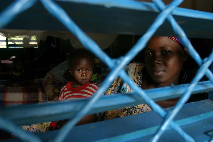
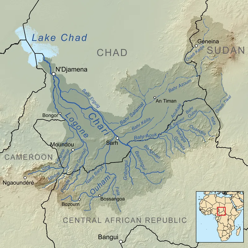
Batangafo is a significant town in the Ouham prefecture in the northern part of the Central African Republic. The town is strategically located at the confluence of the Ouham and Fafa rivers, which has historically made it an important center for trade and fishing. Batangafo was founded in 1898 as a French post and served as an administrative base for managing the surrounding area. The local economy is largely driven by agriculture, with a focus on growing staple crops like cassava, peanuts, and maize, as well as small-scale livestock farming. The regional marketplace is a central hub for traders and farmers from across the area. Geographically, the town is situated in an open savannah landscape, defined by the abundant rivers during the rainy season. As an administrative center, Batangafo hosts schools and medical facilities that are of great importance to the rural population. In recent history, the town's location has often made it vulnerable to regional instability, reinforcing its role as a logistical hub for international aid organizations. The town's architecture consists primarily of traditional buildings, supplemented by a few government administrative structures.
- Location: Central African Republic
- Nearby: Kabo (56 km)
- Population: ~24.119 (2026)
Best time to visit & climate
The most pleasant time to visit is Jan, Nov, Dec.
| Jan | Feb | Mar | Apr | May | Jun | Jul | Aug | Sep | Oct | Nov | Dec | |
|---|---|---|---|---|---|---|---|---|---|---|---|---|
| Avg °C | 27 | 30 | 31 | 31 | 29 | 27 | 26 | 25 | 25 | 26 | 26 | 26 |
| Rain mm | 1 | 5 | 38 | 51 | 137 | 174 | 230 | 240 | 235 | 145 | 20 | 0 |
Geography
Facts
- Town in the Ouham prefecture in the northern CAR.
- Established in 1898 as a French administrative post.
- Located at the confluence of the Ouham and Fafa rivers.
- Important marketplace for the surrounding agricultural area.
- Center for river fishing and local trade activities.
- Logistical base for humanitarian aid operations in the north.
Explore nearby
Notable places around
Route planner — Car & Motorhome
Where do you start? We build the route here, with stops and country notes along the way.
© OpenStreetMap contributors · OpenRouteService
Frequently asked questions
Where is Batangafo located?
What is the main activity in Batangafo?
How is the humanitarian situation?
Is Batangafo relevant for tourism?
How do you reach Batangafo from Bangui?
Batangafo: where is it located?
Batangafo: when is the best time to visit?
Batangafo: why is it worth visiting?

Nearby cities
Nature
More places