Plizio Visual Lab
Niansogoni
Weather…
Water temperature…
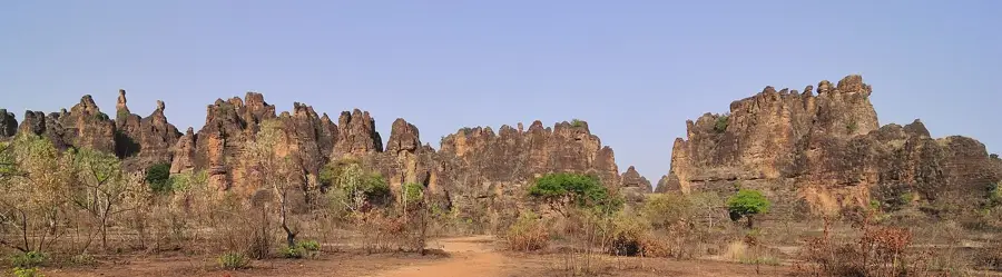
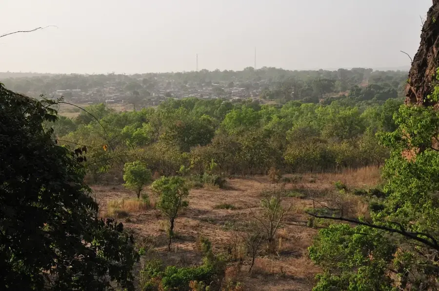
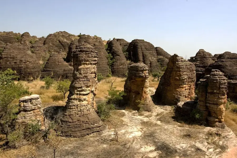
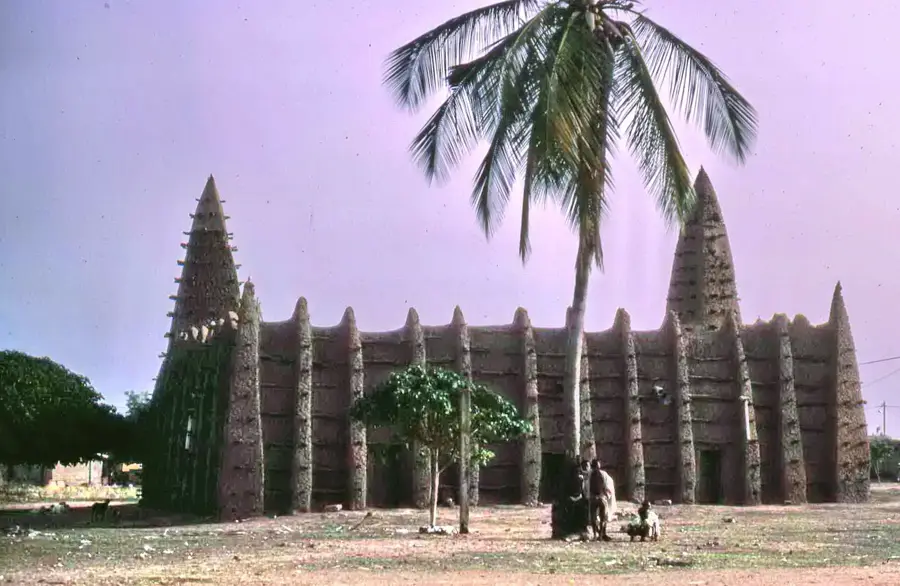
Niansogoni is one of the most fascinating archaeological sites in Burkina Faso, located in the Hauts-Bassins region near the Malian border. The historical village was inhabited starting in the 14th century by the Wara ethnic group, who sought refuge from hostile raids. The residents built their houses, pottery workshops, and dome-shaped granaries directly beneath the overhanging cliffs of the mountain, providing protection from both enemies and the elements. The hike up to the village is moderately challenging, but rewards visitors with a sweeping view of the surrounding savanna landscape. Among the rocks, visitors can still discover amazingly well-preserved storage chambers, stone grinding wheels, and clay pots that offer glimpses into the daily lives of the former inhabitants. It was not until the 1980s that the last residents left the cave dwellings to move to the valley, where modern-day Niansogoni is located. For those interested in cultural history, this site is a must-see, showcasing traditional West African mud-brick architecture in an extraordinary, natural rock shelter. The best time to visit is during the dry season between November and February, when temperatures are milder and the trails are easier to navigate. Hiring a local guide from the new village in the valley is highly recommended to fully appreciate the history of the structures.
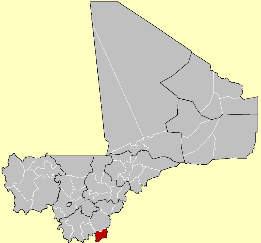
- Location: Burkina Faso
- Nearby: Sindou (28 km)
📋 Practical info
Geography
Facts
- Located near the border with Mali.
- Inhabited starting from the 14th century.
- The former residents belonged to the Wara people.
- Features well-preserved mud-brick granaries.
- Served as a natural refuge from enemy attacks.
- The last inhabitants moved out in the 1980s.
- Requires a moderately challenging hike to reach.
- Ancient grinding stones and pots are still visible.
Explore nearby
Notable places around
Route planner — Car & Motorhome
Where do you start? We build the route here, with stops and country notes along the way.
© OpenStreetMap contributors · OpenRouteService
Sights in the town Niansogoni (1)
Sights nearby
Frequently asked questions
Niansogoni: where is it located?
Niansogoni: why is it worth visiting?

Nearby cities

History & landmarks
More places