Plizio Visual Lab
Jabal Sabir

Weather…
Water temperature…
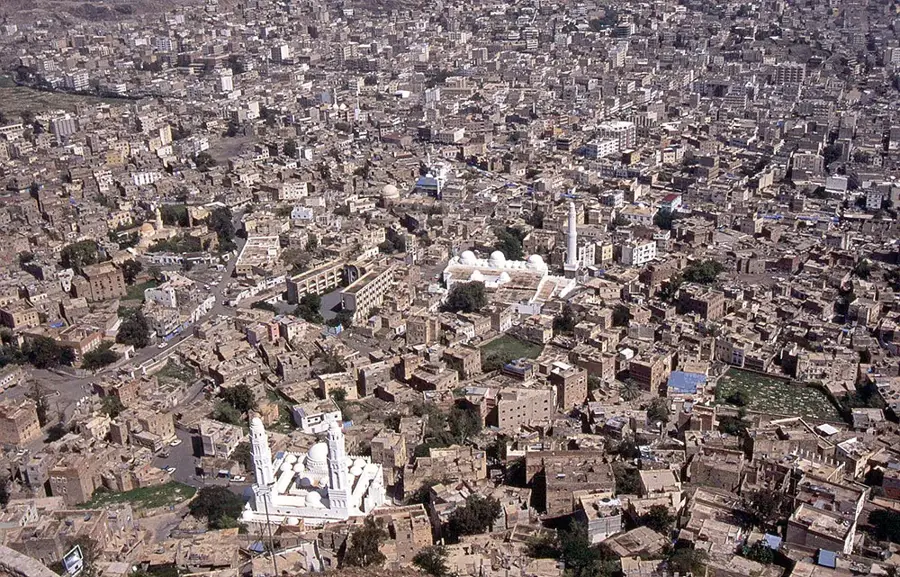
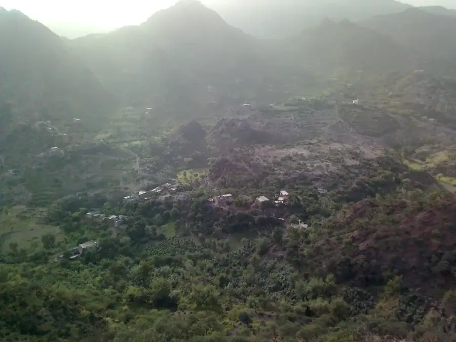
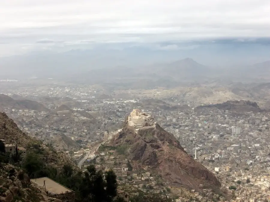
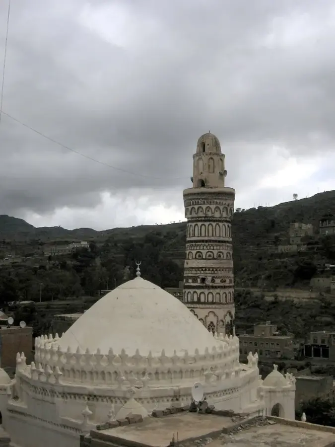
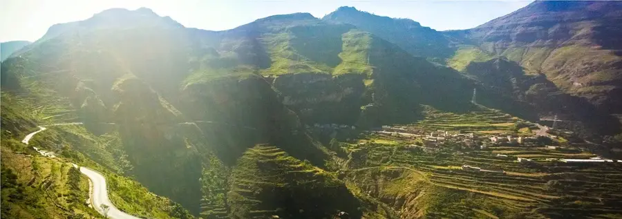
Jabal Sabir is one of Yemen's most prominent mountains, rising directly south of the historic city of Taiz to an elevation of over 3,000 meters. The mountain is celebrated for its extraordinary fertility and dense population, with terraces carved into its steep slopes all the way to the summit to grow cereals, qat, and vegetables. Thanks to significant rainfall and cool mountain air, Jabal Sabir is often referred to as a 'green mountain,' providing a lush contrast to the country's more arid landscapes. The winding road leading to the top features spectacular panoramic views of Taiz city and the surrounding Yemeni highlands. Historically, the mountain has served as a strategic observation post and a site of religious pilgrimage, with its villages housing numerous ancient shrines and mosques. The mountain's residents are renowned for their craftsmanship, particularly in weaving traditional textiles and metalwork. Geologically, Jabal Sabir is primarily composed of volcanic rocks from the Yemeni trap series, shaped by erosion over millions of years. The frequent cloud cover around the peak creates a mystical atmosphere and feeds numerous springs at the mountain's base. Jabal Sabir is more than just a geographic feature; it is a deeply rooted symbol of regional identity for the people of Taiz.
- Location: Yemen
- Top sights: Mashra'a Wa Hadnan district · Watir, Taiz
- Nearby: Jibla (34 km)
Best time to visit & climate
The most pleasant time to visit is Jan, Feb, Dec.
| Jan | Feb | Mar | Apr | May | Jun | Jul | Aug | Sep | Oct | Nov | Dec | |
|---|---|---|---|---|---|---|---|---|---|---|---|---|
| Avg °C | 23 | 25 | 27 | 28 | 30 | 30 | 29 | 28 | 29 | 27 | 25 | 24 |
| Rain mm | 3 | 3 | 8 | 23 | 22 | 29 | 39 | 56 | 45 | 17 | 4 | 9 |
📋 Practical info
Geography
Facts
- Jabal Sabir reaches a maximum elevation of 3,006 meters above sea level.
- The mountain is home to hundreds of small villages built on its steep slopes.
- The annual rainfall here is nearly double the national average of Yemen.
- Taiz, at the foot of the mountain, served as the capital under the Rasulid dynasty.
- The traditional female dress of Jabal Sabir is famous for its vibrant colors.
- Geologically, the mountain consists of Tertiary basalt and rhyolite formations.
Explore nearby
Notable places around
Route planner — Car & Motorhome
Where do you start? We build the route here, with stops and country notes along the way.
© OpenStreetMap contributors · OpenRouteService
Sights in the town Jabal Sabir (2)
Sights nearby
Frequently asked questions
How long does the climb up Jabal Sabir take?
Is there a viewing platform at the top?
Do you need a guide for the mountain?
Can you take photos on the mountain?
Is there drinking water on the mountain?
Jabal Sabir: where is it located?
Jabal Sabir: what is there to see?
Jabal Sabir: when is the best time to visit?
Jabal Sabir: why is it worth visiting?

Nearby cities

More places