Plizio Visual Lab
Mount Pimard
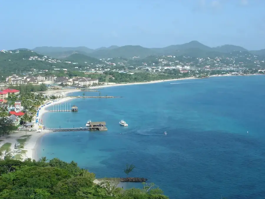
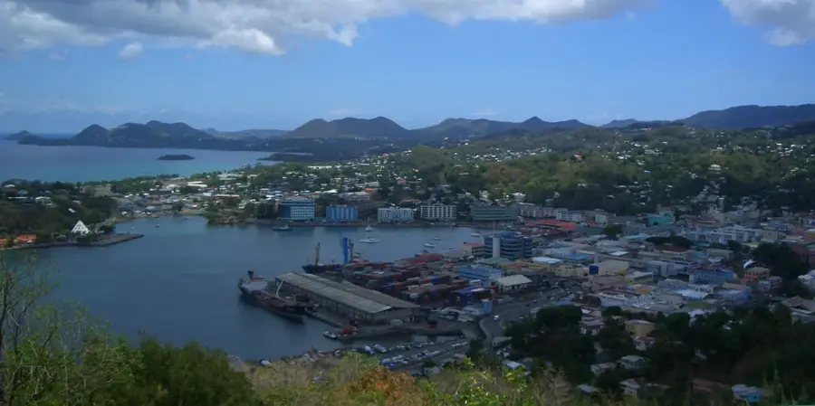
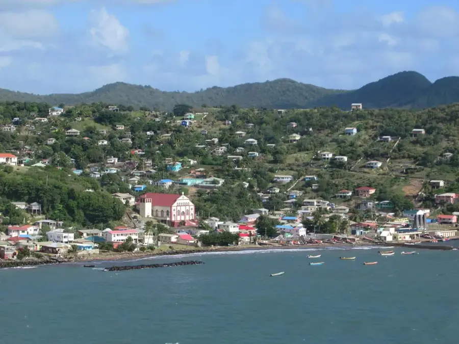
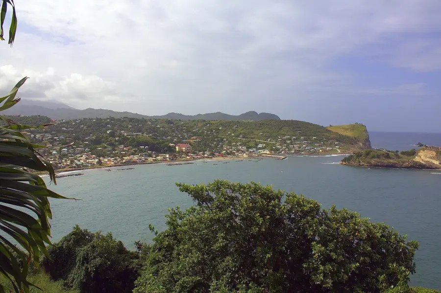
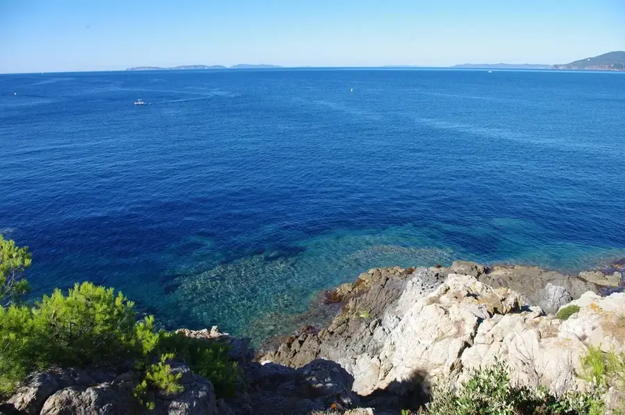
Mount Pimard is a prominent coastal peak in northern Saint Lucia, framing the southern end of the popular Rodney Bay. Rising to an elevation of approximately 200 meters, it serves as a natural green sanctuary amidst the bustling tourist district. The mountain is a favorite destination for hikers and nature enthusiasts, featuring a network of trails that lead through lush tropical scrub and dry forest. Upon reaching the summit, visitors are treated to memorable 360-degree views that encompass the Rodney Bay Marina, the historic Pigeon Island National Landmark, and the vast Caribbean Sea. Geologically, Mount Pimard is characterized by its steep coastal cliffs and volcanic origins, providing a rugged contrast to the sandy beaches nearby. As an ecotourism hotspot, it gives excellent opportunities for birdwatching and enjoying the island's native flora. The mountain also plays a vital role in protecting the coastline from weather systems and erosion. A hike up Mount Pimard is a quintessential Saint Lucian experience, offering a well-suited blend of adventure, exercise, and some of the most iconic photographic vistas in the northern part of the island.
- Location: St. Lucia
- Top sights: Bois d'Orange River · Gros Islet · St. Joseph the Worker Church, Gros Islet
- Nearby: Babonneau Central (4 km)
Best time to visit & climate
The most pleasant time to visit is Jan–Mar.
| Jan | Feb | Mar | Apr | May | Jun | Jul | Aug | Sep | Oct | Nov | Dec | |
|---|---|---|---|---|---|---|---|---|---|---|---|---|
| Avg °C | 26 | 26 | 26 | 27 | 28 | 28 | 28 | 28 | 29 | 28 | 28 | 27 |
| Rain mm | 68 | 44 | 48 | 97 | 102 | 136 | 154 | 180 | 182 | 189 | 159 | 85 |
📋 Practical info
Geography
Facts
- Reaches a maximum elevation of 154 meters
- Composed of pyroclastic rocks and breccias
- Hiking trails extend for approximately 3 kilometers
- Former site of military observation posts
- Border region between volcanic and coralline terrain
- Home to rare lizard species of the genus Anolis
Explore nearby
Notable places around
Route planner — Car & Motorhome
Where do you start? We build the route here, with stops and country notes along the way.
© OpenStreetMap contributors · OpenRouteService
Sights in the town Mount Pimard (3)
Sights nearby
Frequently asked questions
How long does a hike up Mount Pimard take?
Is the trail well-marked?
What is the best viewpoint?
Is there a fee to access Mount Pimard?
Is there shade on the hiking trail?
Mount Pimard: where is it located?
Mount Pimard: what is there to see?
Mount Pimard: when is the best time to visit?
Mount Pimard: why is it worth visiting?

Nearby cities