Plizio Visual Lab
Dennery

ℹ️Practical info — Dennery
▾
🌤 Weather — 5 days
📍 Nearby
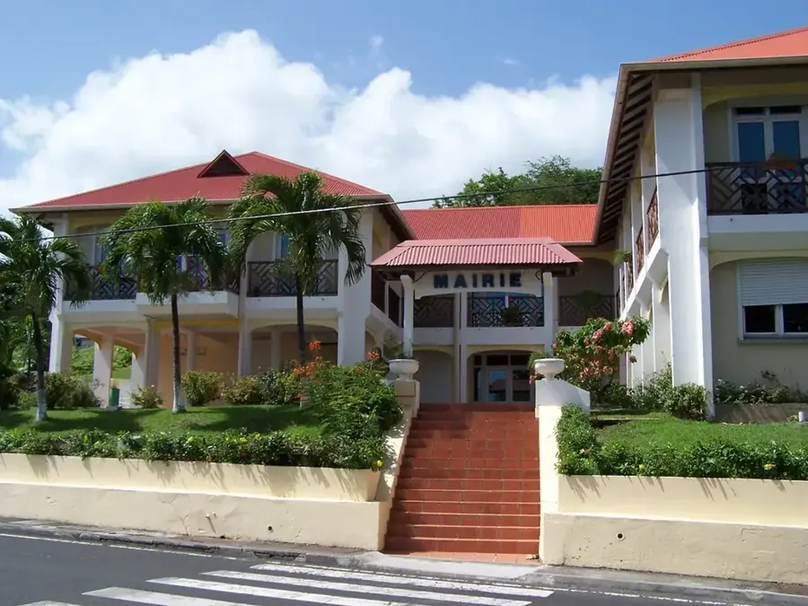
Sights nearby
💡 Tips
- The Atlantic coast here is rougher than the Caribbean side; swimming is often unsafe due to strong currents.
- Don't miss the weekend seafood street parties (Fish Fiesta) for a lively local experience.
- Minibuses travelling between Castries and Vieux Fort pass right through here, making access easy.
- Stop at the Dennery viewpoint on the highway for a fantastic photo of the village and bay.
🍽 Food
Served with bakes at the lively weekend Fish Fiesta.
A popular dish at seaside food stalls.
Freshly baked utilizing the abundant local agricultural produce.
🛍 Shopping · 🧘 Quiet spots
The best spot for fresh daily catch if you have a kitchen.
Pick up fresh bananas, mangoes, and local root crops here.
Pull over on the East Coast Road for an impressive, breezy view.
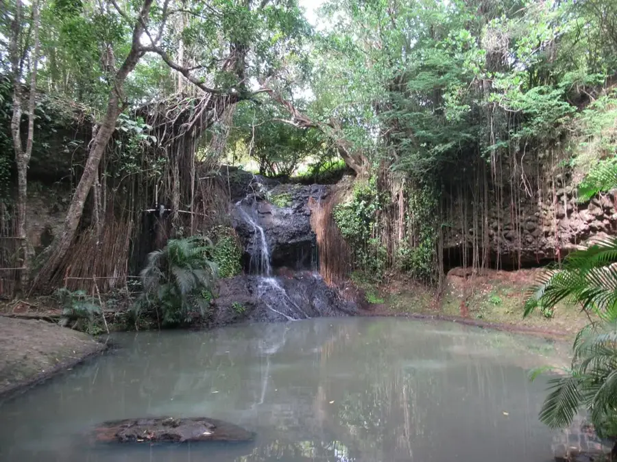
A peaceful waterfall tucked away in the nearby forest.
Water temperature…
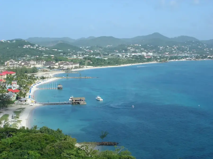
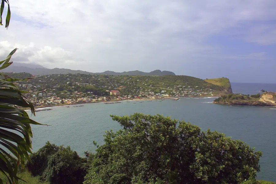
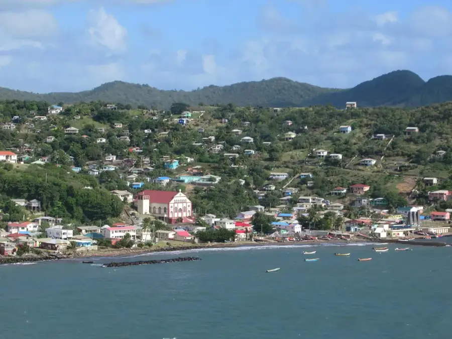
Dennery is a bustling fishing village set on Saint Lucia's rugged Atlantic coast, offering a glimpse into the island's authentic maritime culture. The village's sheltered bay serves as a base for one of the largest fishing fleets on the island, providing a constant supply of fresh seafood to local markets. A major highlight for visitors is the Saturday night Fish Fry, a community event where grilled fish and local music create a festive atmosphere. Beyond the coast, the Mabouya Valley is lush with banana plantations, highlighting the town's agricultural importance. Nearby, the Sault Falls (also known as Errard Falls) gives a spectacular natural retreat for hikers. Dennery is also a key infrastructure hub, housing a significant hydroelectric plant that utilizes the region's water resources to provide green energy for the island.
- Location: St. Lucia
- Top sights: Dennery District · Fond d'Or River · Fond d'Or Bay
- Nearby: Ti Rocher (Micoud) (4 km)
- Population: ~12.589 (2026)
Best time to visit & climate
The most pleasant time to visit is Jan–Mar.
| Jan | Feb | Mar | Apr | May | Jun | Jul | Aug | Sep | Oct | Nov | Dec | |
|---|---|---|---|---|---|---|---|---|---|---|---|---|
| Avg °C | 26 | 26 | 26 | 27 | 28 | 28 | 28 | 28 | 29 | 28 | 28 | 27 |
| Rain mm | 68 | 44 | 48 | 97 | 102 | 136 | 154 | 180 | 182 | 189 | 159 | 85 |
Geography
Facts
- Population: approx. 1,200.
- Dennery Waterfall height: 20 m (66 ft).
- Mamiku Caves length: 150 m (492 ft).
- Dennery Island: 200 m offshore.
- Fishing fleet: 30 boats.
- Distance to Castries: 20 km (12.4 mi).
Explore nearby
Notable places around
Route planner — Car & Motorhome
Where do you start? We build the route here, with stops and country notes along the way.
© OpenStreetMap contributors · OpenRouteService
Sights in the town Dennery (3)
Frequently asked questions
What is Dennery known for?
Are there adventure activities?
What happens at the Dennery Fish Fry?
How far is it from Castries?
Are the waterfalls easily accessible?
Dennery: where is it located?
Dennery: what is there to see?
Dennery: when is the best time to visit?
Dennery: why is it worth visiting?

Nearby cities