Plizio Visual Lab
Marsamxett Harbour
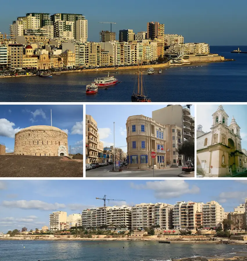
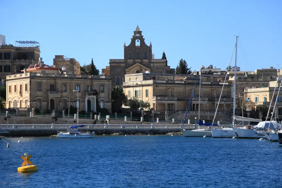
Marsamxett Harbour is one of Malta's primary natural deep-water inlets, located on the northern side of the Sciberras Peninsula. It serves as a natural boundary between the capital city of Valletta and the bustling commercial districts of Sliema and Gżira. Historically, the harbour was a strategic focal point during the Great Siege of 1565, as Ottoman forces utilized Dragut Point to launch artillery attacks against Fort St. Elmo. Today, Marsamxett has transitioned into a premier leisure hub, housing major yacht marinas in Msida, Ta' Xbiex, and around Manoel Island. The island itself is home to the 18th-century Fort Manoel and a historic quarantine hospital known as the Lazzaretto. The sheltered nature of the harbour makes it a handy anchorage for private vessels and high-end yachts throughout the year. Extensive waterfront promenades line the harbour, offering spectacular views of Valletta's fortifications and facilitating an animated tourist and local economy through regular ferry services and seaside establishments.
- Location: Malta
- Top sights: Fort Manoel · The best Valletta view · Il-Port ta' Marsamxett
- Nearby: St. Helen's Basilica (4 km)
Best time to visit & climate
The most pleasant time to visit is May–Jul.
| Jan | Feb | Mar | Apr | May | Jun | Jul | Aug | Sep | Oct | Nov | Dec | |
|---|---|---|---|---|---|---|---|---|---|---|---|---|
| Avg °C | 15 | 14 | 15 | 16 | 19 | 23 | 26 | 27 | 25 | 23 | 20 | 16 |
| Rain mm | 74 | 65 | 51 | 33 | 17 | 11 | 4 | 10 | 63 | 82 | 95 | 82 |
📋 Practical info
Geography
Facts
- Natural deep-water harbour north of the Sciberras Peninsula.
- Strategic site during the Great Siege of Malta in 1565.
- Contains Manoel Island with its 18th-century star fort.
- Primary location for Malta's largest leisure yacht marinas.
- Daily ferry services connect Sliema directly to Valletta.
- Shorelines border the towns of Gżira, Msida, and Ta' Xbiex.
Explore nearby
Notable places around
Route planner — Car & Motorhome
Where do you start? We build the route here, with stops and country notes along the way.
© OpenStreetMap contributors · OpenRouteService
Sights in the town Marsamxett Harbour (10)
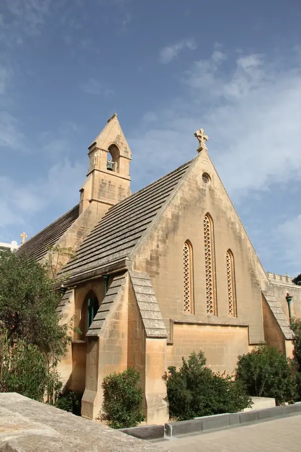
Jesus of Nazareth Church
Church building in Sliema, Malta, dedicated to Jesus of Nazareth.
R Gallery
Art gallery in Sliema featuring rotating exhibitions.
Cambridge Battery
19th-century military installation on the Tigné peninsula.
Garden Battery
1889 artillery battery in Malta, part of the coastal defences.
The Fortress Builders - Fortifications Interpretation Centre🏛 museum
Museum about the history of Maltese fortifications.
Panoramic View of Valetta
Viewpoint offering a panoramic view over the city of Valletta.
Sights nearby
Frequently asked questions
Where is Marsamxett Harbour located?
Are there yacht marinas there?
Do ferries operate there?
What is Manoel Island?
Can you walk along the shore?
Marsamxett Harbour: where is it located?
Marsamxett Harbour: what is there to see?
Marsamxett Harbour: when is the best time to visit?
Marsamxett Harbour: why is it worth visiting?

Nature

More places