Plizio Visual Lab
Hombori Tondo
Weather…
Water temperature…
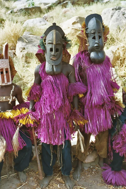
Hombori Tondo is the highest peak in Mali, reaching an elevation of 1,153 meters above sea level. Located near the town of Hombori in the Mopti region, it is part of a striking chain of sandstone inselbergs. The mountain is an imposing tableland characterized by sheer, near-vertical cliffs that rise abruptly from the surrounding semi-desert landscape. Due to its extreme isolation and the difficulty of reaching its summit plateau, a unique microclimate has been preserved at the top, hosting plant species that have long vanished from the broader Sahel region. Historically, the mountain's caves and rocky crevices served as vital refuges for Dogon and Tuareg people during periods of conflict. The area around Hombori Tondo is also significant for archaeological finds dating back to the Stone Age. For climbers and trekkers, the mountain presents a formidable technical challenge, but rewards them with spectacular vistas of the Gourma plains. It remains a sacred site for local communities, steeped in traditional legends and cultural significance.
Best time to visit & climate
The most pleasant time to visit is Jan, Feb, Dec.
| Jan | Feb | Mar | Apr | May | Jun | Jul | Aug | Sep | Oct | Nov | Dec | |
|---|---|---|---|---|---|---|---|---|---|---|---|---|
| Avg °C | 21 | 25 | 29 | 33 | 35 | 35 | 32 | 29 | 29 | 30 | 26 | 23 |
| Rain mm | 1 | 0 | 0 | 4 | 7 | 42 | 115 | 180 | 75 | 8 | 0 | 0 |
📋 Practical info
Geography
Facts
- Mali's highest peak at 1,153 meters
- Geologically composed of sandstone sediments
- The summit preserves pre-glacial plant species
- Historically a key refuge for Dogon people
- Located along the strategic Gao-Mopti highway
- Archaeological sites date back to the Epipaleolithic
Explore nearby
Notable places around
Route planner — Car & Motorhome
Where do you start? We build the route here, with stops and country notes along the way.
© OpenStreetMap contributors · OpenRouteService
Sights in the town Hombori Tondo (1)
Sights nearby
Frequently asked questions
What is Hombori Tondo?
Is it suitable for mountain climbers?
What is the weather like on the mountain?
Is it a family-friendly destination?
What is the best season for the climb?
Hombori Tondo: where is it located?
Hombori Tondo: when is the best time to visit?
Hombori Tondo: why is it worth visiting?