Plizio Visual Lab
Marojejy Massif

Weather…
Water temperature…
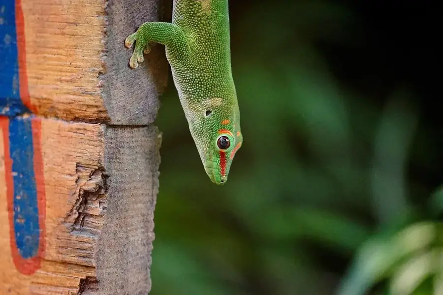
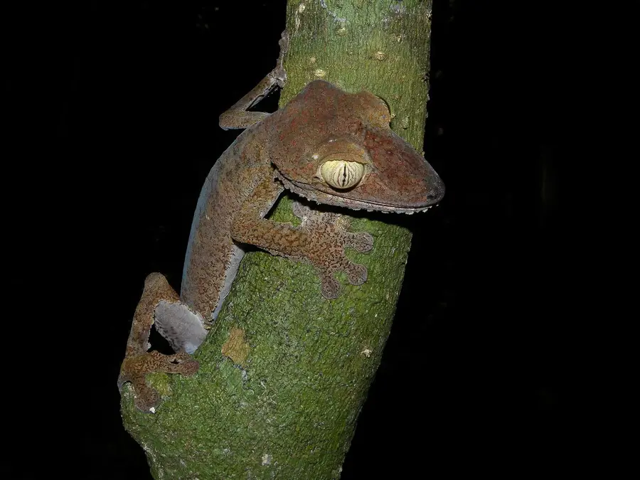
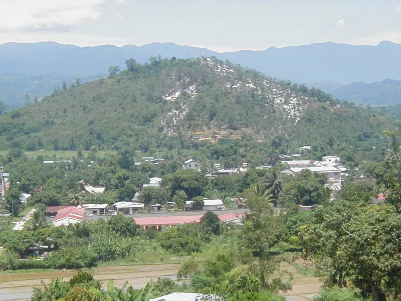
The Marojejy Massif in northeastern Madagascar is a spectacular granite mountain range and a designated UNESCO World Heritage site. It is defined by its extreme elevational gradients and a diverse array of ecosystems, ranging from dense lowland rainforest to high-altitude ericoid scrub on the peaks. This vertical zonation supports extraordinary biodiversity, most famously the critically endangered silky sifaka, often called the 'angel of the forest' due to its white fur. Geologically, the massif is a relic of the Precambrian Gondwana supercontinent, composed primarily of ancient metamorphic and igneous rocks. The high annual rainfall makes this range one of the island's most critical hydrological basins. Historically, the area was protected as a strict nature reserve in 1952 before being reclassified as a national park. Its rugged, steep terrain has historically shielded the inner forest from large-scale exploitation, though the borders remain under pressure.
- Location: Madagascar
- Nearby: Andapa (19 km)
Best time to visit & climate
The most pleasant time to visit is Aug–Oct.
| Jan | Feb | Mar | Apr | May | Jun | Jul | Aug | Sep | Oct | Nov | Dec | |
|---|---|---|---|---|---|---|---|---|---|---|---|---|
| Avg °C | 26 | 26 | 25 | 24 | 23 | 22 | 21 | 21 | 21 | 23 | 24 | 25 |
| Rain mm | 306 | 249 | 341 | 218 | 165 | 156 | 138 | 119 | 99 | 103 | 133 | 223 |
📋 Practical info
Geography
Facts
- The highest peak of Marojejy reaches an altitude of 2,132 meters.
- The park was officially opened to general ecotourism in 1998.
- Researchers have recorded 118 bird species and 147 amphibian species here.
- Marojejy is a core component of the UNESCO 'Rainforests of the Atsinanana' site.
- The trek to the summit traverses four distinct vegetation and climate zones.
- The protected area encompasses a total of approximately 55,500 hectares.
Explore nearby
Notable places around
Route planner — Car & Motorhome
Where do you start? We build the route here, with stops and country notes along the way.
© OpenStreetMap contributors · OpenRouteService
Sights in the town Marojejy Massif (1)
Sights nearby
Frequently asked questions
What distinguishes Marojejy National Park?
Is a guide mandatory?
How is the climate?
How long is the trekking route?
Where to find accommodation?
Marojejy Massif: where is it located?
Marojejy Massif: when is the best time to visit?
Marojejy Massif: why is it worth visiting?

Nearby cities
Nature
More places