Plizio Visual Lab
Mount Wologizi

Weather…
Water temperature…
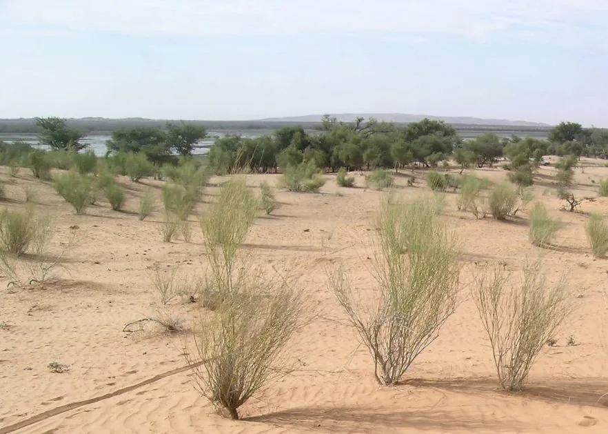
The Wologizi Range is the preeminent mountain formation in Liberia, located in the northern Lofa County. Its highest peak, Mount Wutivi, reaches an elevation of 1,447 meters (4,747 feet), making it the highest point in the country. The range is characterized by rugged terrain and is covered in dense Upper Guinean rainforest, which is one of the most biodiverse regions in West Africa. This mountain forest reserve provides a critical habitat for endangered wildlife, including the West African chimpanzee, the pygmy hippopotamus, and various rare bird species. Geologically, the Wologizi massif contains significant deposits of iron ore, leading to ongoing discussions about the balance between conservation and potential mining development. For hikers and eco-tourists, the area gives a pristine wilderness experience, though the lack of established trails and modern facilities makes any expedition a serious undertaking. The mountains also play a vital role in the regional climate and hydrology, serving as a primary watershed for the surrounding valleys and rivers that flow toward the Atlantic coast.
- Location: Liberia
- Nearby: Konia Trade Center (12 km)
Best time to visit & climate
The most pleasant time to visit is Jan, Feb, Dec.
| Jan | Feb | Mar | Apr | May | Jun | Jul | Aug | Sep | Oct | Nov | Dec | |
|---|---|---|---|---|---|---|---|---|---|---|---|---|
| Avg °C | 24 | 25 | 26 | 26 | 25 | 24 | 23 | 23 | 23 | 24 | 24 | 23 |
| Rain mm | 10 | 44 | 112 | 179 | 206 | 305 | 307 | 418 | 372 | 212 | 77 | 19 |
📋 Practical info
Geography
Facts
- Elevation: 1,440 m
- Reserve area: 500 km²
- Annual rainfall: 3,000 mm
- Forest elephant population: 30
- Bird species: 180
- Distance from Voinjama: 35 km
Explore nearby
Notable places around
Route planner — Car & Motorhome
Where do you start? We build the route here, with stops and country notes along the way.
© OpenStreetMap contributors · OpenRouteService
Sights nearby
Frequently asked questions
Is Mount Wologizi the highest mountain in Liberia?
How long does the climb take?
Are there drinking water sources on the mountain?
What animals live in the Wologizi area?
Is a guide necessary for the climb?
Mount Wologizi: where is it located?
Mount Wologizi: when is the best time to visit?
Mount Wologizi: why is it worth visiting?

Nearby cities


Nature
More places