Plizio Visual Lab
Turgay Trough
Weather…
Water temperature…
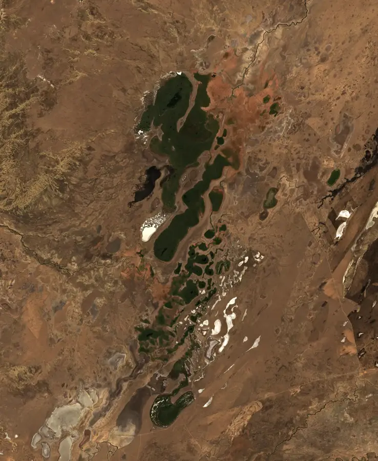
The Turgay Trough, also known as the Turgay Gate, is a long and wide depression that stretches for 800 kilometers in a north-south direction through northwestern Kazakhstan. It separates the Kazakh Uplands to the east from the southern Urals and Mugodzhar Hills to the west. Geologically, it is an ancient strait that once connected the Tethys Sea to the south with the West Siberian Sea to the north. Today, the trough is a flat, slightly hilly plain, drained by the Turgay River and hosting numerous salt lakes. Ecologically, the Turgay Trough is of immense importance as one of the world's most significant bird migration corridors. Every spring and autumn, millions of waterbirds and other birds travelling between Siberia and their wintering grounds in South Asia and Africa pass through this area, resting at its lakes and wetlands.
Best time to visit & climate
The most pleasant time to visit is May, Jun, Aug.
| Jan | Feb | Mar | Apr | May | Jun | Jul | Aug | Sep | Oct | Nov | Dec | |
|---|---|---|---|---|---|---|---|---|---|---|---|---|
| Avg °C | -14 | -12 | -1 | 9 | 18 | 24 | 26 | 24 | 17 | 7 | -2 | -10 |
| Rain mm | 15 | 13 | 20 | 17 | 17 | 16 | 16 | 13 | 8 | 19 | 17 | 17 |
📋 Practical info
Geography
Route planner — Car & Motorhome
Where do you start? We build the route here, with stops and country notes along the way.
© OpenStreetMap contributors · OpenRouteService
Sights in the town Turgay Trough (1)
Sights nearby
Frequently asked questions
What is the Turgay Trough?
Are there lakes there?
What animals can be found there?
What is the terrain like?
Why is the region geologically interesting?
Turgay Trough: where is it located?
Turgay Trough: when is the best time to visit?
Turgay Trough: why is it worth visiting?

More places