Plizio Visual Lab

Weser

Plizio editorial teamData Sources
River
—°2
Weser (Germany)

Weather…

The Weser, with a length of 452 kilometers (744 kilometers including its source river, the Werra), is the only major German river whose drainage basin lies entirely within national borders. It is formed in Hannoversch Münden by the confluence of the Fulda and Werra rivers and flows northward through the Weser Uplands toward the North Sea. Its drainage basin spans approximately 46,000 square kilometers, characterized by the North German Plain and key industrial sites. The Weser passes through cities such as Hamelin, Minden, and Bremen before reaching its prominent estuary at Bremerhaven, where it flows into the German Bight. Historically, the river was a central transport artery for the Hanseatic League and played a vital role in developing the Free Hanseatic City of Bremen as a world-class trading port. Today, the Weser is an essential federal waterway, linked to the European canal network via the Mittelland Canal and the Coastal Canal. Economically, it is globally significant for the German automotive industry's exports through the Bremerhaven container terminal. Ecologically, the Weser estuary provides critical habitats within the Lower Saxony Wadden Sea National Park.

Best time to visit & climate

The most pleasant time to visit is Jun–Aug.

JanFebMarAprMayJunJulAugSepOctNovDec
Avg °C124913161818141062
Rain mm735551395564807458636673

📋 Practical info

🧭
Getting there
The Weser is exceptionally well-connected via the popular Weser Cycle Path, federal highways, and rail links in numerous towns along its route. Access to the riverbanks is easily possible almost everywhere via well-kept footpaths.
📅
Best season
The region is most beautiful from mid-May through October, when passenger ships operate and warm weather invites outdoor activities. Furthermore, spring provides genuinely wonderful views of the blooming meadow landscapes.
⛰️
Terrain & paths
In its upper reaches within the Weser Uplands, the river traverses wooded hills and valleys, whereas in the North German Plain it flows through broad marshlands. The paths along the banks are almost completely paved and smooth.
🎒
What to bring
A wind- and water-resistant jacket is particularly recommended in the North German stretches. Standard casual shoes are entirely sufficient for the paved riverside paths; cyclists, of course, should remember their appropriate gear.
🅿️
Parking
Numerous towns scattered along the Weser provide free or paid parking options in the immediate vicinity of the river. At the larger locks or key tourist boat landings, the designated parking facilities are often very well developed.
⚠️
Safety
The pathways are safe and easily accessible for all types of visitors. However, since the Weser is a major federal waterway, swimmers and water sports enthusiasts must strictly pay attention to heavy shipping traffic and strong currents.
⏱️
Time needed
Whether for a quick one-hour stroll or a multi-week holiday cycling along the path - the duration of a stay is highly flexible. Many visitors use long weekends to quietly explore individual idyllic stretches of the river at their own pace.

Geography

Coordinates
53.08000, 8.74000

Facts

  • Length: 452 kilometers from Hannoversch Münden to the North Sea.
  • Total Length: 744 kilometers when including the Werra's source.
  • Basin Area: 46,306 km², all of which is located within Germany.
  • Mouth: The Outer Weser flows into the North Sea near Bremerhaven.
  • Shipping: The Lower Weser is navigable for seagoing vessels up to Bremen.
  • Weserstein: A famous stone marking the meeting of the Fulda and Werra.

Explore nearby

Notable places around

Route planner — Car & Motorhome

Where do you start? We build the route here, with stops and country notes along the way.

Vehicle
Only stops with (optional):

© OpenStreetMap contributors · OpenRouteService

Sights in the town Weser (2)

Rablinghauser Strand🎡 recreation

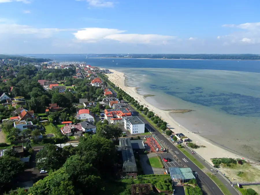
In a natural environment on the banks of the Weser, the Rablinghauser Strand features a quiet contrast to city life. The wide, green riverbank invites you to take leisurely walks and relaxing breaks by the watercourse. To enjoy the peaceful atmosphere away from traffic, a visit in the early evening hours is highly recommended.

Waller Sand🎡 recreation

Waller Sand beach on the Weser river in Bremen.

🆓

Sights nearby

Frequently asked questions

How is the Weser formed?
The Weser is formed in Hann. Münden by the confluence of the Werra and Fulda.
Which Hanseatic city is located on the Weser?
Bremen is the most significant city on the Weser, famous for the Bremen Town Musicians.
What is the Weser Renaissance?
A magnificent architectural style with ornate gables, especially common in the Weser Uplands.
Can you cycle along the Weser?
Yes, the Weser Cycle Route leads almost without inclines from the mountains to the sea.
Are there fairytale locations on the Weser?
Yes, Hameln is world-famous for the legend of the Pied Piper, who is said to have lived here.
Weser: where is it located?
Weser is located in Germany.
Weser: what is there to see?
Highlights include Rablinghauser Strand, Waller Sand.
Weser: when is the best time to visit?
The most pleasant time to visit is Jun, Aug.
Weser: why is it worth visiting?
The Weser, with a length of 452 kilometers (744 kilometers including its source river, the Werra), is the only major German river whose drainage basin lies entirely within national borders.
View on map → The Top 50 Attractions → Most beautiful beaches → OpenStreetMap →
Europe
Explore with Plizio Discover more places in Europe
More places in Germany →

Nearby cities