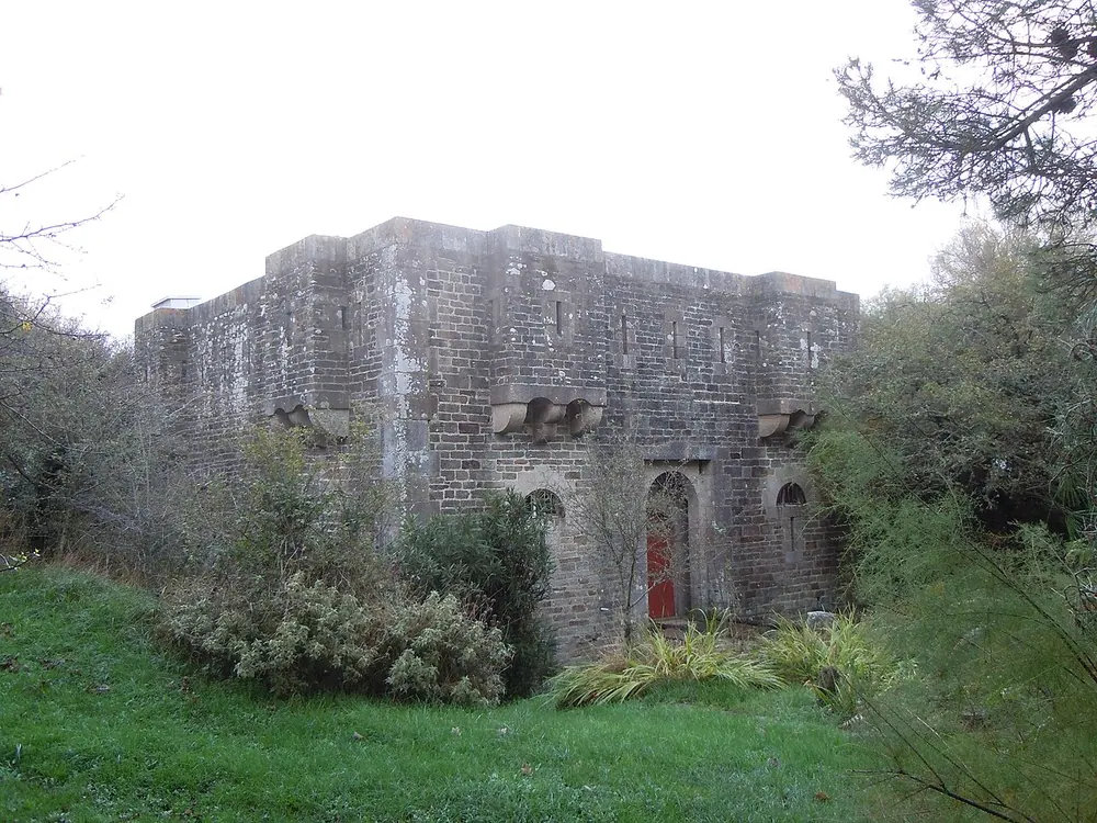
Corps de garde de Fort Larron
The Corps de garde de Fort Larron is a historical military structure on Belle-Île-en-Mer, off the coast of Brittany in northwestern France. Positioned strategically along the rugged coastline, this former guardhouse was constructed as an integral part of the island's coastal defense system. Its primary purpose was to monitor maritime traffic and protect vulnerable coves from naval incursions, particularly by the British navy during the 18th and 19th centuries.
Architecturally, the guardhouse reflects the pragmatic military design typical of French coastal fortifications. Built from sturdy local stone to withstand enemy fire and harsh Atlantic weather, it features thick walls, firing slits, and a highly functional aesthetic. The building seamlessly blends into the natural rocky landscape, utilizing local topography to remain inconspicuous from the sea.
Today, it stands as a silent witness to Belle-Île's turbulent military past. The site remains a captivating point of interest for history and nature enthusiasts. Visitors hiking the coastal paths can encounter this well-preserved relic, offering a tangible connection to maritime history and sweeping views of the Atlantic Ocean.
Weather…
Best time to visit & climate
The most pleasant time to visit is Jul–Sep.
| Jan | Feb | Mar | Apr | May | Jun | Jul | Aug | Sep | Oct | Nov | Dec | |
|---|---|---|---|---|---|---|---|---|---|---|---|---|
| Avg °C | 8 | 8 | 9 | 11 | 14 | 17 | 19 | 19 | 17 | 15 | 12 | 9 |
| Rain mm | 86 | 69 | 60 | 47 | 46 | 41 | 42 | 44 | 37 | 81 | 88 | 91 |
Practical info
Tips
- Wear proper hiking shoes as the coastal paths can be rocky and steep.
- Bring plenty of water and sun protection.
- Carry a camera to capture the dramatic cliffs and the Atlantic panorama.
FAQ
What was the purpose of the Corps de garde de Fort Larron?
Can visitors enter the building?
How do I get there?
What is the best time of year to visit?
Route planner — Car & Motorhome
Where do you start? We build the route here, with stops and country notes along the way.
© OpenStreetMap contributors · OpenRouteService