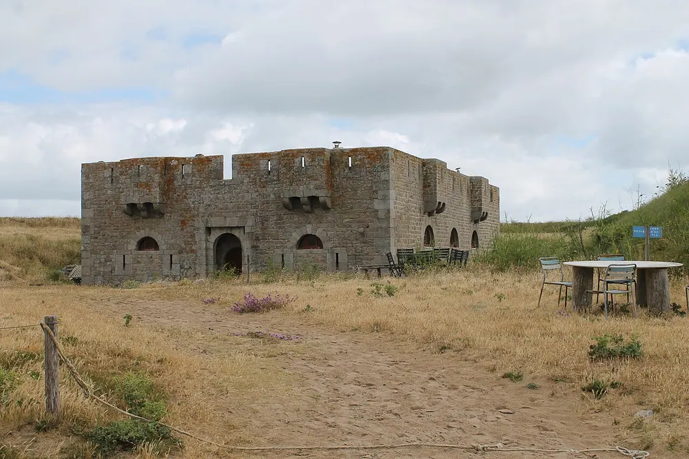
Batterie d'artillerie d'En Tal
The Batterie d'artillerie d'En Tal is a historic coastal defense fortification situated on the picturesque island of Île-d'Houat in the Morbihan department of Brittany, France. Nestled near the striking En Tal beach on the eastern coast of the island, this military structure stands as a testament to France's extensive coastal defense systems built in the 19th century to protect against naval invasions.
Constructed to guard the strategic waters surrounding the island and the nearby Quiberon Bay, the battery features characteristic coastal fort architecture, integrating into the rugged natural landscape. Visitors exploring the ruins can observe the remnants of artillery emplacements and the foundations of garrison structures, offering a glimpse into the isolated and harsh conditions faced by soldiers once stationed here.
Today, the site is a captivating destination for history enthusiasts and nature lovers alike. Reached via scenic walking trails that crisscross the island, the fort offers spectacular panoramic views of the Atlantic Ocean. The surrounding protected natural environment makes a visit to the En Tal battery a memorable combination of historical exploration and natural beauty.
Weather…
Best time to visit & climate
The most pleasant time to visit is Jul–Sep.
| Jan | Feb | Mar | Apr | May | Jun | Jul | Aug | Sep | Oct | Nov | Dec | |
|---|---|---|---|---|---|---|---|---|---|---|---|---|
| Avg °C | 8 | 8 | 9 | 11 | 14 | 17 | 19 | 19 | 17 | 15 | 12 | 9 |
| Rain mm | 86 | 69 | 60 | 47 | 46 | 41 | 42 | 44 | 37 | 81 | 88 | 91 |
Practical info
Tips
- Combine your visit with a relaxing afternoon at the beautiful En Tal beach.
- Wear sturdy walking shoes, as the trails and the area around the ruins can be uneven.
FAQ
What is the Batterie d'artillerie d'En Tal?
Where exactly is the fort located?
Can visitors enter the ruins of the battery?
What else is there to do in the area?
Route planner — Car & Motorhome
Where do you start? We build the route here, with stops and country notes along the way.
© OpenStreetMap contributors · OpenRouteService