Plizio Visual Lab
Dire Dawa
ℹ️Practical info — Dire Dawa
▾
🌤 Weather — 5 days
📍 Nearby
Sights nearby
💡 Tips
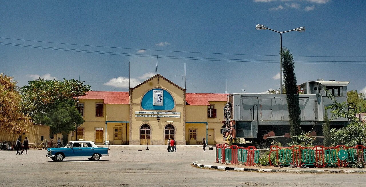
- The old railway station (Chemin de Fer) is a historical landmark; check ahead as interior access can be restricted.
- The city is warmer and lower than Addis Ababa; early morning or late afternoon are the best times for walking.
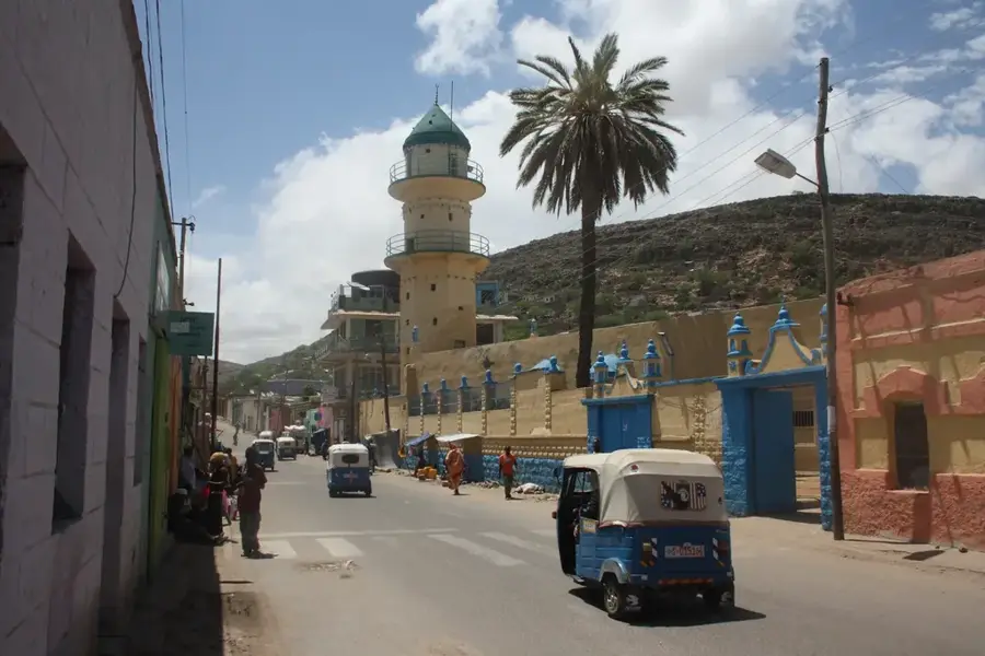
- Explore both Kezira, the planned European-style section, and Megala, the older Islamic quarter, for a striking contrast.
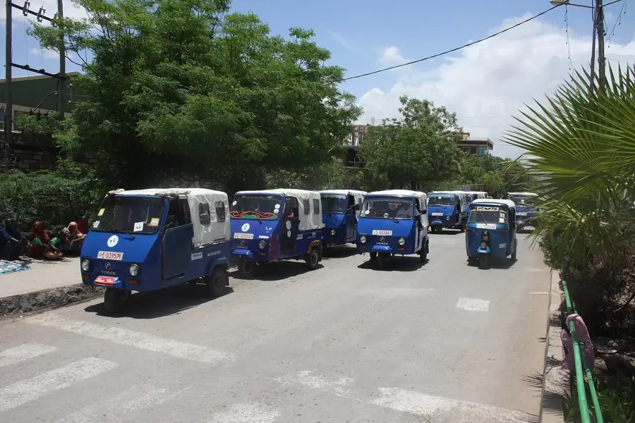
- Three-wheelers (bajaj) are the main mode of transport; always agree on the fare before starting your journey.
🍽 Food
Enjoy at local cafes in the Megala district.
Find them at traditional Somali eateries in the city center.
A popular savory pastry sold by street food vendors near the markets.
🛍 Shopping · 🧘 Quiet spots
A lively traditional market in Megala first-rate for spices and incense.
Bustling livestock market that gives a glimpse into local trade.
When dry it serves as a walking path with unique views, but avoid during rains.
A small green space in the city for a brief rest.
Water temperature…
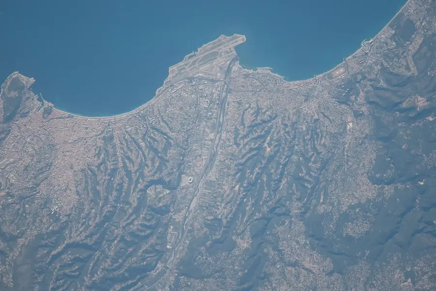
Dire Dawa is a major city in eastern Ethiopia and one of two chartered cities in the country that enjoy a degree of administrative autonomy. Established in 1902 during the construction of the Ethio-Djibouti Railway, the city was born out of necessity when the challenging topography prevented the rail line from reaching the ancient walled city of Harar. Consequently, Dire Dawa was developed as a modern industrial and logistical hub on the plains below the Ahmar Mountains. The city is uniquely split into two distinct sectors: Kezira, the 'new' town characterized by organized colonial-style grids, and Megala, the traditional quarter known for its bustling markets and narrow, winding alleys. Geographically, Dire Dawa sits at an elevation of about 1,200 meters (3,937 feet) and experiences a hot, semi-arid climate that is significantly warmer than the Ethiopian highlands. Its location is strategic, acting as a vital link between the fertile interior and the coastal ports of the Horn of Africa. The architecture in the Kezira district remains a testament to French colonial influence from the railway era, featuring broad, tree-lined streets and historic Mediterranean-style villas. The Dechatu River bisects the city; though it remains dry for much of the year, it is prone to sudden and intense flooding during the rainy season, a phenomenon that has historically shaped the city's urban planning and disaster management. Economically, Dire Dawa is an industrial powerhouse for eastern Ethiopia. It hosts some of the country's oldest and largest factories, including cement works, textile mills, and food processing plants. The city is a primary center for the trade of khat, a stimulant plant widely exported across the region, as well as livestock and coffee. The population is a lively multicultural mosaic of Oromo, Somali, and Amhara ethnic groups, contributing to a cosmopolitan atmosphere that is distinct from the more homogenous highland regions. With an international airport and a central role in the new standard-gauge railway, Dire Dawa continues to be a crucial gateway for trade and tourism, bridging the gap between Ethiopia's rich past and its industrial future.
- Location: Ethiopia
- Population: ~343.000 (2023)
Best time to visit & climate
The most pleasant time to visit is Jan, Feb, Oct.
| Jan | Feb | Mar | Apr | May | Jun | Jul | Aug | Sep | Oct | Nov | Dec | |
|---|---|---|---|---|---|---|---|---|---|---|---|---|
| Avg °C | 19 | 21 | 23 | 23 | 23 | 23 | 21 | 21 | 21 | 21 | 19 | 19 |
| Rain mm | 6 | 13 | 46 | 114 | 85 | 51 | 116 | 146 | 113 | 37 | 22 | 11 |
Geography
Facts
- Dire Dawa was founded in 1902 during the construction of the Djibouti railway.
- It is one of two federally administered chartered cities in Ethiopia.
- The city is divided by the Dechatu River into two distinct urban zones.
- It sits at an altitude of approximately 1,200 meters (3,937 feet).
- The city is a major industrial center for cement, textiles, and chemicals.
- It is the main market hub for Khat, which is exported to Djibouti and Somalia.
- French colonial influence is visible in the architecture of the Kezira district.
- The city is home to several technical colleges and research institutions.
Explore nearby
Notable places around
Route planner — Car & Motorhome
Where do you start? We build the route here, with stops and country notes along the way.
© OpenStreetMap contributors · OpenRouteService
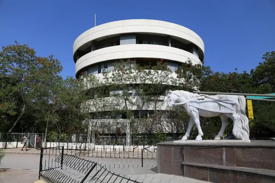
Sights in the town Dire Dawa (1)
Frequently asked questions
Where is Dire Dawa and how do I get there?
What is Dire Dawa known for?
How long should I stay in Dire Dawa?
What should I see in Dire Dawa?
Is Dire Dawa easily accessible and safe?
Dire Dawa: where is it located?
Dire Dawa: when is the best time to visit?
Dire Dawa: why is it worth visiting?

Nearby cities


History & landmarks
Nature
More places