Plizio Visual Lab
Sahel Lowlands
Weather…
Water temperature…
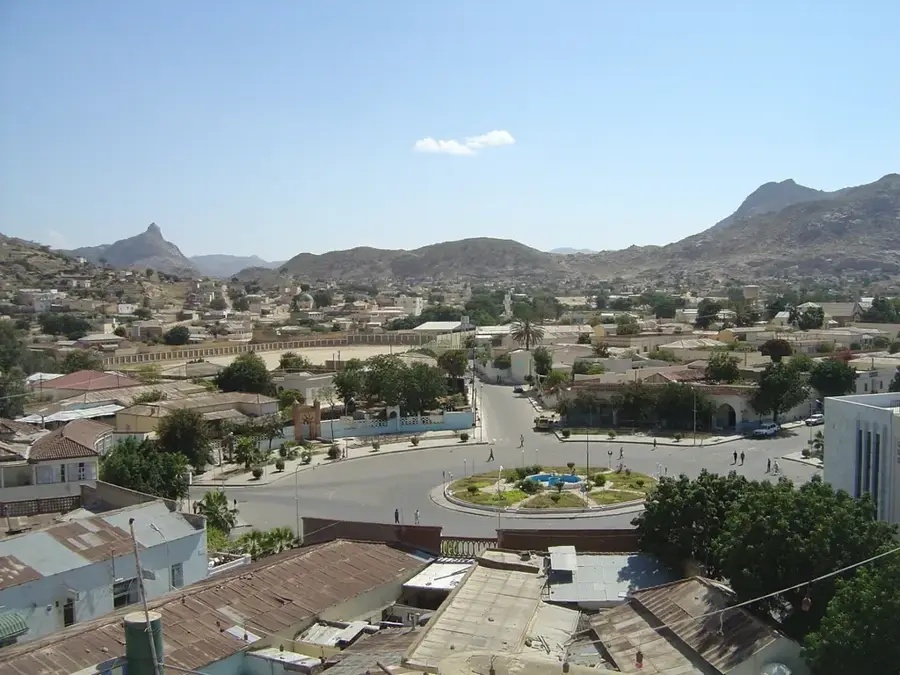
The Sahel lowlands extend across northern Eritrea, forming a transition zone between the rugged mountain landscape of the highlands and the arid coastal region. This relief is characterized by vast, dry plains, seasonal riverbeds (wadis), and isolated hill ranges. The region is climatically extremely demanding, with low rainfall and high temperatures requiring special adaptation of flora and fauna. Historically, the Sahel area played a crucial role in the Eritrean War of Independence, as the remote and inaccessible landscape provided strategic protection for the resistance. The town of Nakfa, located in the heart of this region, became a symbol of steadfastness. Today, the plain mainly serves nomadic groups as grazing land for camels and goats, while the geological structure is rich in minerals, sparking interest in mining activity.
- Location: Eritrea
- Nearby: Keren (69 km)
Best time to visit & climate
The most pleasant time to visit is Jan, Feb, Dec.
| Jan | Feb | Mar | Apr | May | Jun | Jul | Aug | Sep | Oct | Nov | Dec | |
|---|---|---|---|---|---|---|---|---|---|---|---|---|
| Avg °C | 21 | 23 | 25 | 27 | 29 | 28 | 25 | 23 | 25 | 24 | 23 | 21 |
| Rain mm | 3 | 5 | 3 | 11 | 10 | 14 | 69 | 99 | 22 | 6 | 8 | 4 |
📋 Practical info
Geography
Facts
- The Sahel region gave its name to the Eritrean currency, the Nakfa.
- The relief is characterized by deeply incised wadis.
- Less than 200 mm of rain falls per year in this region.
- Nakfa was an impregnable fortress during the War of Independence.
- Vegetation consists almost exclusively of xerophytic plants.
- Geologically, the area is part of the Arabian-Nubian Shield.
Explore nearby
Notable places around
Route planner — Car & Motorhome
Where do you start? We build the route here, with stops and country notes along the way.
© OpenStreetMap contributors · OpenRouteService
Sights nearby
Frequently asked questions
What is the Sahel lowlands?
When is the best time to travel?
Is the area safe?
What is the appeal of the landscape?
Do I need special clothing?
Sahel Lowlands: where is it located?
Sahel Lowlands: when is the best time to visit?
Sahel Lowlands: why is it worth visiting?

Nearby cities

History & landmarks
More places