Plizio Visual Lab
Jalapão State Park
Weather…
Water temperature…
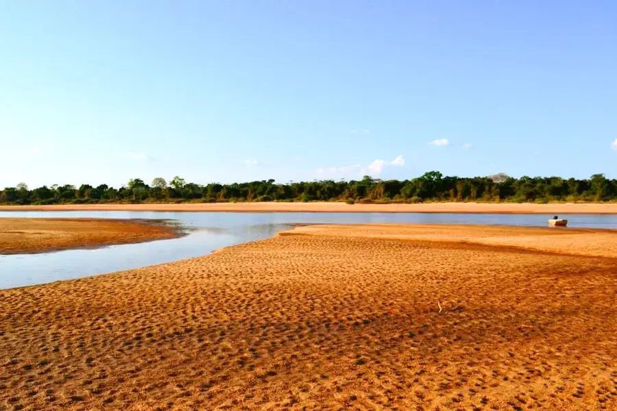
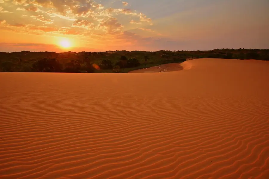
Jalapão State Park, located in the state of Tocantins, is a nature reserve of exceptional beauty and ecological significance. Established on January 12, 2001, it encompasses an area of nearly 159,000 hectares in the heart of Brazil. The region is renowned for its contrasting landscapes, ranging from orange sand dunes to crystal-clear springs called fervedouros and impressive waterfalls like Cachoeira da Velha. Fervedouros are natural springs where the water pressure is so high that swimmers cannot sink. Geographically, Jalapão belongs to the Cerrado biome, the Brazilian savanna, and hosts a rich diversity of flora and fauna, including the maned wolf and the jaguar. Due to its difficult accessibility via unpaved sandy tracks, the area has remained largely pristine. The local community utilizes the golden grass known as 'Capim Dourado' to create traditional handicrafts that are internationally esteemed.
Best time to visit & climate
The most pleasant time to visit is Jun–Aug.
| Jan | Feb | Mar | Apr | May | Jun | Jul | Aug | Sep | Oct | Nov | Dec | |
|---|---|---|---|---|---|---|---|---|---|---|---|---|
| Avg °C | 26 | 25 | 26 | 26 | 26 | 25 | 26 | 27 | 29 | 29 | 27 | 27 |
| Rain mm | 219 | 189 | 198 | 130 | 36 | 4 | 1 | 3 | 23 | 93 | 164 | 179 |
📋 Practical info
Geography
Facts
- Jalapão State Park was officially established on January 12, 2001.
- The total area of the protected reserve is approximately 158,737 hectares.
- The region's famous sand dunes reach heights of up to 40 meters.
- There are over 100 mapped springs of the fervedouro type within the park.
- Cachoeira da Velha waterfall is the largest in the park at 100 meters wide.
- The region is the only area in the world where Capim Dourado grows naturally.
Route planner — Car & Motorhome
Where do you start? We build the route here, with stops and country notes along the way.
© OpenStreetMap contributors · OpenRouteService
Sights in the town Jalapão State Park (1)
Sights nearby
Frequently asked questions
What are the 'fervedouros'?
Do you need a 4x4 vehicle?
When is the best time to travel?
Where is Jalapão located?
Are there hotels there?
Jalapão State Park: where is it located?
Jalapão State Park: when is the best time to visit?
Jalapão State Park: why is it worth visiting?