Plizio Visual Lab
Isla de los Estados
Weather…
Water temperature…
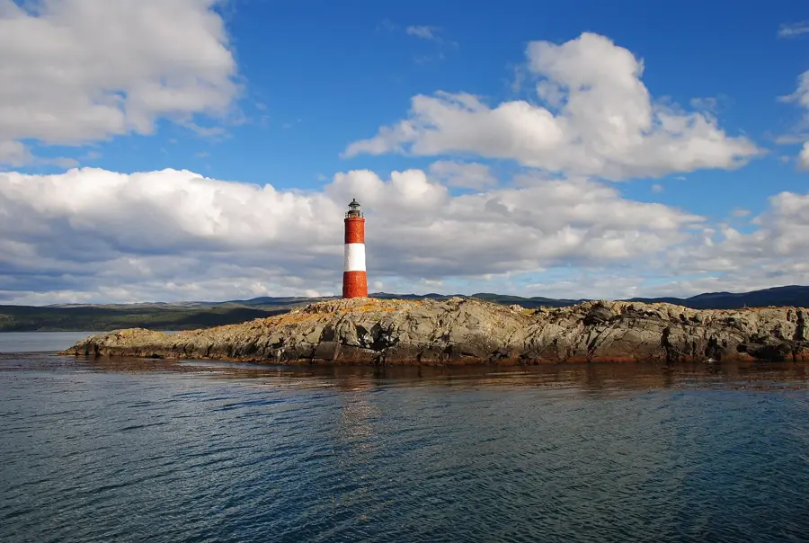
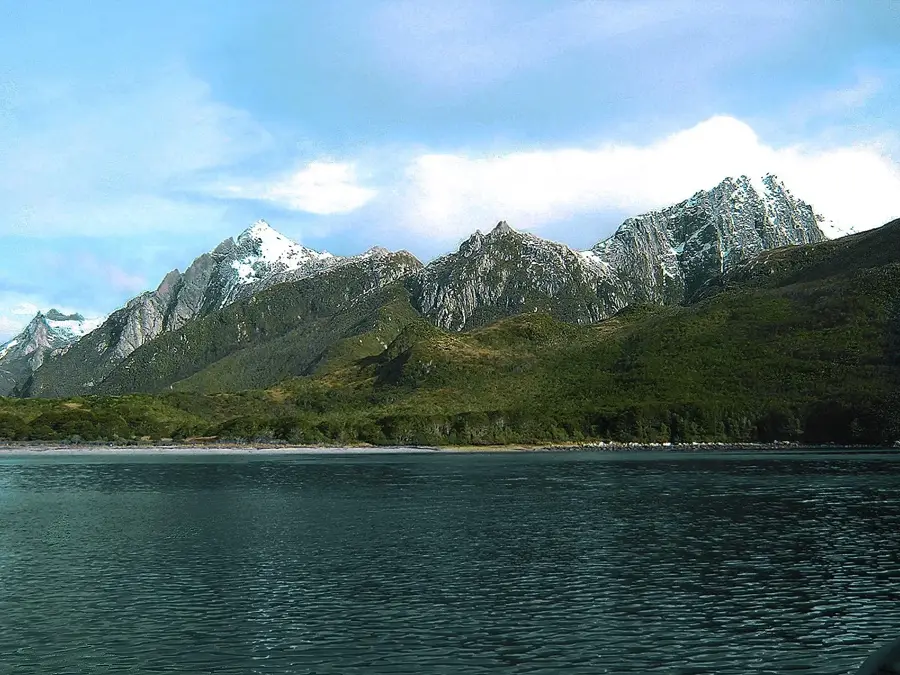
Isla de los Estados is located east of the Mitre Peninsula in Tierra del Fuego, separated from the mainland by the Le Maire Strait. The island is renowned for its extremely harsh climate, rugged cliffs, and dense subantarctic forests. Historically, it gained fame through Jules Verne's novel 'The Lighthouse at the End of the World', inspired by the San Juan de Salvamento lighthouse built in 1884. The topography is characterized by deep fjords and mountains that rise up to 800 meters above sea level. Since 1991, the island has been part of a strict nature reserve, the Reserva Provincial Isla de los Estados, and public access is highly restricted. The surrounding seas are notorious for dangerous currents and violent storms, making the island a graveyard for numerous ships over the centuries. Today, it serves primarily as a sanctuary for seabirds, penguins, and marine mammals, thriving undisturbed by human interference.
- Location: Argentina
- Top sights: Monte Buckland · Bahia Colnett
Best time to visit & climate
The most pleasant time to visit is Jan, Feb, Dec.
| Jan | Feb | Mar | Apr | May | Jun | Jul | Aug | Sep | Oct | Nov | Dec | |
|---|---|---|---|---|---|---|---|---|---|---|---|---|
| Avg °C | 8 | 8 | 8 | 6 | 5 | 4 | 4 | 4 | 4 | 5 | 6 | 7 |
| Rain mm | 96 | 84 | 96 | 84 | 74 | 73 | 64 | 66 | 56 | 55 | 78 | 76 |
📋 Practical info
Geography
Facts
- The island has a total surface area of approximately 534 square kilometers.
- The highest peak is Monte Bove, reaching an elevation of 823 meters.
- The climate is defined by more than 250 rainy days per year.
- There is no permanent civilian population residing on the island.
- The Argentine Navy maintains a small outpost on the island.
- The island was discovered in 1616 by Dutch navigators Schouten and Le Maire.
Route planner — Car & Motorhome
Where do you start? We build the route here, with stops and country notes along the way.
© OpenStreetMap contributors · OpenRouteService
Sights in the town Isla de los Estados (2)
Sights nearby
Frequently asked questions
What is Isla de los Estados?
Can you visit the island?
What animals live there?
What is the weather like?
What makes the island legendary?
Isla de los Estados: where is it located?
Isla de los Estados: what is there to see?
Isla de los Estados: when is the best time to visit?
Isla de los Estados: why is it worth visiting?

History & landmarks

More places