Plizio Visual Lab
Saurimo
ℹ️Practical info — Saurimo
▾
🌤 Weather — 5 days
📍 Nearby
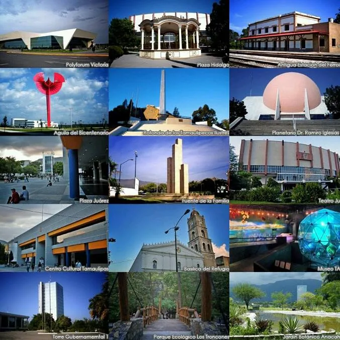
Sights nearby
💡 Tips
- Minibuses (candongueiros) operate locally, but renting a 4x4 is advisable for exploring outside the city limits.
- Carry enough cash in Kwanzas, as ATMs can occasionally run out of money.
- The dry season (May to October) has the best road conditions for travel.
- Always ask politely before photographing locals or official buildings.
🍽 Food
This cassava-based staple is best tried in local traditional eateries.
A hearty chicken stew commonly served at restaurants in the city center.
Fresh fish available at casual dining spots around town.
🛍 Shopping · 🧘 Quiet spots
The main hub for fresh produce and everyday local goods.
Look for traditional wooden carvings in the small shops.
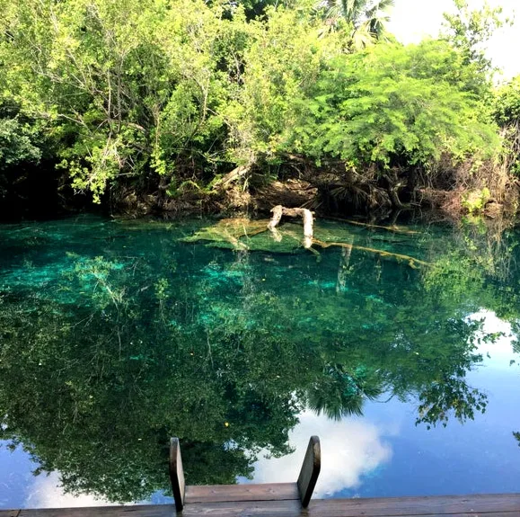
Peaceful natural spots slightly away from the main town activity.
Quiet local corners well-suited for a short rest.
Water temperature…
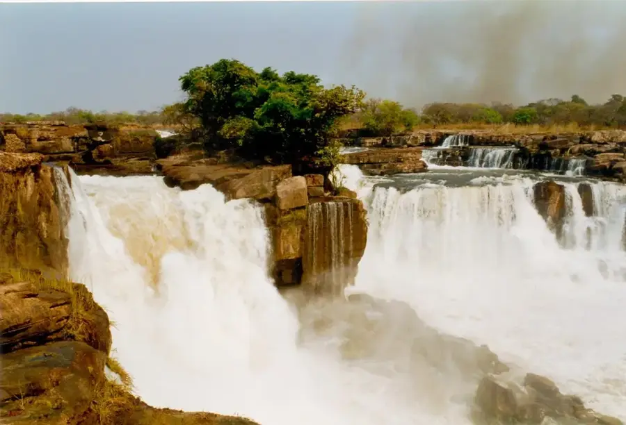
Saurimo, the capital of Lunda Sul Province in eastern Angola, is recognized globally as the center of the country’s diamond industry. Perched on a high plateau at an elevation of approximately 1,080 meters, the city enjoys a tropical climate with a long rainy season and moderate temperatures. Originally named Vila Henrique de Carvalho by the Portuguese, it was renamed Saurimo after independence in 1975. The city's destiny changed forever with the discovery of massive diamond pipes in the region; today, the Catoca diamond mine, located a short distance away, is the fourth largest kimberlite pipe in the world. This industrial backbone has made Saurimo a wealthy but expensive city, driving the development of modern infrastructure, including the Saurimo Diamond Development Hub, inaugurated in 2021 to centralize the value chain from mining to polishing. Beyond diamonds, Saurimo is the cultural heartland of the Chokwe people, renowned for their intricate wood carvings and the 'Cingandji' spiritual masks. The local Museum of Lunda Sul provides a deep dive into the history and ethnography of eastern Angola. The city’s geography is shaped by the Chicapa and Luari rivers, which offer hydroelectric potential and pretty waterfalls nearby. Saurimo’s urban core is characterized by colonial-style bungalows interspersed with contemporary office buildings and bustling markets like the 'Mercado de Saurimo.' The city is a vital transport link on the national highway network, connecting the central highlands to the Congolese border. Educational expansion is a priority, with the Lunda Sul Polytechnic Institute training the next generation of technicians for the mining and agricultural sectors. Despite its mineral wealth, the province faces the challenge of diversifying its economy, with current initiatives promoting large-scale farming of pineapples and cassava. Saurimo remains a dynamic and vital city, a place where traditional Bantu culture meets the high-stakes world of international mining, playing a key role in Angola’s vision for eastern regional development.
- Location: Angola
- Top sights: Estádio das Mangueiras · Archdiocese of Saurímo
- Population: ~393.000 (2026)
Best time to visit & climate
The most pleasant time to visit is May–Jul.
| Jan | Feb | Mar | Apr | May | Jun | Jul | Aug | Sep | Oct | Nov | Dec | |
|---|---|---|---|---|---|---|---|---|---|---|---|---|
| Avg °C | 23 | 23 | 23 | 23 | 23 | 22 | 22 | 25 | 27 | 25 | 24 | 23 |
| Rain mm | 148 | 148 | 154 | 75 | 8 | 2 | 0 | 8 | 41 | 105 | 155 | 171 |
Geography
Facts
- Saurimo serves as the administrative seat for Lunda Sul's four municipalities.
- The city's name comes from a local traditional leader of the Lunda people.
- The Diamond Development Hub covers an area of over 300,000 square meters.
- Average annual rainfall in Saurimo is approximately 1,350 mm.
- The city is a major center for the Catholic Church in eastern Angola.
- Local craftsmanship includes 'Sona' sand drawings, a UNESCO intangible heritage.
- Saurimo is surrounded by a vast network of tributaries to the Kasai River.
- The city's economy is shifting towards sustainable energy with new solar plants.
Explore nearby
Notable places around
Route planner — Car & Motorhome
Where do you start? We build the route here, with stops and country notes along the way.
© OpenStreetMap contributors · OpenRouteService
Sights in the town Saurimo (2)
Frequently asked questions
How many days do you need for Saurimo?
When is the best time to visit?
What is Saurimo known for?
Is the city suitable for families?
What is the best way to get there?
Saurimo: where is it located?
Saurimo: what is there to see?
Saurimo: when is the best time to visit?
Saurimo: why is it worth visiting?