Plizio Visual Lab
Shelter Cove
ℹ️Practical info — Shelter Cove
▾
🌤 Weather — 5 days
📍 Nearby
Sights nearby
💡 Tips
- The drive from the US-101 is winding and steep; allow more time than GPS suggests and check your brakes.
- Gas up before heading to the Lost Coast, as fuel options are very limited in town.
- Cell phone service is unreliable; download offline maps before your trip.
- Always check tide charts before hiking along Black Sand Beach to avoid getting stranded.
🍽 Food
Grab fresh fish from the deli near the RV park or boat launch area.
Enjoy a cold brew with an ocean view at the local brewery.
Warm up on a foggy day with a bowl at a waterfront cafe.
🛍 Shopping · 🧘 Quiet spots
Pick up basic supplies and locally made souvenirs or postcards.
Look for small galleries or community centers selling Lost Coast artisan goods.
Walk a mile down the shore to leave the few crowds behind completely.
A great spot to watch the sunset near the relocated lighthouse.
Water temperature…
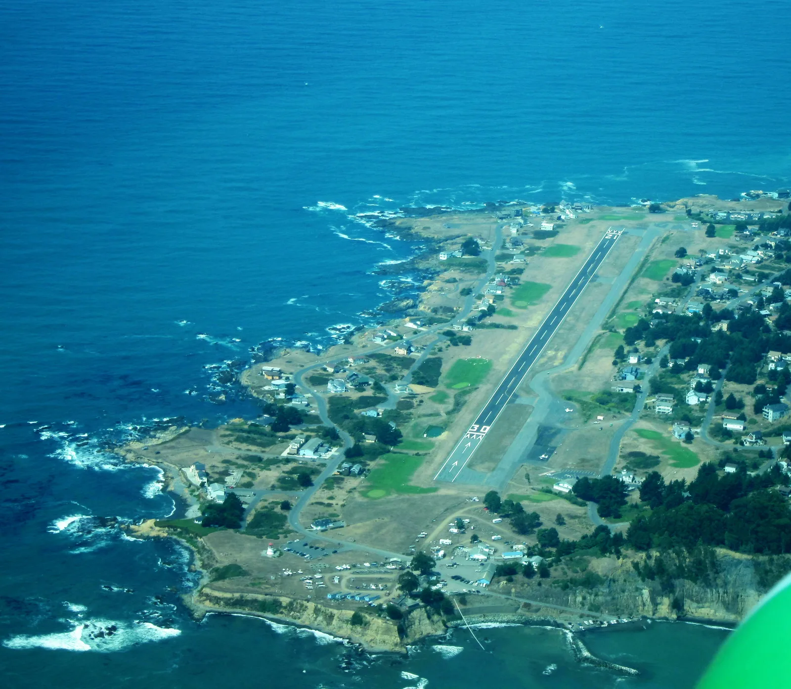
Shelter Cove is the epitome of seclusion. Located on the famous Lost Coast, where Highway 1 had to turn inland due to the rugged terrain, this spot is accessible only via a steep, winding road. The settlement serves as a gateway to the King Range National Conservation Area, offering nature lovers a backdrop of mist-shrouded mountains and dark beaches. It is a place for adventurers, fishermen, and hikers seeking silence away from the tourist paths. One of the main highlights is Black Sands Beach, which gained its characteristic color through the erosion of dark shale. It marks the southern terminus of the famous Lost Coast Trail. Needle Rock Beach and Jones Beach offer further opportunities to explore the rugged coastline, with Needle Rock known for its historical buildings and proximity to Sinkyone Wilderness State Park. The tide pools here are rich in marine life, and whales can often be spotted from the shore. The local gastronomy is small but excellent, focusing on freshly caught fish. There is a small airstrip right in the village, often used by private pilots. Reaching the cove requires patience and a reliable vehicle, but the reward is one of the most spectacular and least developed landscapes along the entire U.S. West Coast.
- Location: United States
- Top sights: Cape Mendocino Lighthouse · Black Sands Beach
- Nearby: Petrolia (30 km)
- Population: ~693 (2011)
Geography
Facts
- Part of the Lost Coast
- Black sand beach
- Gateway to King Range
- Access via winding road
- Small local airstrip
- Whale watching possible
- Fishing village vibe
- Limited cell service
Explore nearby
Notable places around
Route planner — Car & Motorhome
Where do you start? We build the route here, with stops and country notes along the way.
© OpenStreetMap contributors · OpenRouteService
Sights in the town Shelter Cove (2)
Frequently asked questions
How do you get to Shelter Cove?
What is the 'Lost Coast'?
Are there services available?
Can you go hiking here?
When is the best time to visit?
Shelter Cove: where is it located?
Shelter Cove: what is there to see?
Shelter Cove: why is it worth visiting?

Nearby cities