Plizio Visual Lab
Third Mainland Bridge
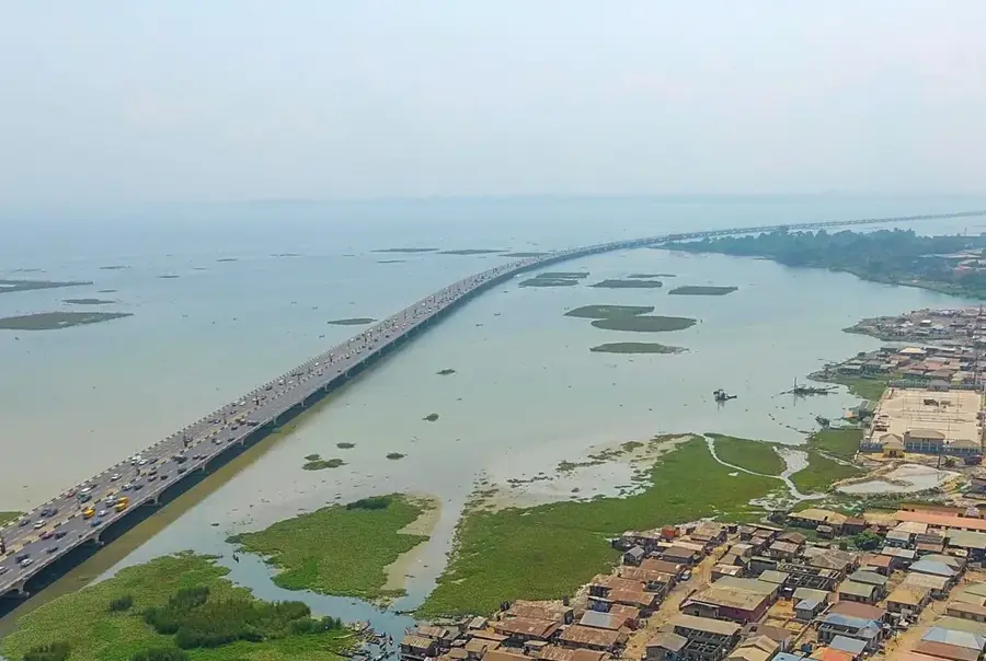
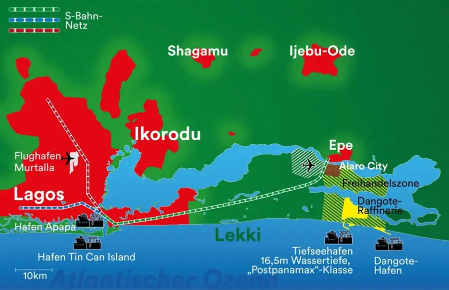
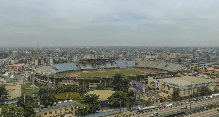
The Third Mainland Bridge is the longest of three bridges connecting Lagos Island to the mainland, serving as a critical artery for the city's transport network. Stretching approximately 11.8 kilometers (7.3 miles), it was the longest bridge in Africa from its completion in 1990 until 1996. The bridge was constructed by Julius Berger Nigeria PLC and officially opened by President Ibrahim Babangida. It spans the Lagos Lagoon, starting from Oworonshoki and ending at the Adeniji Adele Interchange on Lagos Island. Due to the massive volume of daily commuters, the bridge is well-known for its heavy traffic congestion during peak hours. In recent years, it has undergone several rounds of structural repairs and upgrades to ensure the safety of its thousands of users. The Third Mainland Bridge is more than just a roadway; it is an iconic engineering feat that reflects the immense scale and economic vitality of Lagos.
- Location: Nigeria
- Nearby: Lekki (36 km)
Best time to visit & climate
The most pleasant time to visit is Jan, Feb, Dec.
| Jan | Feb | Mar | Apr | May | Jun | Jul | Aug | Sep | Oct | Nov | Dec | |
|---|---|---|---|---|---|---|---|---|---|---|---|---|
| Avg °C | 26 | 27 | 28 | 28 | 27 | 26 | 25 | 25 | 25 | 26 | 27 | 27 |
| Rain mm | 28 | 33 | 74 | 133 | 203 | 266 | 237 | 135 | 277 | 221 | 80 | 27 |
📋 Practical info
Geography
Facts
- The bridge has a total length of 11.8 kilometers.
- It was commissioned by President Ibrahim Babangida in 1990.
- Julius Berger Nigeria PLC completed the construction project.
- The bridge consists of 8 lanes for vehicular traffic.
- It connects the mainland at Oworonshoki to Lagos Island.
- It was the longest bridge in Africa until the 6th October Bridge in Cairo was finished.
Explore nearby
Notable places around
Route planner — Car & Motorhome
Where do you start? We build the route here, with stops and country notes along the way.
© OpenStreetMap contributors · OpenRouteService
Sights in the town Third Mainland Bridge (1)
Sights nearby
Frequently asked questions
How long is the bridge?
Is there traffic?
Can I walk there?
When is the least traffic?
Is it architecturally significant?
Third Mainland Bridge: where is it located?
Third Mainland Bridge: when is the best time to visit?
Third Mainland Bridge: why is it worth visiting?

Nearby cities
History & landmarks
More places