Plizio Visual Lab
Kogi Hills

Weather…
Water temperature…
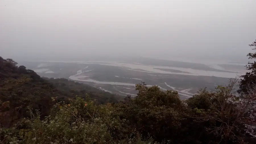
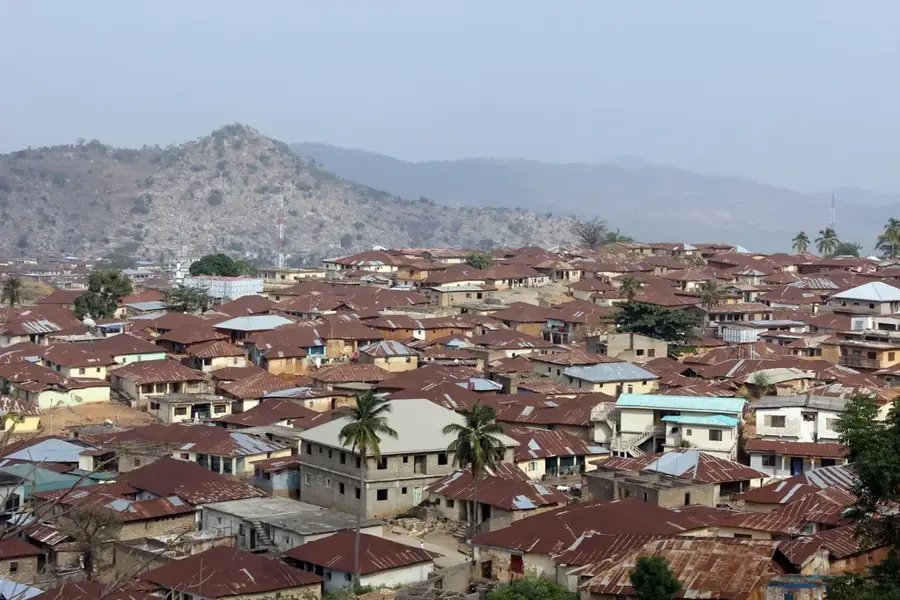
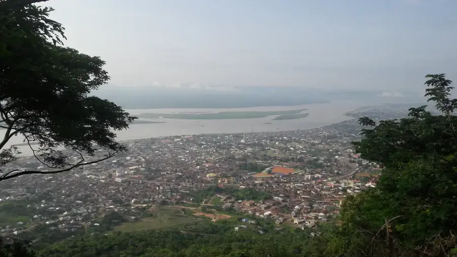
The Kogi Hills in central Nigeria define the landscape surrounding the confluence of the Niger and Benue rivers. A prominent feature is Mount Patti, a flat-topped sandstone plateau rising about 450 meters above the surrounding terrain near Lokoja. Geologically, the area belongs to the Nigerian basement complex but is heavily overlaid with sedimentary rocks, resulting in a mixture of rolling hills and steep escarpments. The strategic location of these hills facilitated the founding of Lokoja in the 19th century, which later became the first capital of the British Protectorate of Northern Nigeria. From the heights, one can survey the vast floodplains of the two major rivers, making the region historically significant for military and administrative observation. Today, the hills are vital for tourism and provide a unique ecological habitat within the Guinea savanna zone.
- Location: Nigeria
- Nearby: Okene (54 km)
Best time to visit & climate
The most pleasant time to visit is Jan, Nov, Dec.
| Jan | Feb | Mar | Apr | May | Jun | Jul | Aug | Sep | Oct | Nov | Dec | |
|---|---|---|---|---|---|---|---|---|---|---|---|---|
| Avg °C | 25 | 27 | 28 | 28 | 27 | 26 | 25 | 25 | 25 | 25 | 26 | 25 |
| Rain mm | 6 | 19 | 32 | 88 | 122 | 149 | 195 | 202 | 241 | 138 | 25 | 9 |
📋 Practical info
Geography
Facts
- Mount Patti is the most famous landmark in the hills, standing at 450 meters.
- The hills overlook the confluence of the Niger and Benue rivers.
- Lokoja, at the foot of the hills, was established as a trade post in 1860.
- The first Governor-General's office in Northern Nigeria was located here.
- The geological formation is primarily composed of ferruginous sandstones.
- The hills act as a natural watershed for the surrounding agricultural plains.
Explore nearby
Notable places around
Route planner — Car & Motorhome
Where do you start? We build the route here, with stops and country notes along the way.
© OpenStreetMap contributors · OpenRouteService
Sights nearby
Frequently asked questions
What is the Kogi hilly area?
Can you visit the area?
Are there cultural attractions?
What is the climate like?
What is the best time to visit?
Kogi Hills: where is it located?
Kogi Hills: when is the best time to visit?
Kogi Hills: why is it worth visiting?

Nearby cities
Nature
More places