Plizio Visual Lab
Yenagoa
ℹ️Practical info — Yenagoa
▾
🌤 Weather — 5 days
📍 Nearby
Sights nearby
💡 Tips
- With its water-rich geography, exploring by traditional or motorized boat is often the fastest way to reach neighboring communities.
- Strong insect repellent is an absolute necessity due to the surrounding mangrove swamps and high humidity.
- Waterproof footwear and clothing are highly recommended, as the region experiences significant rainfall almost year-round.
- Always ask for permission before taking photographs near the rivers, out of respect for the local Ijaw water shrines and customs.
🍽 Food
A rich palm nut extract soup, traditionally prepared with fresh river fish, found at authentic Ijaw restaurants.
A hearty plantain porridge cooked with seafood and spices, a staple in the waterside eateries.
Spicy and deeply flavorful, best enjoyed at the open-air bars lining the waterways in the evening.
🛍 Shopping · 🧘 Quiet spots
The go-to large market for fresh river catches, local vegetables, and unique regional spices.
Look for small artisan stalls selling hand-carved wooden paddles and intricate woven baskets.
A well-maintained public space excellent for a relaxing afternoon away from the busy streets.
Find a quiet spot along the banks of the Nun River tributaries to watch the traditional canoes glide by.
Water temperature…
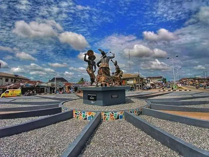
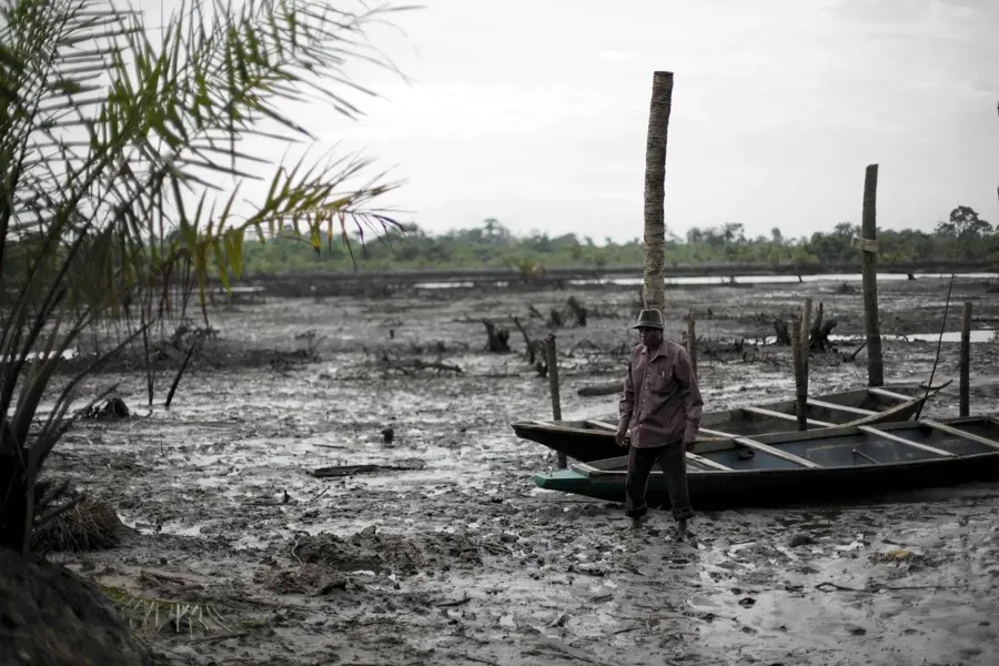
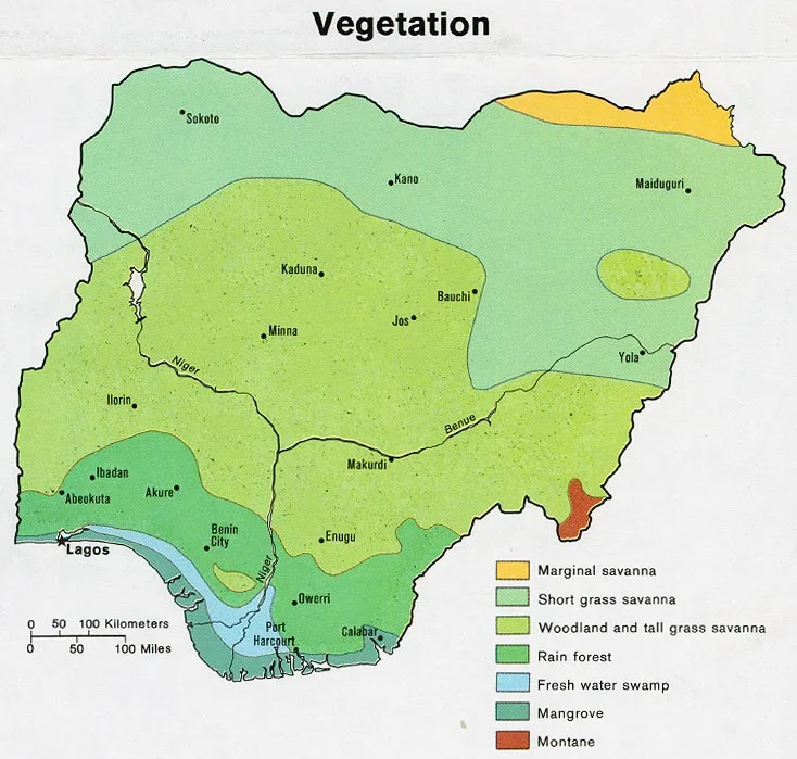
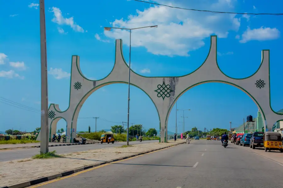
Yenagoa is the capital city of Bayelsa State, positioned in the complex aquatic landscape of the Niger Delta in southern Nigeria. Since its designation as a state capital in 1996, it has evolved from a serene riverside settlement into a burgeoning administrative and commercial hub. The city's geography is uniquely defined by its location along the banks of the Ekoli Creek, surrounded by vast freshwater swamps and mangroves that characterize the deltaic terrain. This environment dictates a humid tropical climate with one of the highest annual rainfall rates in the country, often leading to seasonal flooding challenges. Economically, Yenagoa is central to Nigeria's oil and gas production, serving as a base for administrative operations of several major energy firms and the Nigerian Content Development and Monitoring Board (NCDMB). The city features landmarks such as the Melford Okilo Expressway, the state's main artery, and the architecturally striking Peace Park. The social fabric is primarily composed of the Ijaw people, whose history is deeply intertwined with the river systems, manifested in their maritime expertise and traditional festivals like the 'Boro Day' celebrations. Educationally, the city is supported by nearby institutions like the Niger Delta University and the Federal University Otuoke. Urban development in Yenagoa has seen the rise of modern residential estates and luxury hotels, aimed at accommodating the influx of professionals in the petroleum sector. The recent operationalization of the Bayelsa International Airport at Wilberforce Island marks a significant milestone in the city's connectivity to global markets. As a symbol of the 'Glory of All Lands,' Yenagoa continues to strive for balanced growth, seeking to leverage its vast natural resources to improve infrastructure and the quality of life for its residents while preserving its unique ecological heritage.
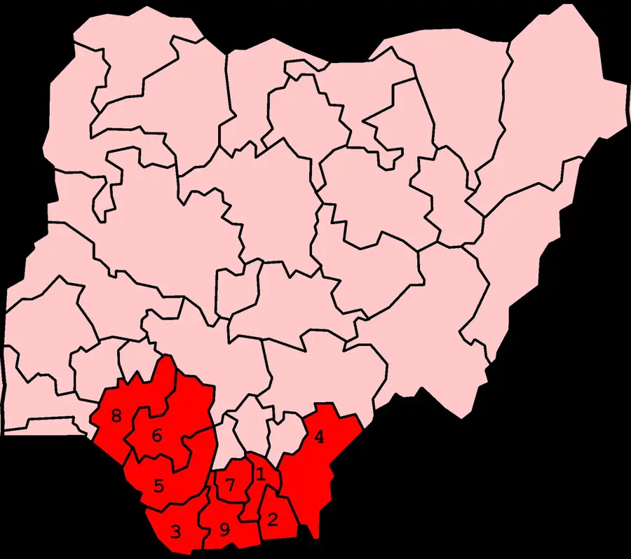
- Location: Nigeria
- Top sights: Golden Gate Multipurpose Hall · Nengi's Place · D. S. P. Alamiesiegha Memorial Hall
- Nearby: Ughelli (69 km)
- Population: ~365.000 (2026)
Best time to visit & climate
The most pleasant time to visit is Jan, Feb, Dec.
| Jan | Feb | Mar | Apr | May | Jun | Jul | Aug | Sep | Oct | Nov | Dec | |
|---|---|---|---|---|---|---|---|---|---|---|---|---|
| Avg °C | 26 | 27 | 27 | 27 | 27 | 26 | 25 | 25 | 25 | 26 | 26 | 26 |
| Rain mm | 26 | 53 | 110 | 162 | 220 | 330 | 334 | 319 | 393 | 252 | 125 | 33 |
Geography
Facts
- The city is located within the Yenagoa Local Government Area.
- Yenagoa serves as the gateway to the deep-sea oil fields of the Atlantic.
- The NCDMB building in Yenagoa is 17 stories tall, making it a regional landmark.
- The city was originally a collection of farming and fishing hamlets.
- Yenagoa is roughly 500 miles south of the federal capital, Abuja.
- The vegetation is dominated by freshwater swamp forests.
- Major cultural attractions include the Isaac Boro Memorial Park.
- Yenagoa is one of the fastest-growing cities in the South-South geopolitical zone.
Explore nearby
Notable places around
Route planner — Car & Motorhome
Where do you start? We build the route here, with stops and country notes along the way.
© OpenStreetMap contributors · OpenRouteService
Sights in the town Yenagoa (7)
Frequently asked questions
When should I visit Yenagoa?
Is Yenagoa safe for tourists?
What is the typical food in Yenagoa?
How much time is needed to see Yenagoa?
Are there natural highlights nearby?
Yenagoa: where is it located?
Yenagoa: what is there to see?
Yenagoa: when is the best time to visit?
Yenagoa: why is it worth visiting?