Plizio Visual Lab
Mont Nakada
Weather…
Water temperature…
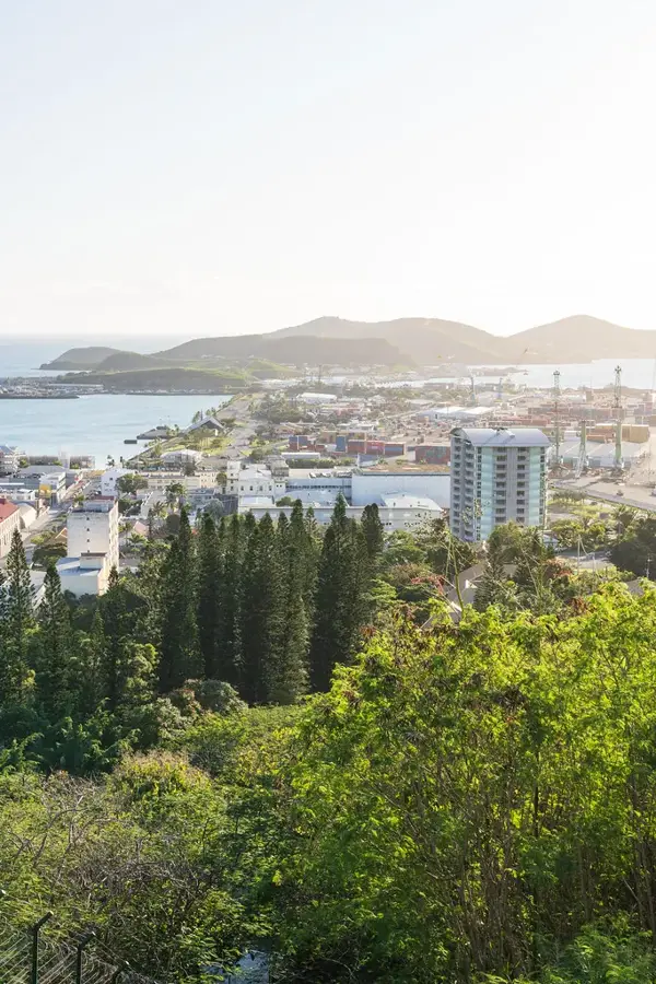
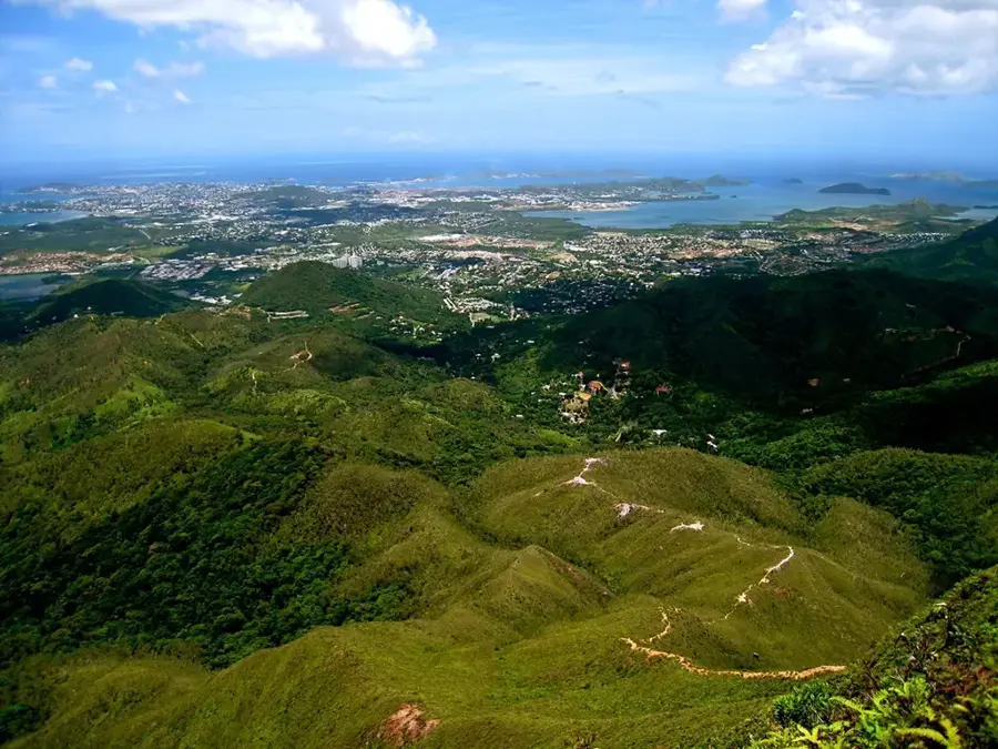
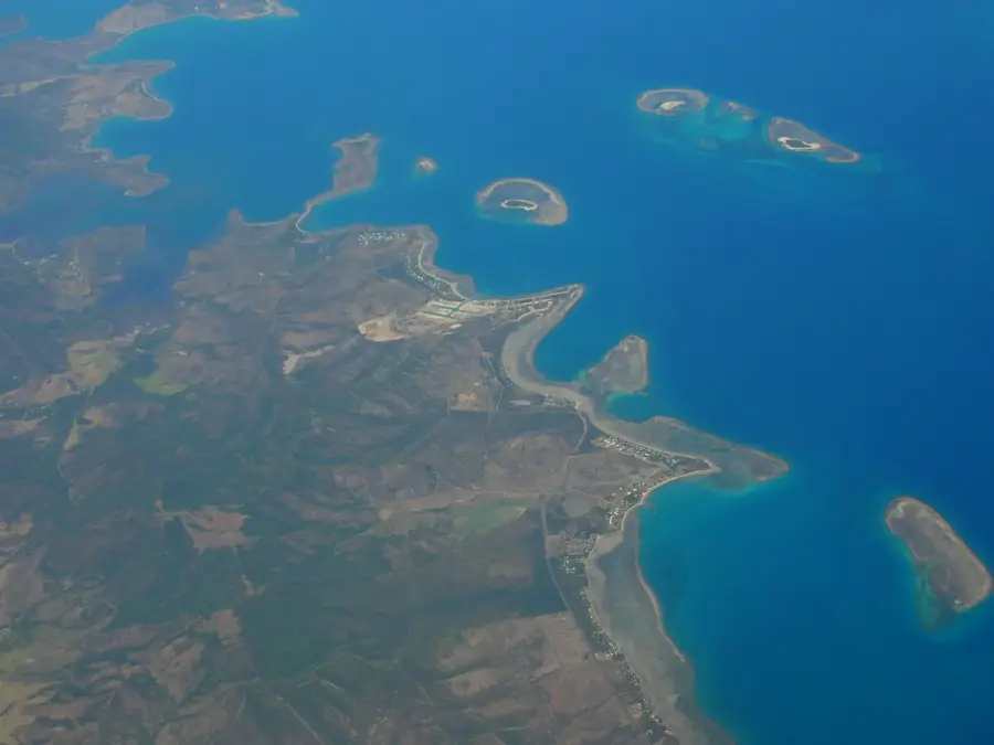
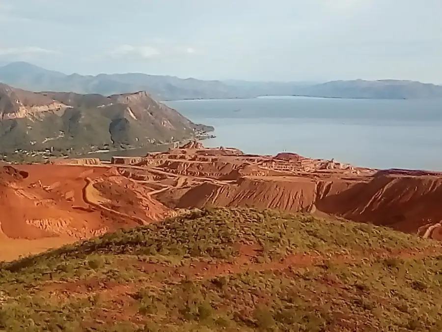
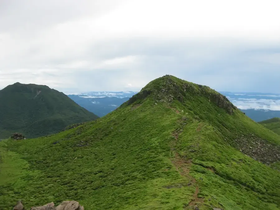
Mont Nakada is a distinctive peak in southeastern New Caledonia, rising to an elevation of 1,134 meters and dominating the landscape above the Thio valley. As part of the Chaîne Centrale, the rugged mountain range that runs the length of the main island of Grande Terre, it serves as a significant geographical landmark on the east coast. The slopes of Mont Nakada are draped in dense, primary rainforest, which is home to a high concentration of endemic plant species found nowhere else on Earth. The area is a magnet for serious hikers and naturalists, offering challenging terrain and trails that cut through lush jungle. From its higher reaches, the mountain provides sweeping views of the Thio River delta and the surrounding mining areas that are characteristic of this mineral-rich region. The summit is frequently shrouded in mist, creating a humid microclimate that supports lively mosses and tree ferns, lending Mont Nakada a mysterious and primordial atmosphere that captivates all who visit.
- Location: New Caledonia
- Nearby: Thio (15 km)
Best time to visit & climate
The most pleasant time to visit is Jul–Sep.
| Jan | Feb | Mar | Apr | May | Jun | Jul | Aug | Sep | Oct | Nov | Dec | |
|---|---|---|---|---|---|---|---|---|---|---|---|---|
| Avg °C | 26 | 27 | 26 | 25 | 23 | 22 | 21 | 21 | 22 | 23 | 24 | 25 |
| Rain mm | 157 | 149 | 209 | 130 | 100 | 84 | 63 | 61 | 48 | 55 | 72 | 110 |
📋 Practical info
Geography
Facts
- Elevation of 1,080 meters.
- Located in the Thio district.
- Important site for nickel extraction.
- Steep relief structure with erosion forms.
- Traditional land of the Kanak tribes.
- Coastal proximity with mountainous character.
Explore nearby
Notable places around
Route planner — Car & Motorhome
Where do you start? We build the route here, with stops and country notes along the way.
© OpenStreetMap contributors · OpenRouteService
Sights nearby
Frequently asked questions
Is Mont Nakada suitable for families?
Are there marked hiking trails?
What is the best preparation?
Can you camp there?
How is the mobile signal?
Mont Nakada: where is it located?
Mont Nakada: when is the best time to visit?
Mont Nakada: why is it worth visiting?

Nearby cities