Plizio Visual Lab
Saint-Antoine Headland
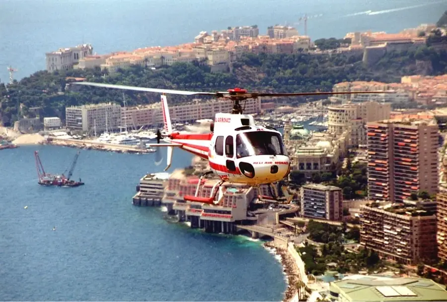
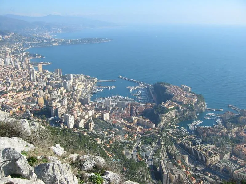
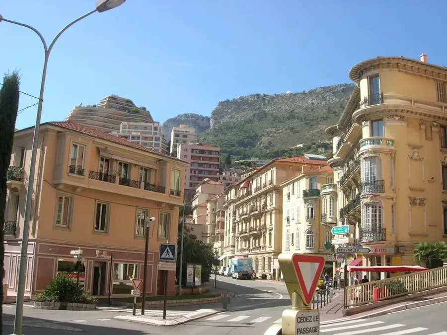
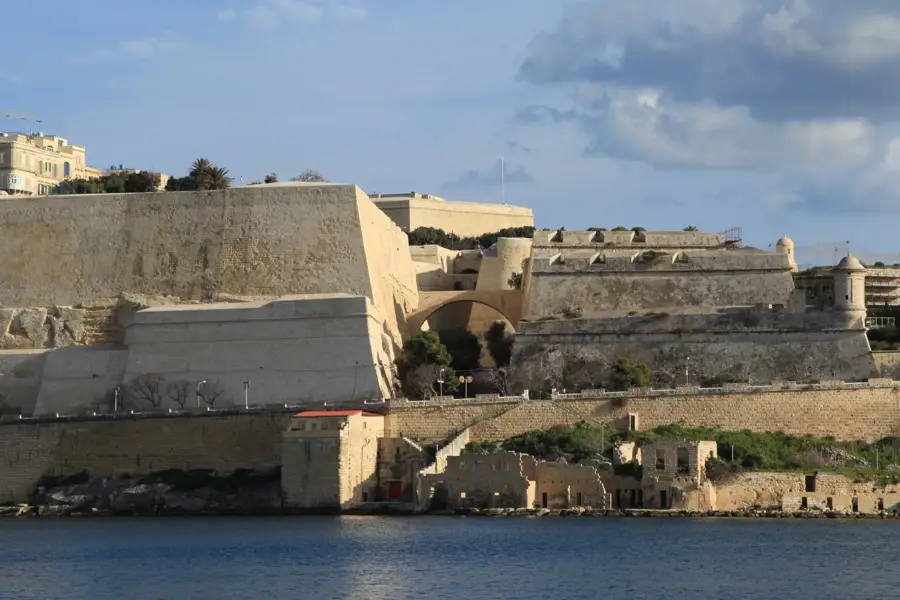
The Promontoire de Saint-Antoine is a striking rocky headland forming the western portion of the famous Rock of Monaco (Le Rocher), dropping steeply toward the Fontvieille harbor. Geologically, it is part of a Jurassic limestone formation that has held a strategically decisive position for coastal defense since antiquity. In the 18th century, Fort Antoine was constructed on this site, a military fortress built during the reign of Prince Antoine I, which now serves as a popular open-air theater. The headland's topography is characterized by its rugged cliffs and exposed location, providing sweeping views across the Mediterranean Sea. During the reign of Prince Rainier III, the area surrounding the promontory was extensively landscaped while preserving the historical fortifications. Today, this relief feature connects the grand architecture of the Old Town with the modern, land-reclamation structures of the Fontvieille district, serving as a vital cultural link.
- Location: Monaco
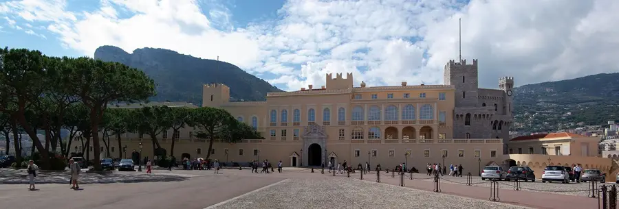
- Top sights: Prince's Palace of Monaco · Chapelle de la Miséricorde · Saint Nicholas Cathedral
Best time to visit & climate
The most pleasant time to visit is Jun, Jul, Sep.
| Jan | Feb | Mar | Apr | May | Jun | Jul | Aug | Sep | Oct | Nov | Dec | |
|---|---|---|---|---|---|---|---|---|---|---|---|---|
| Avg °C | 11 | 11 | 12 | 14 | 17 | 21 | 24 | 24 | 22 | 18 | 15 | 12 |
| Rain mm | 55 | 53 | 62 | 56 | 48 | 29 | 17 | 23 | 47 | 88 | 123 | 81 |
📋 Practical info
Geography
Facts
- Fort Antoine was originally built in the early 18th century
- In 1944, the original fortress was destroyed by a bombing raid
- Prince Rainier III rebuilt the fort as a theater in 1953
- The cliff drops nearly 60 meters down to the sea
- The local vegetation consists mainly of Mediterranean succulents
- It marks the end of the historic fortification line of Monaco-Ville
Explore nearby
Notable places around
Route planner — Car & Motorhome
Where do you start? We build the route here, with stops and country notes along the way.
© OpenStreetMap contributors · OpenRouteService
Sights in the town Saint-Antoine Headland (10)
Saint Nicholas Cathedral
Cathedral in Monaco, built in Romanesque-Byzantine style.
Exhibition Hall🏛 museum
Exhibition hall in Monaco for temporary art and cultural displays.
Musée de la Chapelle de la Visitation🏛 museum
Museum in a former chapel in Monaco, displaying sacred art.
Le Jardin Animalier
Zoological Garden of the European nation of Monaco.
Oceanographic Museum of Monaco🏛 museum
Museum of marine sciences in Monaco, founded by Albert I.
Monaco Grand Prix Start/Finish Line
Start and finish line of the famous Formula 1 race in Monaco.
Espace Léo Ferré
Cultural centre in Monaco, named after singer Léo Ferré.
Sights nearby
Frequently asked questions
What is the Saint-Antoine Promontory?
Can the promontory be visited?
What is the view from the top?
Are there historical cannons there?
Is the path there strenuous?
Saint-Antoine Headland: where is it located?
Saint-Antoine Headland: what is there to see?
Saint-Antoine Headland: when is the best time to visit?
Saint-Antoine Headland: why is it worth visiting?

Nearby cities
History & landmarks
More places