Plizio Visual Lab
Sierra Tarahumara
Weather…
Water temperature…
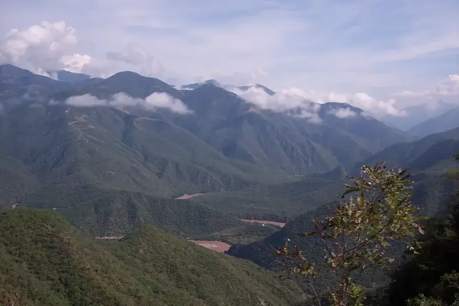
The Sierra Tarahumara is a rugged mountain range located in the southwestern part of the state of Chihuahua, forming a significant portion of the Sierra Madre Occidental. It is globally renowned for the Copper Canyon (Barranca del Cobre) system, which consists of six distinct canyons that are deeper and more expansive than the Grand Canyon in the United States. The region is the ancestral home of the Rarámuri or Tarahumara indigenous people, who are famous for their extraordinary endurance and long-distance running abilities in the difficult terrain. Geologically, the range was formed by volcanic activity approximately 20 to 40 million years ago, resulting in dramatic cliffs and deep gorges. The elevation varies drastically, from high-altitude pine-oak forests at 2,500 meters to subtropical environments at the canyon floors. Today, it is a vital ecological corridor and a major destination for eco-tourism and cultural exploration in northern Mexico.
- Location: Mexico
- Nearby: Creel (71 km)
Best time to visit & climate
The most pleasant time to visit is Apr–Jun.
| Jan | Feb | Mar | Apr | May | Jun | Jul | Aug | Sep | Oct | Nov | Dec | |
|---|---|---|---|---|---|---|---|---|---|---|---|---|
| Avg °C | 6 | 8 | 11 | 14 | 18 | 22 | 20 | 20 | 18 | 15 | 10 | 7 |
| Rain mm | 24 | 19 | 13 | 6 | 9 | 67 | 181 | 160 | 106 | 40 | 25 | 23 |
📋 Practical info
Geography
Facts
- The Copper Canyon system covers an area of approximately 65,000 square kilometers.
- Some canyons reach depths of over 1,800 meters from the rim to the floor.
- The name Rarámuri translates to 'light-footed runners' in their native language.
- The Chihuahua-al-Pacífico railway crosses the range via 86 tunnels and 37 bridges.
- The highest peak in the region is Cerro Mohinora, standing at 3,300 meters.
- The area contains over 200 species of oak and pine trees.
Explore nearby
Notable places around
Route planner — Car & Motorhome
Where do you start? We build the route here, with stops and country notes along the way.
© OpenStreetMap contributors · OpenRouteService
Sights nearby
Frequently asked questions
What is the train journey like?
Best time for hikers?
Is there accommodation?
Is the area family-friendly?
How to protect against cold?
Sierra Tarahumara: where is it located?
Sierra Tarahumara: when is the best time to visit?
Sierra Tarahumara: why is it worth visiting?